MyTopo
Cub Run Kentucky US Topo Map
Couldn't load pickup availability
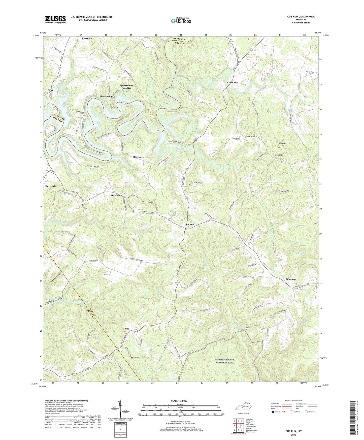
2022 topographic map quadrangle Cub Run in the state of Kentucky. Scale: 1:24000. Based on the newly updated USGS 7.5' US Topo map series, this map is in the following counties: Hart, Grayson, Edmonson. The map contains contour data, water features, and other items you are used to seeing on USGS maps, but also has updated roads and other features. This is the next generation of topographic maps. Printed on high-quality waterproof paper with UV fade-resistant inks.
Quads adjacent to this one:
West: Nolin Lake
Northwest: Clarkson
North: Millerstown
Northeast: Upton
East: Munfordville
Southeast: Horse Cave
South: Mammoth Cave
Southwest: Rhoda
This map covers the same area as the classic USGS quad with code o37086c1.
Contains the following named places: Bacon Creek, Barton Run, Bee, Big Sink, Big Windy, Blowing Springs, Cane Run, Cane Run Church, Cave Hill Church, Center Point, Cherry Spring Church, Cox Cemetery, Cub Run, Cub Run Fire Department, Cub Run Post Office, Dorsey Chapel, Jericho Church, Kissinger Hollow, Lick Run, Lines Mill, Macedonia Church, Macon, Oak Hill Church, Pearman, Pine Branch, Pine Grove Church, Pine Springs, Reams Church, Roseburg, Saint Benedicts Catholic Church, Sinking Creek, Sportsmens Paradise, Wax, Winesap, ZIP Code: 42729