MyTopo
Shawhan Kentucky US Topo Map
Couldn't load pickup availability
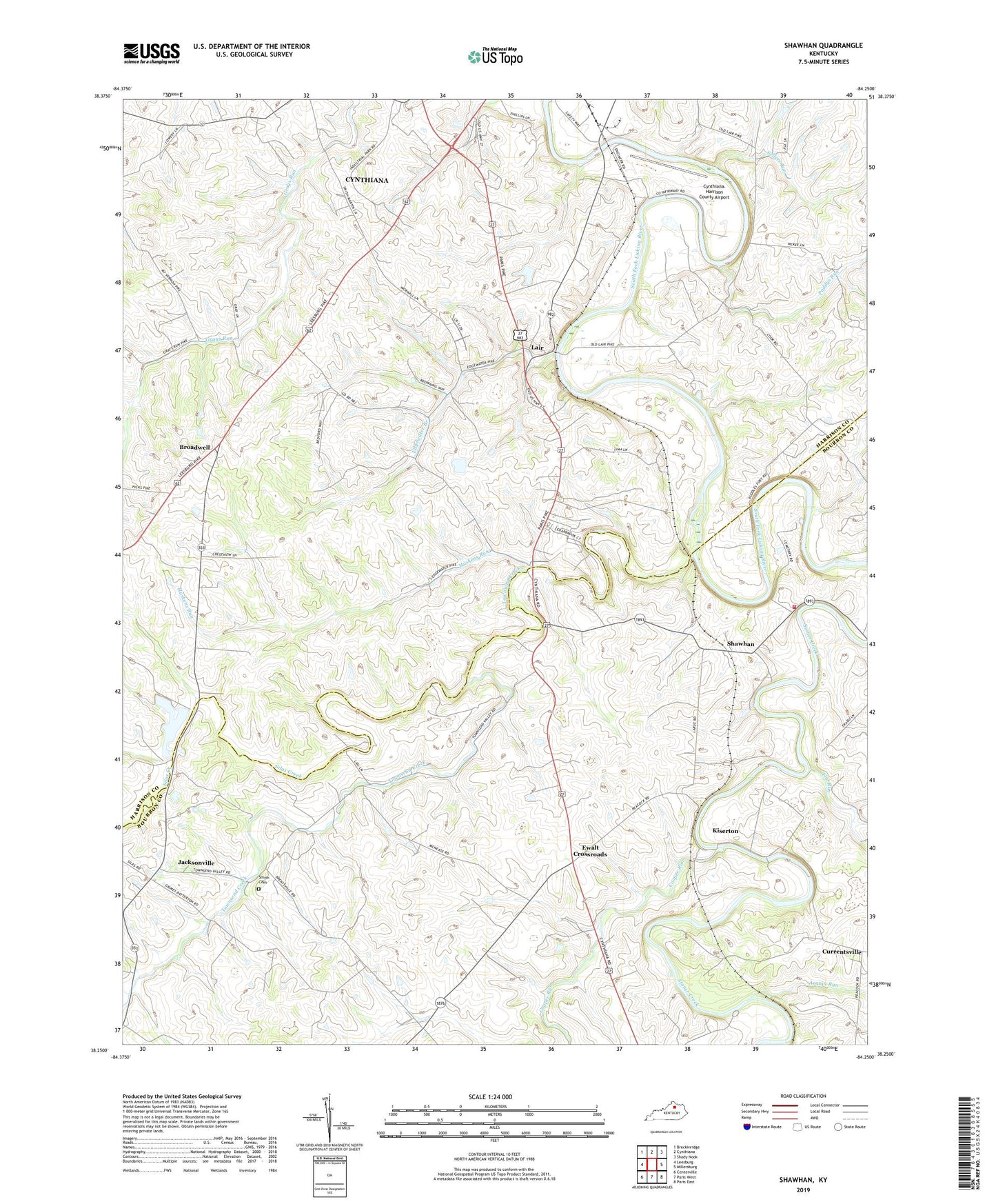
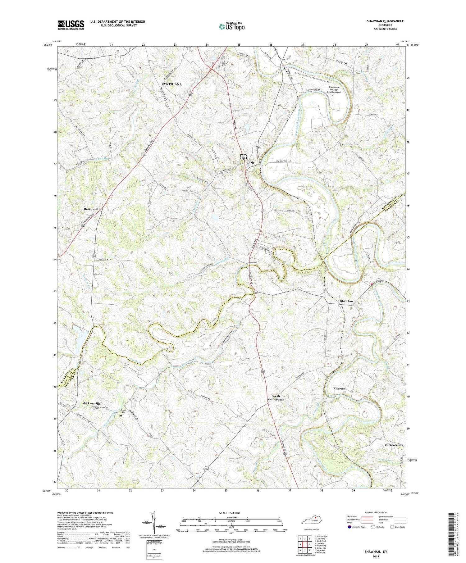
2022 topographic map quadrangle Shawhan in the state of Kentucky. Scale: 1:24000. Based on the newly updated USGS 7.5' US Topo map series, this map is in the following counties: Harrison, Bourbon. The map contains contour data, water features, and other items you are used to seeing on USGS maps, but also has updated roads and other features. This is the next generation of topographic maps. Printed on high-quality waterproof paper with UV fade-resistant inks.
Quads adjacent to this one:
West: Leesburg
Northwest: Breckinridge
North: Cynthiana
Northeast: Shady Nook
East: Millersburg
Southeast: Paris East
South: Paris West
Southwest: Centerville
This map covers the same area as the classic USGS quad with code o38084c3.
Contains the following named places: Acquia Run, Broadwell, Broadwell Post Office, Broadwell School, Cedar Brook, Cooper Run, Currentsville, Cynthiana Nursery, Cynthiana-Harrison County Airport, East Lair School, Edgewater Branch, Evergreen Valley Farm, Ewalt Crossroads, Flat Run, Huskens Run, Jacksonville, Kiserton, Lair, Lair Post Office, Lairs Railroad Station, Mount Carmel Christian Church, Mount Pleasant Church, Mount Vernon School, Paddys Run, Pleasant Home Farm, Prospect Hill Farm, Ruddles Mill Shawhan Volunteer Fire Department, Sellers Run, Shawhan, Silas Creek, Smith Cemetery, Sunny Side Farm, Townsend Creek, Woodland Farm