MyTopo
Pikeville Kentucky US Topo Map
Couldn't load pickup availability
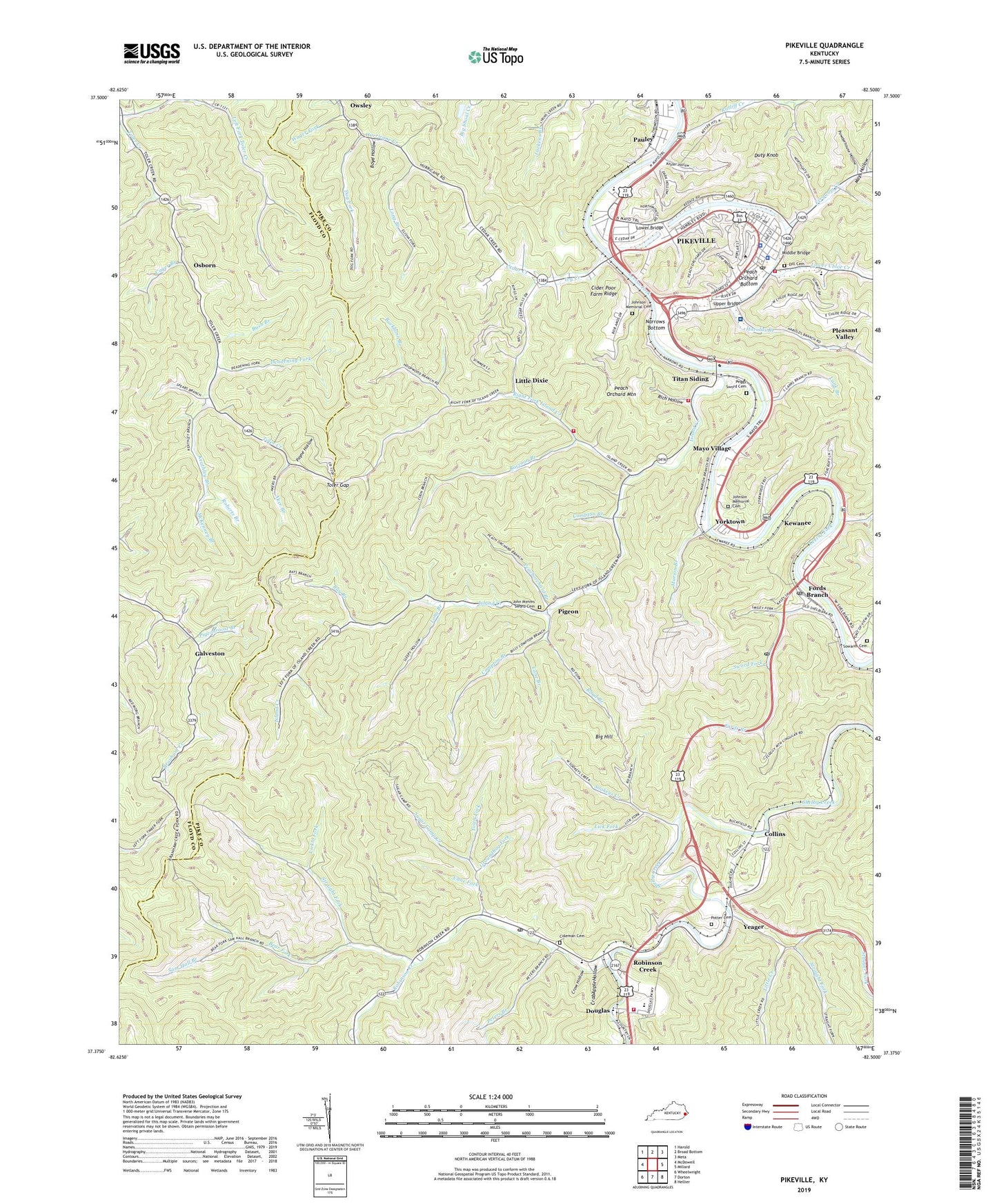
2022 topographic map quadrangle Pikeville in the state of Kentucky. Scale: 1:24000. Based on the newly updated USGS 7.5' US Topo map series, this map is in the following counties: Pike, Floyd. The map contains contour data, water features, and other items you are used to seeing on USGS maps, but also has updated roads and other features. This is the next generation of topographic maps. Printed on high-quality waterproof paper with UV fade-resistant inks.
Quads adjacent to this one:
West: McDowell
Northwest: Harold
North: Broad Bottom
Northeast: Meta
East: Millard
Southeast: Hellier
South: Dorton
Southwest: Wheelwright
This map covers the same area as the classic USGS quad with code o37082d5.
Contains the following named places: Aker Branch, Aldeps Gate Church, Bear Fork, Bent School Number Nine, Big Hill, Big Rock Branch of Bear Fork, Bob Amos Park, Bolyn Post Office, Boyd Hollow, Buckfield Church, Buckfield School, Buckhorn Branch, Burns Post Office, Bush Branch, Cager Branch, Cane Branch, Cane Fork, Cedar Creek, Church of Prophecy, Cider Poor Farm Ridge, City of Pikeville, Cline Hollow, Coleman Cemetery, Collins, Collins Railroad Station, Compton Branch, Crab Apple Hollow, Crow Hollow, Deadening Fork, Dill Cemetery, Dog Fork, Douglas, Douglas Housing Project, Douglas Industrial Park, Duty Knob, Effie Waller Smith Historical Marker, Elksam Post Office, Energyville Church, Ferguson Creek, First Christian Church, Fords Branch, Fords Branch Post Office, Groundhog Fork, Hambley Athletic Complex, Harolds Branch, Harrolds Branch, Harrolds Branch School, Hatfield-McCoy Trial Historical Marker, Hildason Post Office, Hoopwood Branch, Horseshoe Branch, Indian Rock, Island Creek, Island Creek Church, Island Creek Volunteer Fire Department, Ivy Creek, J B School, John Mimms Sword Cemetery, John Paul Riddle Historical Marker, Johnson Memorial Cemetery, Keathley Branch, Keel Addition, Kewanee, Kewnee Post Office, Kewnee Railroad Station, Keyser Hollow, Lank Branch, Left Fork Toler Creek, Lick Fork, Licklo Fork, Little Creek, Little Creek Church, Little Dixie, Long Branch, Lovers Leap Rock, Lower Bridge, Lower Chloe, Lower Chloe Creek, Lower Chloe School, Lower Little Creek School, Main Street Post Office, Marion Branch, Mayo Village, Mays Hollow, McCoy Graves Historical Marker, McCoy House Historical Marker, McKenney Branch, Middle Bridge, Mothers Home Church, Narrows Bottom, Osborn, Pauley, Pauley Post Office, Payne Hollow, Peach Orchard Bottom, Peach Orchard Mountain, Peachorchard Branch, Peggy Sword Cemetery, Peters Branch, Pigeon, Pigeonroost Branch, Pike County Courthouse and Jail Historical Marker, Pike County Historical Marker, Pike County Sheriff's Office, Pikeville, Pikeville City Police Department, Pikeville College, Pikeville Collegiate Institute Historical Marker, Pikeville Elementary School, Pikeville Fire and Ambulance Station 2, Pikeville Fire and Ambulance Station 3, Pikeville Fire Department Station 1, Pikeville High School, Pikeville Medical Center Hospital, Pikeville School of Osteopathic Medicine, Pleasant Valley, Poor Farm, Potter Cemetery, Powderhouse Hollow, Raccoon Branch, Rachel Fork, Ratliff Creek, Ray Branch, Rich Hollow, Richam Post Office, Richam Railroad Station, Right Fork Island Creek, Right Fork of Horseshoe Branch, Road Branch, Roberts Branch, Robinson Creek, Robinson Creek Post Office, Robinson Creek School, Saltlick School, Sam Hall Branch, School Number Twelve, Shelbiana Post Office, Shelby Valley High School, Shelby Valley Volunteer Fire Department, Sookeys Creek, Sookeys Creek Church, Sookeys Creek School, Sowards Cemetery, Spears Branch, Stagger Fork, Stillhouse Branch, Straight Fork, Sugar Camp Creek, Sugar Camp School, Sword Fork, Taylor Branch, Titan Siding, Toler Creek Church, Toler Gap, Town Fork, Upper Bridge, Upper Hurricane, Upper Island Creek School, Upper Little Creek, Upper Little Creek School, Upper Toler Creek Church, Wager Fork, WDHR-FM (Pikeville), WJSO-FM (Pikeville), WLSI-AM (Pikeville), WPKE-AM (Pikeville), Yeager, Yeager Post Office, Yeager Railroad Station, Yorktown, ZIP Codes: 41526, 41560


