MyTopo
Harold Kentucky US Topo Map
Couldn't load pickup availability
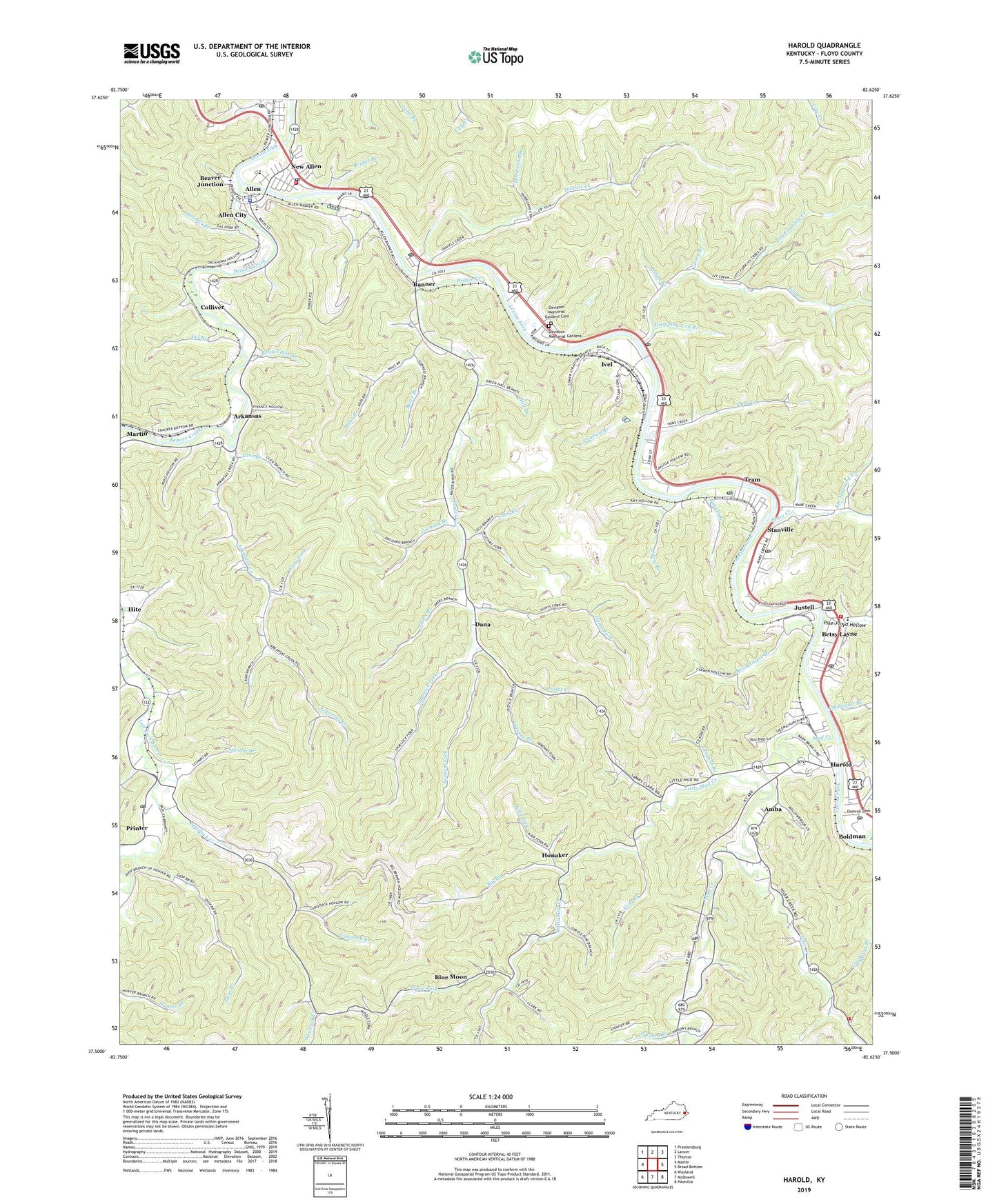
2022 topographic map quadrangle Harold in the state of Kentucky. Scale: 1:24000. Based on the newly updated USGS 7.5' US Topo map series, this map is in the following counties: Floyd. The map contains contour data, water features, and other items you are used to seeing on USGS maps, but also has updated roads and other features. This is the next generation of topographic maps. Printed on high-quality waterproof paper with UV fade-resistant inks.
Quads adjacent to this one:
West: Martin
Northwest: Prestonsburg
North: Lancer
Northeast: Thomas
East: Broad Bottom
Southeast: Pikeville
South: McDowell
Southwest: Wayland
This map covers the same area as the classic USGS quad with code o37082e6.
Contains the following named places: Akers Branch, Allen City, Allen Police Department, Allen Post Office, Allen Volunteer Fire Department, Amba, Arkansas, Arkansas Creek, Banner, Banner Post Office, Beaver Creek, Beaver Junction, Betsy Clark Branch, Betsy Layne, Betsy Layne Branch, Betsy Layne Census Designated Place, Betsy Layne Post Office, Betsy Layne Volunteer Fire Department, Betsy Layne-Stanville Division, Big Branch, Blue Moon, Bridge Branch, Butler Branch, Calvary Baptist Church, Camp Branch, Cane Fork, Cecil Branch, City of Allen, Coldwater Branch, Colliver, Crum Branch, Dana, Daniels Creek, Daniels Creek School, Davidson Memorial Gardens, Davidson Memorial Gardens Cemetery, Davison Branch, Dillon Branch, Dropping Lick Branch, Dwale, Dwale Post Office, Eel Branch, Floyd County, Frog Branch, Gayheart Branch, Gunstock Branch, Hall Branch, Handcock Branch, Harold, Harold Post Office, Harold School, Hatcher Branch, Haus Branch, Honaker, Hunts Fork, Hurricane Branch, Ivel, Ivel Post Office, Ivy Creek, Jim Maynard Branch, Johnson Fork, Justell, Justice Branch, Kentucky Division of Forestry Eastern District, Kidd Fork, Kinney Branch, Lane Branch, Left Fork Ivy Creek, Left Fork of Toms Creek, Linwood Post Office, Little Dove Church, Little Mud Creek, Mare Creek, Mud Creek, Mud Creek Church, New Allen, New Life Church, Orchard Branch, Osborn Branch, Parsons Branch, Penhook Branch, Pike-Floyd Hollow, Powell Branch, Prater Creek, Prater Creek School, Printer, Printer Post Office, Salem Church, Sammy Branch Church, Sansom Fork, Shop Branch, Spruce Pine School, Spurlock Creek, Spurlock Creek Church, Spurlock Fork, Stanville, Stanville Census Designated Place, Stanville Post Office, Stratton Branch, Stumbo Branch, Tanyard Branch, Toler Creek, Toler Creek Volunteer Fire Department, Toms Creek, Trace Fork, Tram, Tram Census Designated Place, Tram Post Office, WMDJ-AM (Martin), WMDJ-FM (Allen), WMQZ-FM (Allen), ZIP Codes: 41601, 41603, 41615, 41642, 41655, 41663