MyTopo
Whitney Island South Louisiana US Topo Map
Couldn't load pickup availability
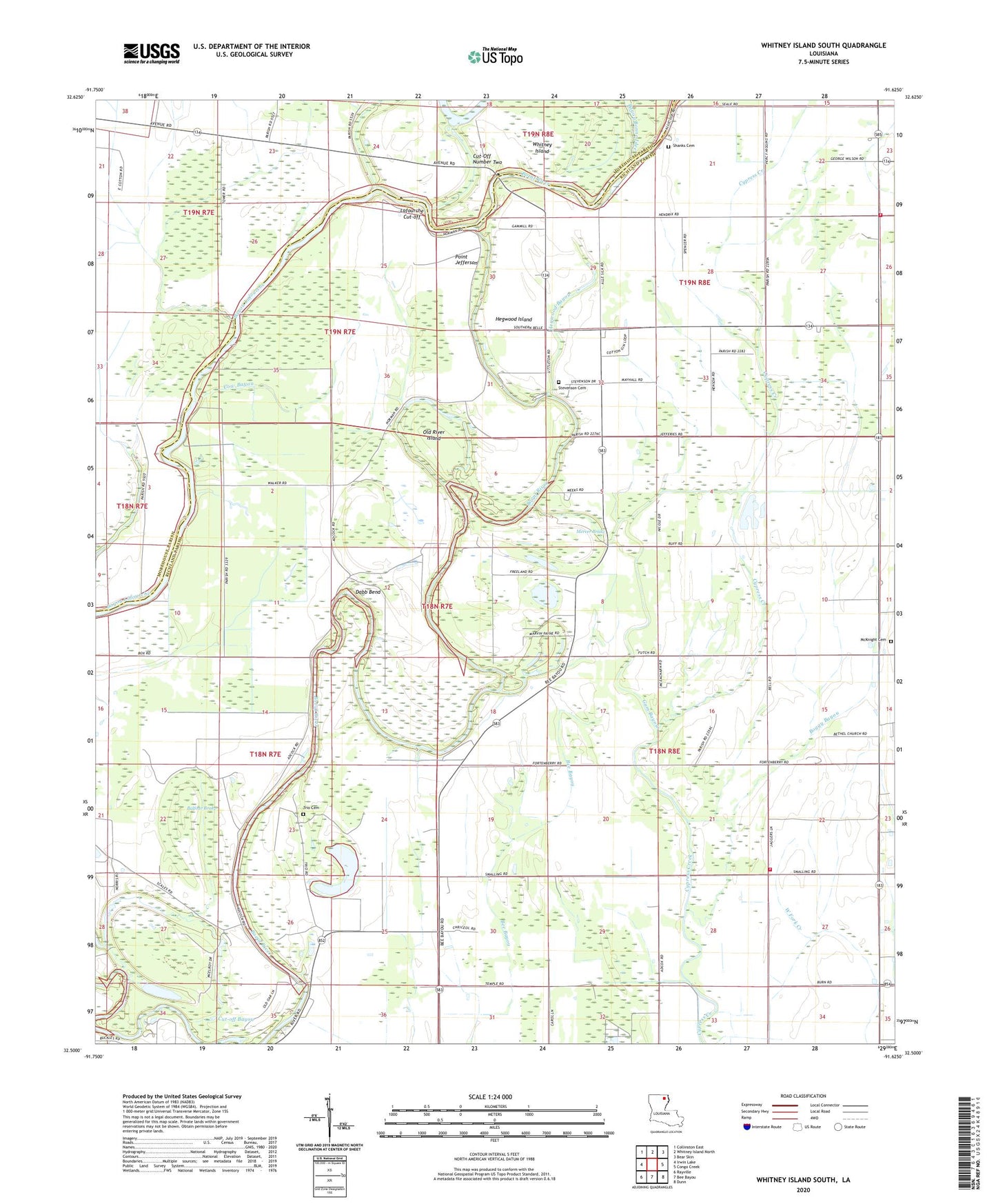
2024 topographic map quadrangle Whitney Island South in the state of Louisiana. Scale: 1:24000. Based on the newly updated USGS 7.5' US Topo map series, this map is in the following counties: Richland, Morehouse. The map contains contour data, water features, and other items you are used to seeing on USGS maps, but also has updated roads and other features. This is the next generation of topographic maps. Printed on high-quality waterproof paper with UV fade-resistant inks.
Quads adjacent to this one:
West: Irwin Lake
Northwest: Collinston East
North: Whitney Island North
Northeast: Bear Skin
East: Congo Creek
Southeast: Dunn
South: Bee Bayou
Southwest: Rayville
This map covers the same area as the classic USGS quad with code o32091e6.
Contains the following named places: Antioch Church, Balfour Brake, Bayou Bonne Idee, Bethel Church, Boeuf River Church, Boggy Bayou, Church of God, Cow Bayou, Cut-off Bayou, Cut-Off Number Two, Dabb Bend, Faith Missionary Church, Friendship Church, Gum Bayou, Hegwood Bayou, Hegwood Island, Holly Ridge Fire District Station 1, Jordan Lake, Lafourche Cut-off, Lake Lafourche, Little Lake, McKnight Cemetery, Mercer Brake, Morning Star Church, Mound Landing, New Zion Church, Old River Island, Parish Governing Authority District 3, Parkview Church, Picketts Island, Point Jefferson, Scotts Ferry, Shady Grove Church, Shanks Cemetery, Stevenson Cemetery, Trio Cemetery, West New Home Church, Whitney Island