MyTopo
Bird Island Point Louisiana US Topo Map
Couldn't load pickup availability
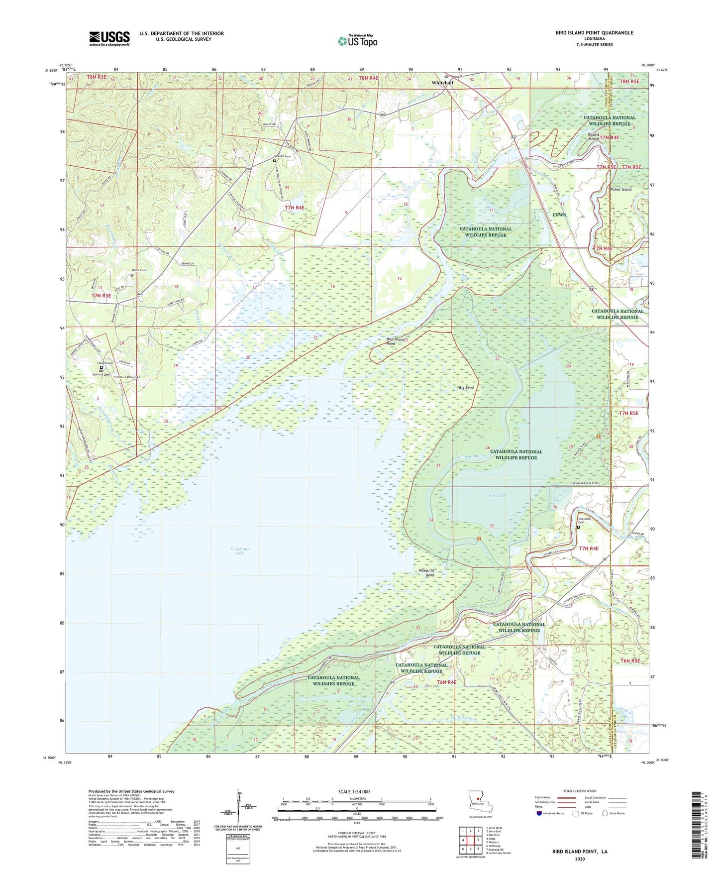
2024 topographic map quadrangle Bird Island Point in the state of Louisiana. Scale: 1:24000. Based on the newly updated USGS 7.5' US Topo map series, this map is in the following counties: LaSalle, Catahoula. The map contains contour data, water features, and other items you are used to seeing on USGS maps, but also has updated roads and other features. This is the next generation of topographic maps. Printed on high-quality waterproof paper with UV fade-resistant inks.
Quads adjacent to this one:
West: Nebo
Northwest: Jena West
North: Jena East
Northeast: Manifest
East: Walters
Southeast: Larto Lake North
South: Buckeye NE
Southwest: Holloway
This map covers the same area as the classic USGS quad with code o31092e1.
Contains the following named places: Big Bay, Big Bend, Big Bushley Creek, Bird Island Point, Browns Branch, Buck Holly Branch, Camp Bayou, Catahoula Lake, Catahoula Lake Oil Field, Chevallier Cemetery, Cowpen Bayou, Crossroads Baptist Church, Crossroads School, Dawes Branch School, Devils Creek, Doyle Branch, Earl Creek, East Nebo Oil Field, French Fork Oil Field, Gelvin Creek, Hemphill Creek, Hickory Branch, Island Bayou, Jones Branch, Little Bushley Creek, Little Lake, Little Lake Slough, Long Branch, McCure Cemetery, Miller Cemetery, Mosquito Bend, Mosquito Bend Oil Field, Parish Governing Authority District 9, Picket Island, Pritchard Church, Prosperity Baptist Church, Prosperity School, Rabbit Island, Rhineharts Ferry, Sandy Run, Shady Grove Church, Sharp Town, Spencer Cemetery, Tidwell Cemetery, Ward Nine, Whitehall, Willow Lake