MyTopo
Holloway Louisiana US Topo Map
Couldn't load pickup availability
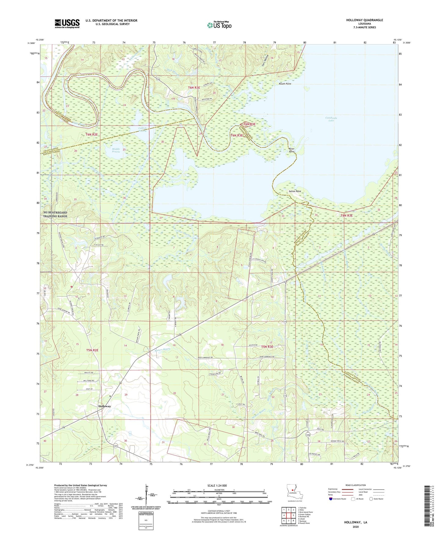
2024 topographic map quadrangle Holloway in the state of Louisiana. Scale: 1:24000. Based on the newly updated USGS 7.5' US Topo map series, this map is in the following counties: Rapides, LaSalle, Grant. The map contains contour data, water features, and other items you are used to seeing on USGS maps, but also has updated roads and other features. This is the next generation of topographic maps. Printed on high-quality waterproof paper with UV fade-resistant inks.
Quads adjacent to this one:
West: Green Gables
Northwest: Fishville
North: Nebo
Northeast: Bird Island Point
East: Buckeye NE
Southeast: Powell Point
South: Buckeye
Southwest: Libuse
This map covers the same area as the classic USGS quad with code o31092d2.
Contains the following named places: Alligator Bayou, Bethel Church, Carr Hollow, Catfish Prairie, Clear Bayou, Deville Volunteer Fire Department, Duck Slough, Evans Branch, Flagon Bayou, Flagon Creek, Holloway, Holloway Church, Holloway Prairie, Holloway School, Little Saline Bayou, Martha Chapel Free Methodist Church, Middle Prairie, North Big Island Oil Field, River Point, Routh Creek, Routh Point, Saline Point, Schoolhouse Branch, Slash Bayou, Slash Bayou School, South Catahoula Oil Field, Waters Bayou