MyTopo
Jena East Louisiana US Topo Map
Couldn't load pickup availability
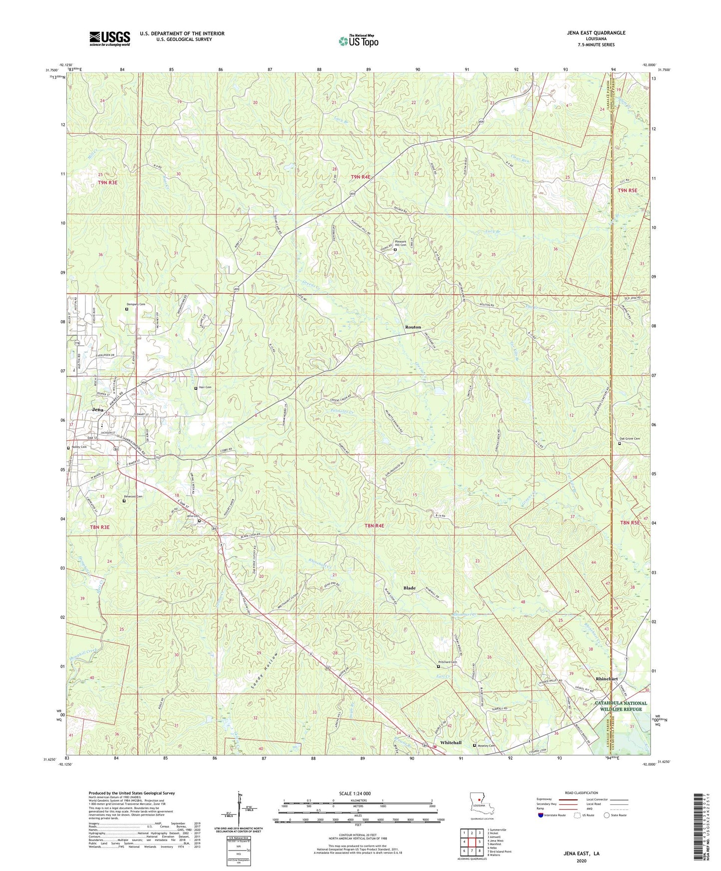
2024 topographic map quadrangle Jena East in the state of Louisiana. Scale: 1:24000. Based on the newly updated USGS 7.5' US Topo map series, this map is in the following counties: LaSalle, Catahoula. The map contains contour data, water features, and other items you are used to seeing on USGS maps, but also has updated roads and other features. This is the next generation of topographic maps. Printed on high-quality waterproof paper with UV fade-resistant inks.
Quads adjacent to this one:
West: Jena West
Northwest: Summerville
North: Nickel
Northeast: Aimwell
East: Manifest
Southeast: Walters
South: Bird Island Point
Southwest: Nebo
This map covers the same area as the classic USGS quad with code o31092f1.
Contains the following named places: Bellevue Baptist Church, Blade, Blade Church, Cane, Center School, Dempsey Cemetery, Ezell Branch, Hair Cemetery, Hair Creek, Jena Cemetery, Jena Junior High School, Jena Seminary, Jena Town Park, KJNA-AM (Jena), KJNA-FM (Jena), Moseley Cemetery, Mount Vernon Baptist Church, Nolley Cemetery, Nolley Memorial United Methodist Church, Oak Grove Baptist Church, Oak Grove Cemetery, Oak Grove School, Oak Ridge Baptist Church, Palmetto Creek, Parish Governing Authority District 4, Parish Governing Authority District 5, Penecost Cemetery, Pine Grove Baptist Church, Pine Grove School, Pleasant Hill Baptist Church, Pleasant Hill Cemetery, Pleasant Hill School, Pritchard Cemetery, Rhinehart, Rhinehart Post Office, Routon, Sandy Hollow, Tar Kiln Branch, Ward Five, Ward Four, White Hall Volunteer Fire Department