MyTopo
Bluff Creek Louisiana US Topo Map
Couldn't load pickup availability
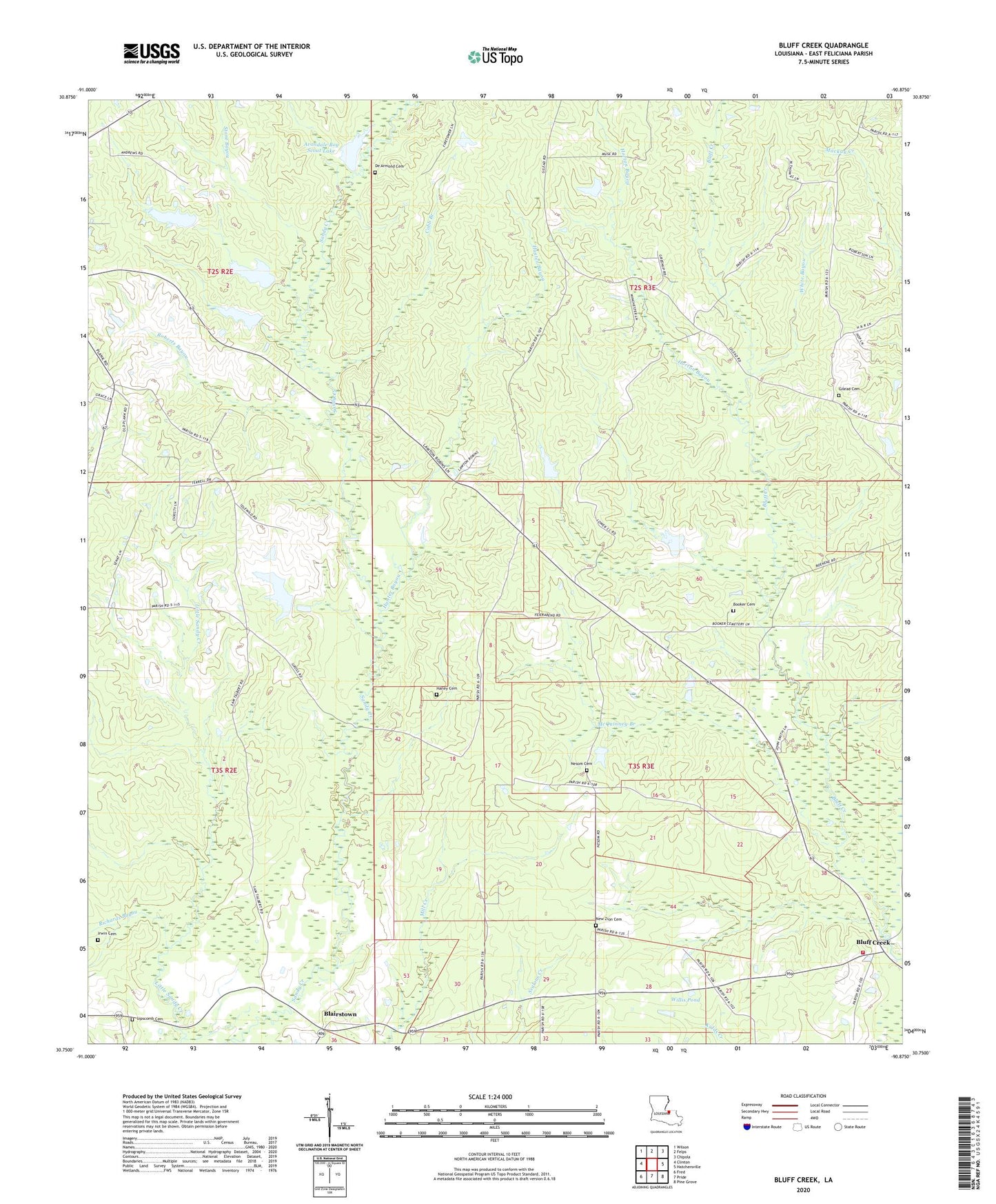
2024 topographic map quadrangle Bluff Creek in the state of Louisiana. Scale: 1:24000. Based on the newly updated USGS 7.5' US Topo map series, this map is in the following counties: East Feliciana. The map contains contour data, water features, and other items you are used to seeing on USGS maps, but also has updated roads and other features. This is the next generation of topographic maps. Printed on high-quality waterproof paper with UV fade-resistant inks.
Quads adjacent to this one:
West: Clinton
Northwest: Wilson
North: Felps
Northeast: Chipola
East: Hatchersville
Southeast: Pine Grove
South: Pride
Southwest: Fred
This map covers the same area as the classic USGS quad with code o30090g8.
Contains the following named places: Avondale Boy Scout Lake, Avondale Boy Scout Lake Dam, Blairstown, Bluff Creek Baptist Church, Bluff Creek Volunteer Fire Department, Booker Cemetery, Cobb Branch, De Armond Cemetery, Gilead Cemetery, Gilead Church, Haney Cemetery, Horton Bayou, Hunter Bayou, Idlewild Lake, Idlewild Lake Dam, Independence Church, Irwin Cemetery, Lipscomb Cemetery, Louisiana State University Experiment Station, Lutheran Church, McGee Lake Dam, McQuinney Branch, Nesom, Nesom Cemetery, Nesom Pond Dam, New Zion Cemetery, New Zion Church, Parish Governing Authority District 6, Precinct School, Richards Bayou, Roberts Bayou, Saint Johns Church, Stone Bayou, Sunbeam, Wall School, Ward Six, White Bayou, Willis Pond, ZIP Code: 70722