MyTopo
Hatchersville Louisiana US Topo Map
Couldn't load pickup availability
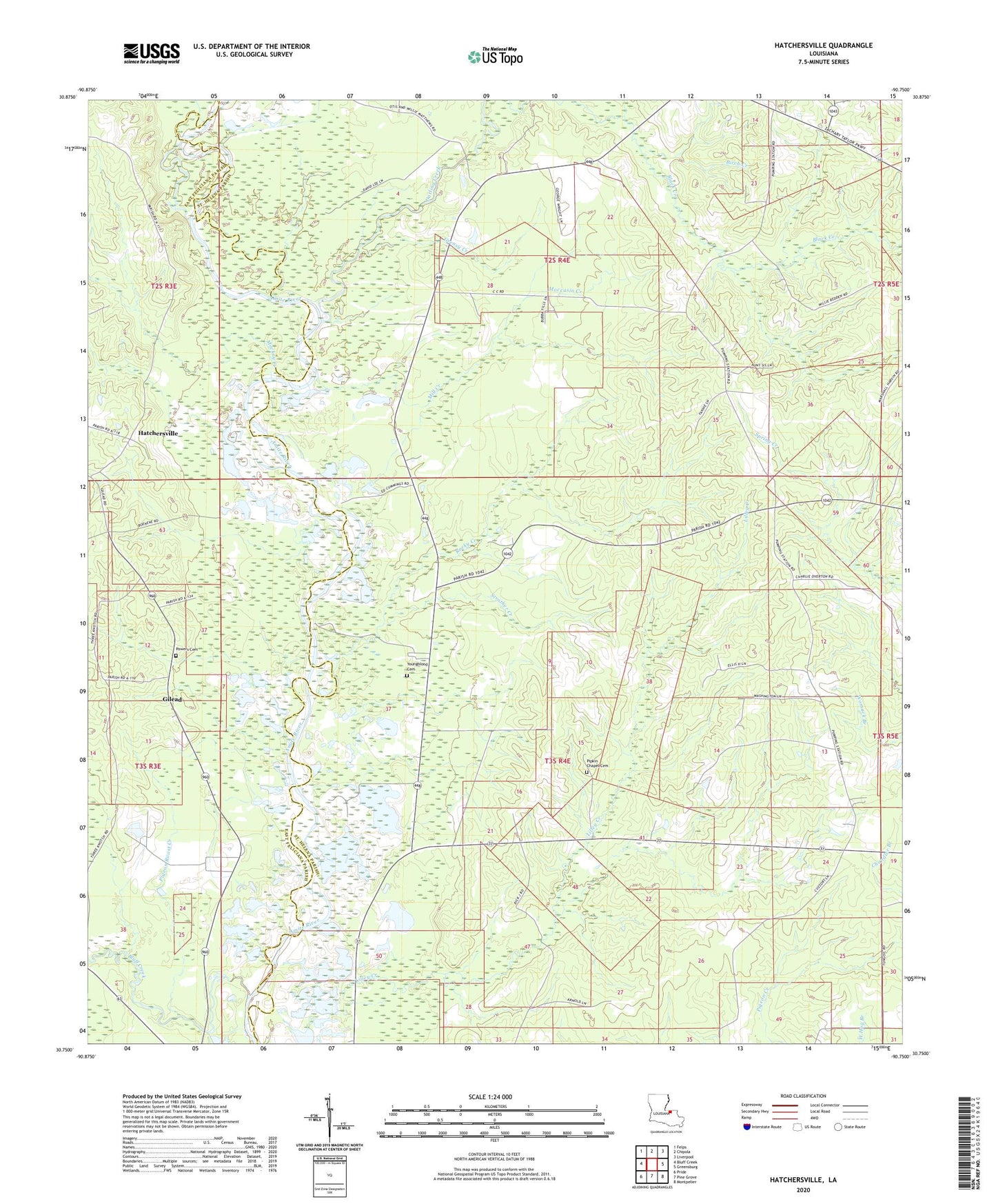
2024 topographic map quadrangle Hatchersville in the state of Louisiana. Scale: 1:24000. Based on the newly updated USGS 7.5' US Topo map series, this map is in the following counties: St. Helena, East Feliciana. The map contains contour data, water features, and other items you are used to seeing on USGS maps, but also has updated roads and other features. This is the next generation of topographic maps. Printed on high-quality waterproof paper with UV fade-resistant inks.
Quads adjacent to this one:
West: Bluff Creek
Northwest: Felps
North: Chipola
Northeast: Liverpool
East: Greensburg
Southeast: Montpelier
South: Pine Grove
Southwest: Pride
This map covers the same area as the classic USGS quad with code o30090g7.
Contains the following named places: Birch Creek, Black Creek, Darling Creek, Darlington Church, Dead River, East Amite Creek Prong, Gilead, Gilead Post Office, Greasy Creek, Hatchersville, Mackay Creek, Matthews Chapel, Mill Creek, Moccasin Creek, Mount Everett Church, New Star Church, New Star School, Pigeon Roost Creek, Pipkin Chapel, Pipkin Chapel Cemetery, Powers Cemetery, Rocky Creek, Spring Branch, Strother Creek, Sunflower School, Wesley Chapel, West Amite Creek Prong, Youngblood Cemetery