MyTopo
Pride Louisiana US Topo Map
Couldn't load pickup availability
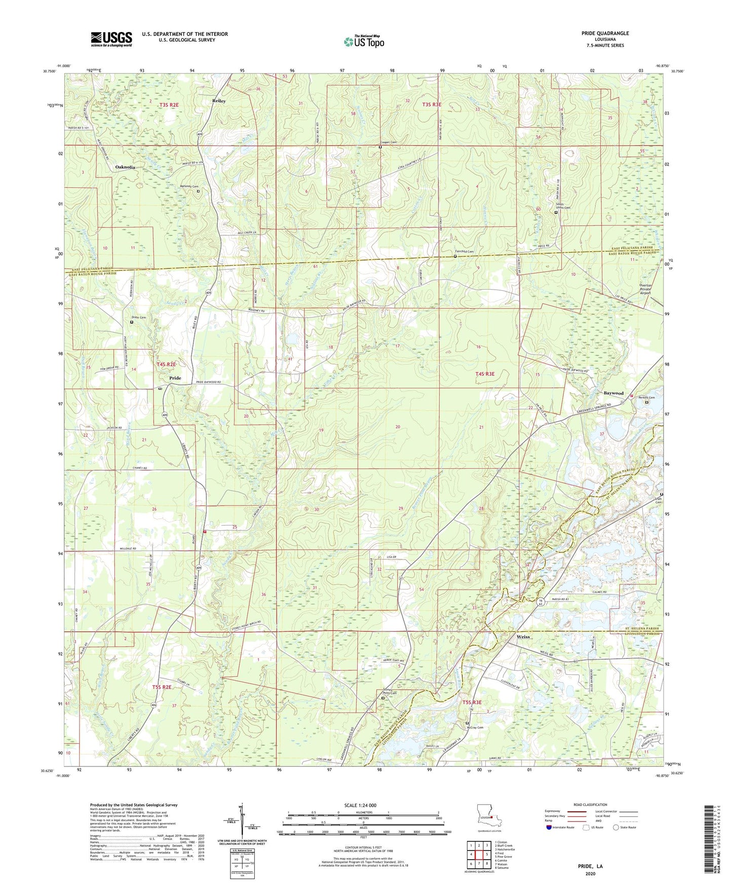
2024 topographic map quadrangle Pride in the state of Louisiana. Scale: 1:24000. Based on the newly updated USGS 7.5' US Topo map series, this map is in the following counties: East Baton Rouge, East Feliciana, Livingston, St. Helena. The map contains contour data, water features, and other items you are used to seeing on USGS maps, but also has updated roads and other features. This is the next generation of topographic maps. Printed on high-quality waterproof paper with UV fade-resistant inks.
Quads adjacent to this one:
West: Fred
Northwest: Clinton
North: Bluff Creek
Northeast: Hatchersville
East: Pine Grove
Southeast: Satsuma
South: Watson
Southwest: Comite
This map covers the same area as the classic USGS quad with code o30090f8.
Contains the following named places: Andrew Chapel, Baywood, Baywood Church, Baywood Park, Beaver Pond Bayou, Bell Creek, Bethany Church, Cedar Grove Church, Chaney Branch, Cooper Cemetery, Cotton Creek, Craft Cemetery, Dennis Mills, Drehr Cemetery, Duff Bayou, Fairchild Cemetery, Flanagan Bayou, Hanna Creek, Kidds Creek, Little Sandy Creek, Mahoney Cemetery, McCray Cemetery, McKnight Crossing, Mill Creek, New Hope Church, New Zion Church, Oaknolia, Oaknolia Post Office, Odom School, Perkins Cemetery, Pride, Pride Lookout Tower, Pride Post Office, Pride Volunteer Fire Department Station 10, Pride Volunteer Fire Department Station 12, Pride Ward Chapel, Reiley, Reimer Crossing, Salters Chapel, Sandy Creek Baptist Church, Saulteis Chapel, Scalous Creek, South Union Cemetery, South Union Church, Steep Bayou, Stoney Point Cemetery, Stonypoint, Strangers Home Church, Taber Creek, Weiss, Whitten Creek, Wind Bayou, ZIP Code: 70770