MyTopo
Pine Grove Louisiana US Topo Map
Couldn't load pickup availability
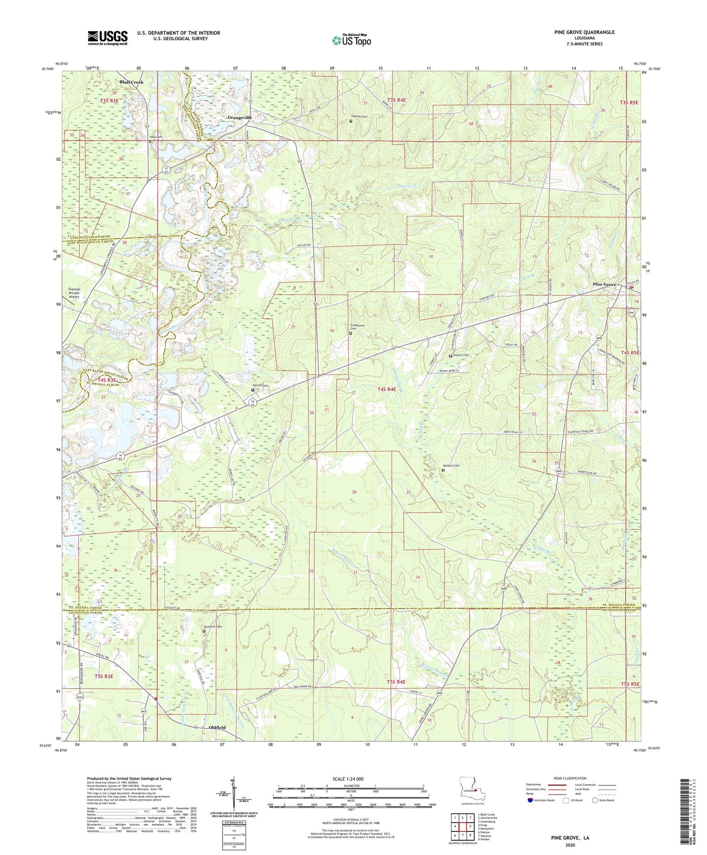
2024 topographic map quadrangle Pine Grove in the state of Louisiana. Scale: 1:24000. Based on the newly updated USGS 7.5' US Topo map series, this map is in the following counties: St. Helena, Livingston, East Feliciana, East Baton Rouge. The map contains contour data, water features, and other items you are used to seeing on USGS maps, but also has updated roads and other features. This is the next generation of topographic maps. Printed on high-quality waterproof paper with UV fade-resistant inks.
Quads adjacent to this one:
West: Pride
Northwest: Bluff Creek
North: Hatchersville
Northeast: Greensburg
East: Montpelier
Southeast: Holden
South: Satsuma
Southwest: Watson
This map covers the same area as the classic USGS quad with code o30090f7.
Contains the following named places: Beech Grove Church, Bluff Creek, Camp Stallion, Claibourne Branch, Claibourne Cemetery, Claibourne Chapel, Coast Guard Station Grangeville, Donald Chapel, Dutchman Creek, Felbert Creek, Glover Cemetery, Gospel Temple, Grangeville, Harrell Cemetery, Lilley Creek, Livingston Parish Fire Protection District 4 Station 8, Mill Creek, Mount Pleasant Church, Mullens Cemetery, Naul Cemetery, Oldfield, Overton Private Airport, Parish Governing Authority District 4, Pigeon Creek, Pine Grove, Pine Grove Church, Pine Grove Lookout Tower, Pine Grove Post Office, Pine Grove Volunteer Fire Department, Saint Joseph Church, Salem Baptist Church, Salem School, Sand Hill Cemetery, Thomas Cemetery, Williams Bridge, ZIP Code: 70453