MyTopo
Effie Louisiana US Topo Map
Couldn't load pickup availability
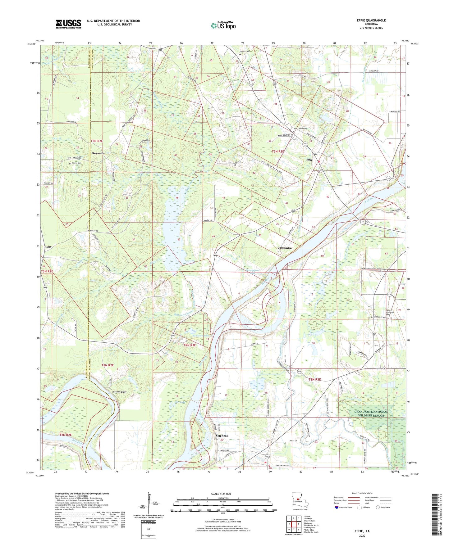
2024 topographic map quadrangle Effie in the state of Louisiana. Scale: 1:24000. Based on the newly updated USGS 7.5' US Topo map series, this map is in the following counties: Avoyelles, Rapides. The map contains contour data, water features, and other items you are used to seeing on USGS maps, but also has updated roads and other features. This is the next generation of topographic maps. Printed on high-quality waterproof paper with UV fade-resistant inks.
Quads adjacent to this one:
West: Latanier
Northwest: Libuse
North: Buckeye
Northeast: Powell Point
East: Marksville North
Southeast: Marksville South
Southwest: Cheneyville
This map covers the same area as the classic USGS quad with code o31092b2.
Contains the following named places: Big Lake, Bordelon Lake, Bringol Landing, Cannon Lake, Cassandra, Cassandria Landing, Center Point, Center Point Post Office, Champignol Lake, Cow Creek, Dads Lake, David Ferry, Effie, Effie Post Office, Effie Volunteer Fire Department, Egg Bend, Experiment Plantation, Fifth Ward, Fifth Ward Church, Fifth Ward School, Fifth Ward Volunteer Fire Department, French Cemetery, George Guillott Landing, Gin Bayou, Gin Lake, Grime Lake, Grimes Bluff, Grimes Bluff Landing, Harrisons Branch, Hays Cemetery, Hays Chapel, Lafargue Elementary School, Luneau Chapel, Marksville Middle School, Martinez Landing, Midway Landing, Moncla Landing, Myrtle Grove Landing, Oak Grove Cemetery, Oak Grove Church, Once More Landing, Our Lady of Lourdes Church, Pierce Cemetery, Pillars Creek, Pine Grove Church, Pine Grove School, Pinegrove, Rays Landing Strip, Redmond Bayou, Reynolds, Reynolds Lake, Riverside Church, Ruby, Ruby Post Office, Ruby School, Saint Catherine Cemetery, Saint Catherine Church, Saint Winfred Church, Star Light Church, Swoffords Creek, Upper Ashland Landing, Wiggins Bayou