MyTopo
East Point Louisiana US Topo Map
Couldn't load pickup availability
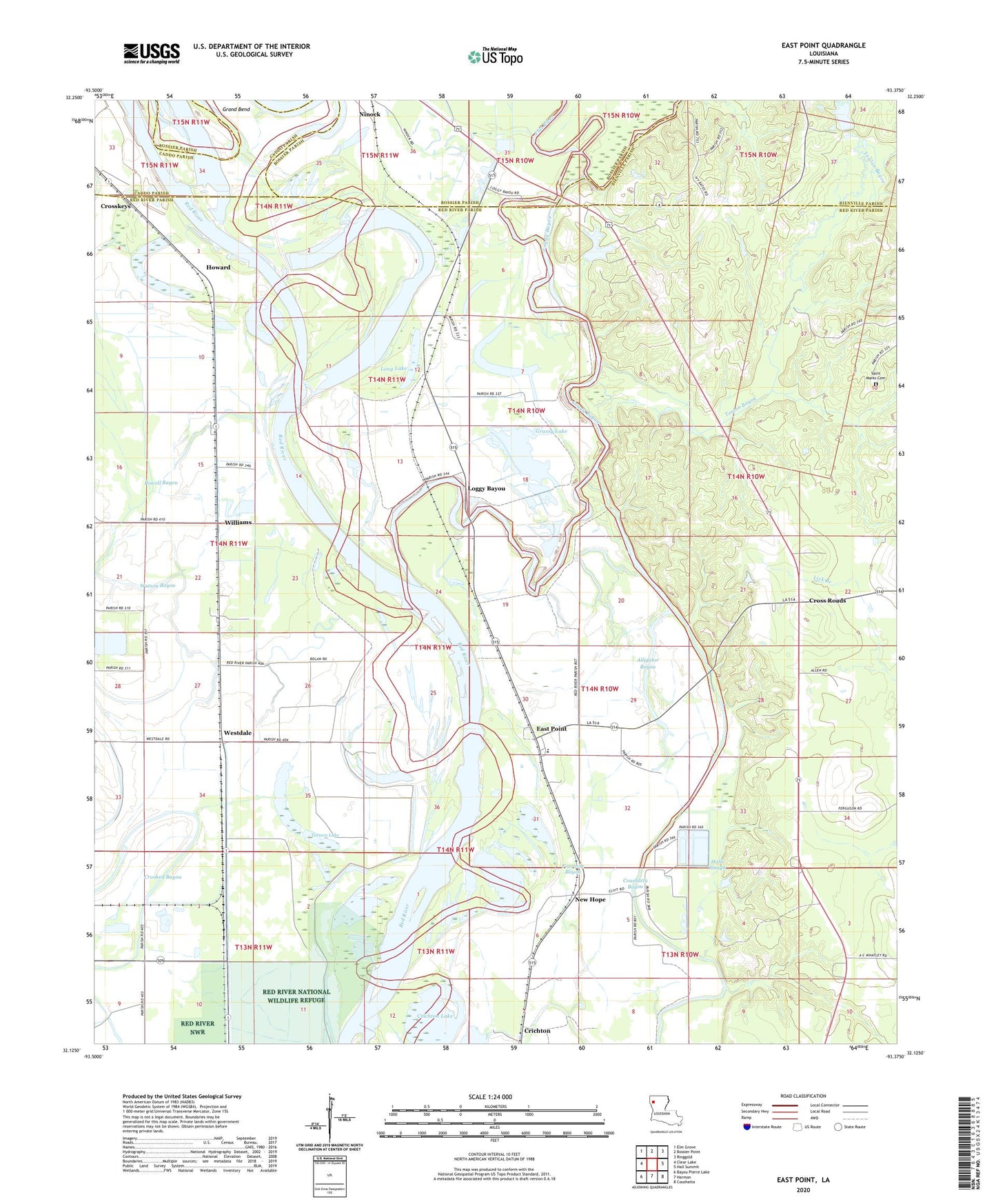
2024 topographic map quadrangle East Point in the state of Louisiana. Scale: 1:24000. Based on the newly updated USGS 7.5' US Topo map series, this map is in the following counties: Red River, Bossier, Bienville, Caddo. The map contains contour data, water features, and other items you are used to seeing on USGS maps, but also has updated roads and other features. This is the next generation of topographic maps. Printed on high-quality waterproof paper with UV fade-resistant inks.
Quads adjacent to this one:
West: Clear Lake
Northwest: Elm Grove
North: Bossier Point
Northeast: Ringgold
East: Hall Summit
Southeast: Coushatta
South: Harmon
Southwest: Bayou Pierre Lake
This map covers the same area as the classic USGS quad with code o32093b4.
Contains the following named places: Alligator Bayou, Bayou Pierre, Coushatta Bayou, Crichton Lake, Crooked Bayou, Cross Roads, Crosskeys, Des Arc Oil Field, East Hope Gas Field, East Point, East Point Post Office, Elizabeth Church, Flat River, Fourmile Bayou, Grassy Lake, Grassy Lake Gas Field, Halls Slough, Howard, Liberty Hill Church, Loggy Bayou, Long Lake, New Era Church, New Hope, New Jerusalem Church, Ninock, Parish Governing Authority District 4, Powell Bayou, Prudhomme Lake, Riverdale Academy School, Saint John the Baptist Church, Saint Marks Cemetery, Saint Mary Church, Spring Hill Branch, Thomas Landing, Toulon Bayou, Toulon Bayou Gas Field, Toulon Bayou Number One Dam, True Vine Church, Turners Lake, Westdale, Williams, Williams Gas Field