MyTopo
Harmon Louisiana US Topo Map
Couldn't load pickup availability
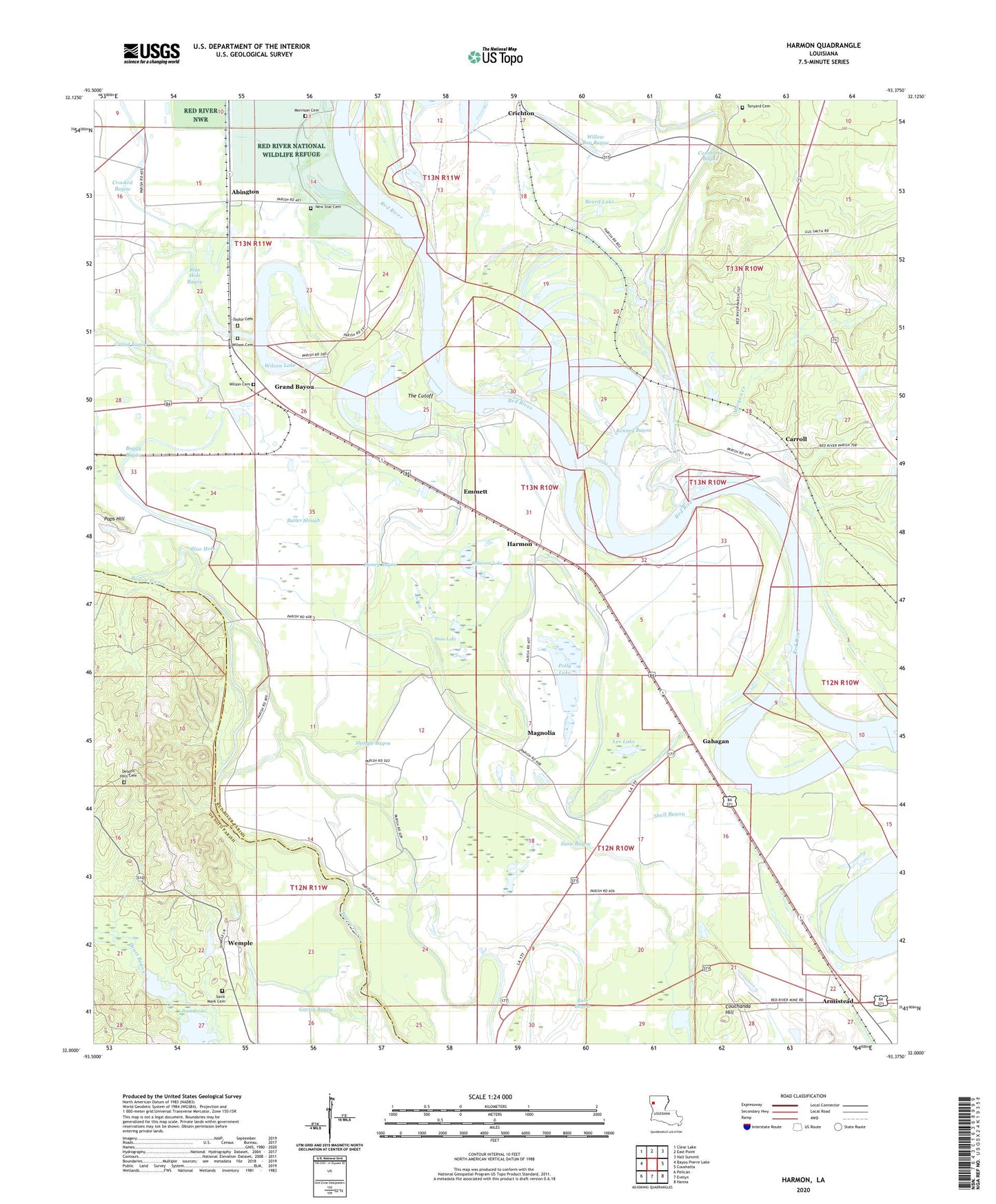
2024 topographic map quadrangle Harmon in the state of Louisiana. Scale: 1:24000. Based on the newly updated USGS 7.5' US Topo map series, this map is in the following counties: Red River, De Soto. The map contains contour data, water features, and other items you are used to seeing on USGS maps, but also has updated roads and other features. This is the next generation of topographic maps. Printed on high-quality waterproof paper with UV fade-resistant inks.
Quads adjacent to this one:
West: Bayou Pierre Lake
Northwest: Clear Lake
North: East Point
Northeast: Hall Summit
East: Coushatta
Southeast: Hanna
South: Evelyn
Southwest: Pelican
This map covers the same area as the classic USGS quad with code o32093a4.
Contains the following named places: Abington, Armistead, Barnes Lake, Beard Lake, Blue Hole, Blue Hole Bayou, Boggy Bayou, Boon Brake, Bright and Morning Star Church, Bull Bayou, Butler Slough, Carroll, Corinth Church, Couchanda Hill, Crichton, Emmett, Fortson, Gahagan, Garsia Bayou, Grand Bayou, Grand Bayou School, Greenings Ferry, Harmon, Harmon Post Office, Heart Bayou, Honey Bayou, Kenney Bayou, Lee Lake, Linsberry, Macedonia Church, Magnolia, Mary Magdalene Church, Morgan Creek, Morning Star Church, Morrison Cemetery, Moss Lake, Mount Olive Church, New Beulah Church, New Star Cemetery, New Star Church, Old Mary Magdalene Church, Oxbow, Polly Lake, Red River Bull Bayou Oil Field, Robinson Lake, Shingle Bayou, Starlight Church, Stuart Airstrip, Susie Bayou, Susie Island School, Tanyard Cemetery, Taylor Cemetery, The Cutoff, Ward Four, Ware Youth Center School, Wemple, Willow Bay Bayou, Willow Grove Church, Wilson Cemetery, Wilson Lake