MyTopo
Evelyn Louisiana US Topo Map
Couldn't load pickup availability
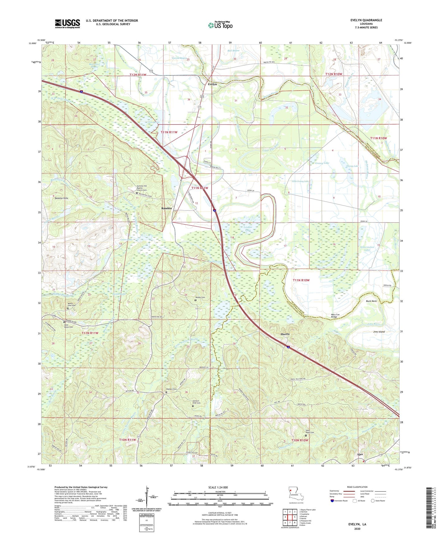
2024 topographic map quadrangle Evelyn in the state of Louisiana. Scale: 1:24000. Based on the newly updated USGS 7.5' US Topo map series, this map is in the following counties: De Soto, Natchitoches, Red River. The map contains contour data, water features, and other items you are used to seeing on USGS maps, but also has updated roads and other features. This is the next generation of topographic maps. Printed on high-quality waterproof paper with UV fade-resistant inks.
Quads adjacent to this one:
West: Pelican
Northwest: Bayou Pierre Lake
North: Harmon
Northeast: Coushatta
East: Hanna
Southeast: Allen
South: Hollis Creek
Southwest: Pleasant Hill
This map covers the same area as the classic USGS quad with code o31093h4.
Contains the following named places: Ajax, Alexander Branch, Belle Bayou, Blanchard Bayou, Bois d'arc Bayou, Buck Neck, Butler, Campti Lake, Chemard Lake, Chemard Lake Oil Field, Couchanda Lake, Dolet Bayou, Dolet Brake, Egypt Church, Evelyn, Flat River, Grassy Lake, Grogan Oil Field, Harris, Hickman Bayou, Jims River, Little Flat River, Little Grassy Lake, Little Wallace Bayou, Long Lake, Louies Bayou, Louies Brake, Maguire Branch, Mary Cox Bridge, Natchitoches Fire Protection District 7 Station 5, Pigpen Bayou, Pleasant Hill, Prairie Bayou, Rambin, Rambin Bayou, Red Bayou Church, Saint James Church, Saint Lukes Baptist Church, Saint Marys Cemetery, Saint Marys Church, Saint Pauls Cemetery, Sample Brake, Shell Bayou, Stumpy Lake, Teloque Lake, Thompson Creek, Thorny Lake, Wallace, Wallace Bayou, Wallace Cemetery, Wallace Church, Watermelon Lake, West Branch Dolet Bayou