MyTopo
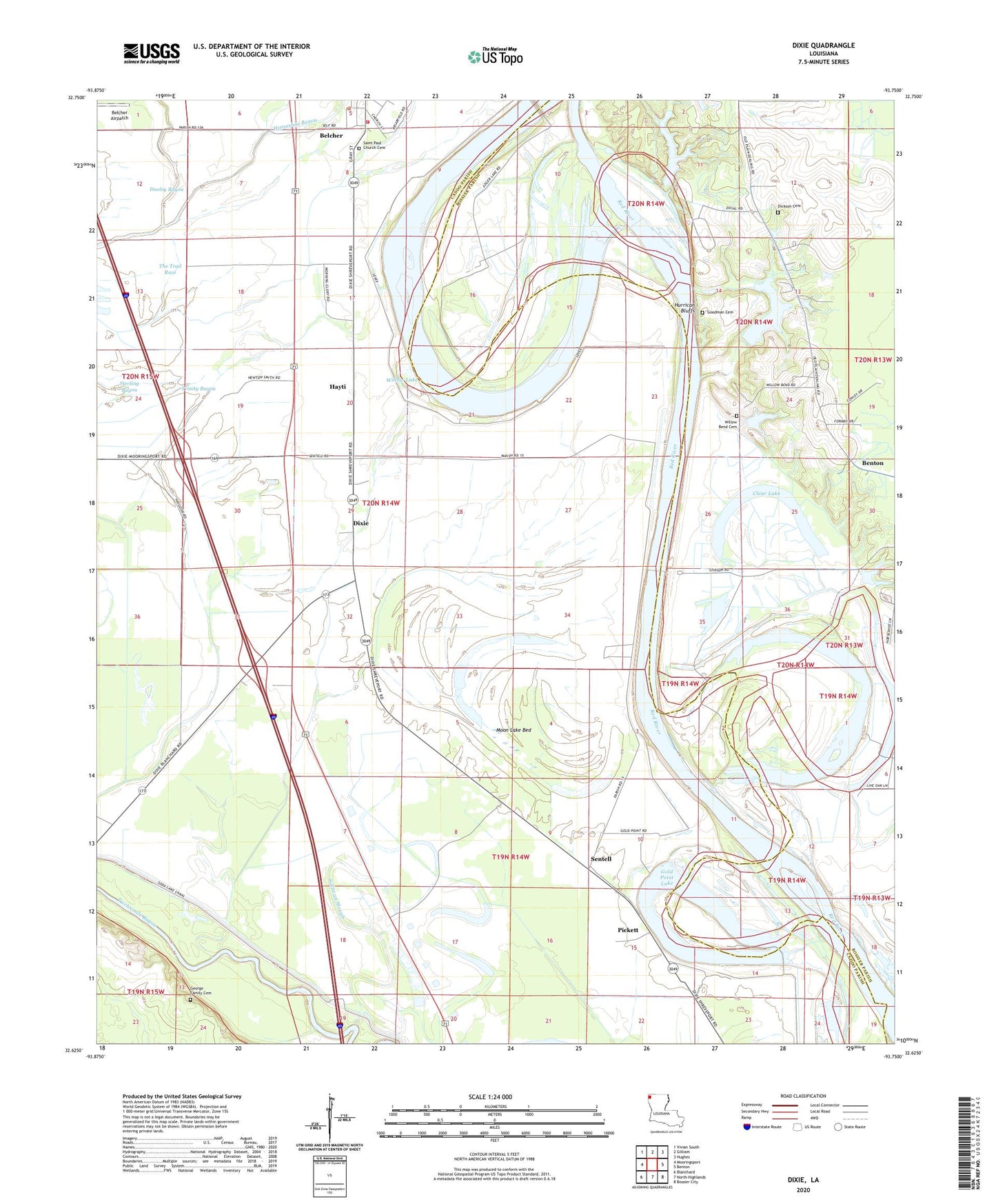
Dixie Louisiana US Topo Map
Couldn't load pickup availability
2024 topographic map quadrangle Dixie in the state of Louisiana. Scale: 1:24000. Based on the newly updated USGS 7.5' US Topo map series, this map is in the following counties: Caddo, Bossier. The map contains contour data, water features, and other items you are used to seeing on USGS maps, but also has updated roads and other features. This is the next generation of topographic maps. Printed on high-quality waterproof paper with UV fade-resistant inks.
Quads adjacent to this one:
West: Mooringsport
Northwest: Vivian South
North: Gilliam
Northeast: Hughes
East: Benton
Southeast: Bossier City
South: North Highlands
Southwest: Blanchard
This map covers the same area as the classic USGS quad with code o32093f7.
Contains the following named places: Bee Lake, Bee Lake Dam, Belcher, Belcher Airpatch, Bethel Church, Brier Field Ferry, Caddo Prairie, Cash Point Canal, Cat Island Lake, Clear Lake, Cottonwood Canal, Cottonwood Lake, Cowhide Bayou, Cypress Lake, Dickson Cemetery, Dixie, Dixie Airstrip, Dixie Oil Field, Doe Slough Canal, Dooley Bayou, Gold Point Lake, Hayti, Horseshoe Bayou, Hurrican Bluffs, Irish Bayou, Jefferson Shreveport Waterway Project, KEEL-AM (Shreveport), Lenwood Church, Little Kingdom Church, Moon Lake, Moon Lake Bed, Pickett, Providence School, Rock Point Oil Field, Rose of Sharon Church, Rosenwald School, Saint James School, Sentell, Sentell Ferry, Sentell Plantation, Slay's Ultralight Flightpark, Stumpy Lake, Sullivan Slough, The Trail Race, Thompson Bayou, Trinity Bayou, Uni, Williams Lake, Willow Chute, Willow Lake, ZIP Code: 71004


