MyTopo
Bayou Pierre Lake Louisiana US Topo Map
Couldn't load pickup availability
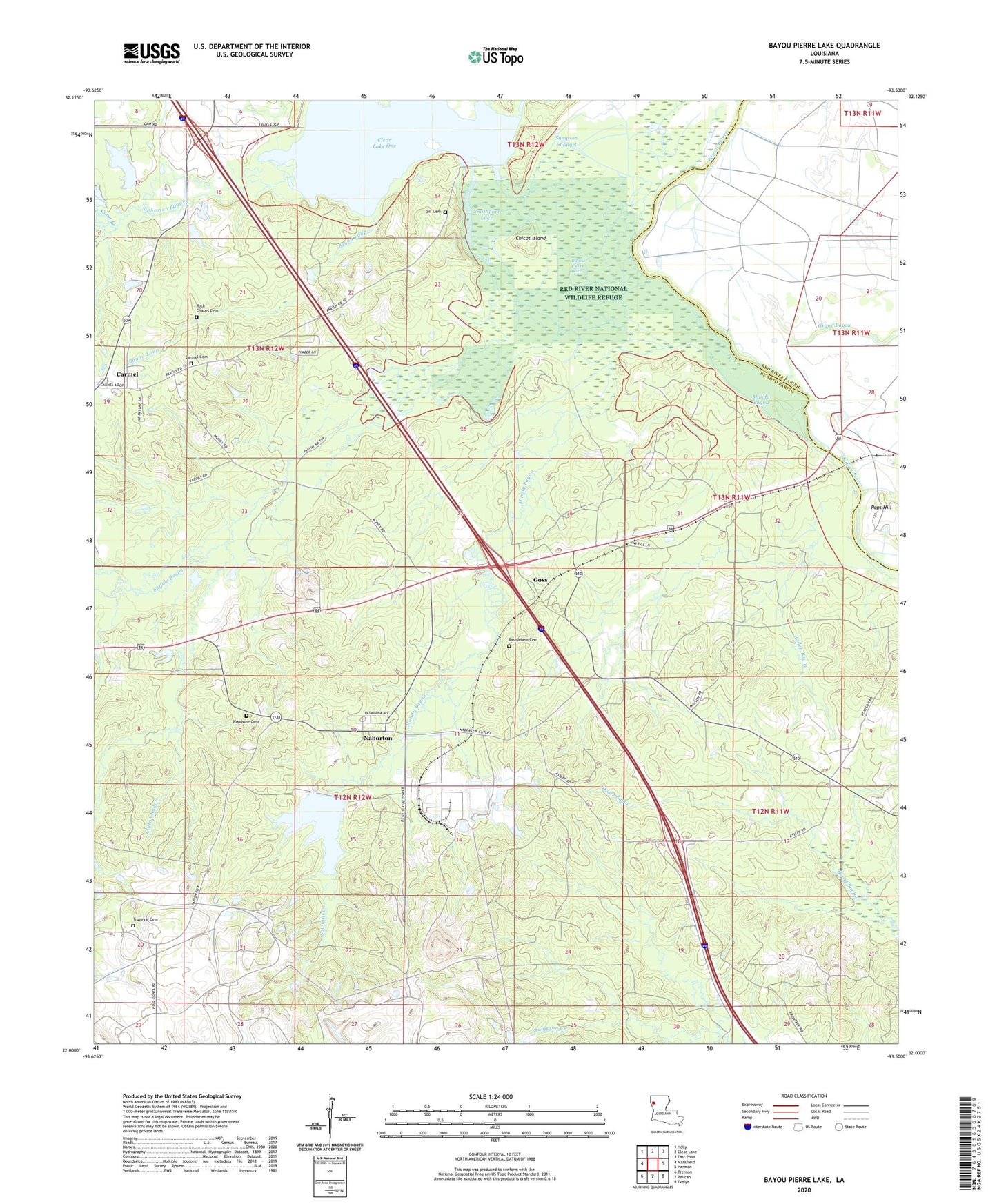
2024 topographic map quadrangle Bayou Pierre Lake in the state of Louisiana. Scale: 1:24000. Based on the newly updated USGS 7.5' US Topo map series, this map is in the following counties: De Soto, Red River. The map contains contour data, water features, and other items you are used to seeing on USGS maps, but also has updated roads and other features. This is the next generation of topographic maps. Printed on high-quality waterproof paper with UV fade-resistant inks.
Quads adjacent to this one:
West: Mansfield
Northwest: Holly
North: Clear Lake
Northeast: East Point
East: Harmon
Southeast: Evelyn
South: Pelican
Southwest: Trenton
This map covers the same area as the classic USGS quad with code o32093a5.
Contains the following named places: Bailey Bayou, Bayou Loup, Bayou Pierre Lake, Bethlehem Cemetery, Buffalo Bayou, Carmel, Carmel School, Chicot Island, Clifton Bayou, Coon Branch, Dill Cemetery, Goss, Immaculate Conception Church, Mount Carmel Church, Mundy Bayou, Mundy Church, Naborton, Paps Hill, Parish Governing Authority District 4C, Red River - Bull Bayou Oil and Gas Field, Rock Chapel, Sampson Channel, Sawlog Lake, Sawmill Creek, Siphorien Bayou, Smithport Dam, Smithport Lake, Truevine Cemetery, Truevine Church, Ward Five, Willow Lake, Woodvine Cemetery