MyTopo
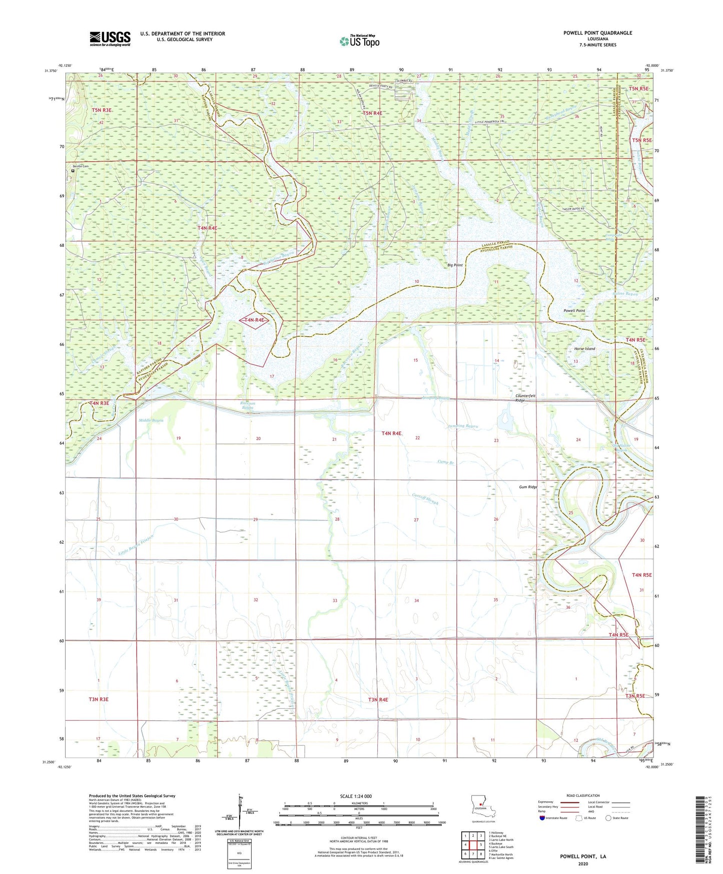
Powell Point Louisiana US Topo Map
Couldn't load pickup availability
2024 topographic map quadrangle Powell Point in the state of Louisiana. Scale: 1:24000. Based on the newly updated USGS 7.5' US Topo map series, this map is in the following counties: Avoyelles, LaSalle, Rapides, Catahoula. The map contains contour data, water features, and other items you are used to seeing on USGS maps, but also has updated roads and other features. This is the next generation of topographic maps. Printed on high-quality waterproof paper with UV fade-resistant inks.
Quads adjacent to this one:
West: Buckeye
Northwest: Holloway
North: Buckeye NE
Northeast: Larto Lake North
East: Larto Lake South
Southeast: Lac Sainte Agnes
South: Marksville North
Southwest: Effie
This map covers the same area as the classic USGS quad with code o31092c1.
Contains the following named places: Big Bayou Friejon, Big Creek, Big Island Oil Field, Big Point, Big Saline Bayou, Bushyhead Bayou, Camels Slough, Camp Branch, Campright Brake, Castoff Slough, Counterfeit Ridge, Deville Cemetery, Gum Ridge, Horse Island, Horseshoe Lake, Jumping Bayou, Little Bayou Friejon, Middle Bayou, Middle Bayou Oil Field, Muddy Bayou, Muddy Slough, Nolan Bayou, Nolans Bayou Oil Field, North Saline Lake Oil Field, Old Saline Bayou, Open Bayou, Pointe Saline, Powell Point, Raccoon Bayou, Racoon Lake, Saint Leo Church Oil Field, Saline Lake, Shoe Bayou, Taylor Bayou, Vick Oil Field, ZIP Code: 71331