MyTopo
Aimwell Louisiana US Topo Map
Couldn't load pickup availability
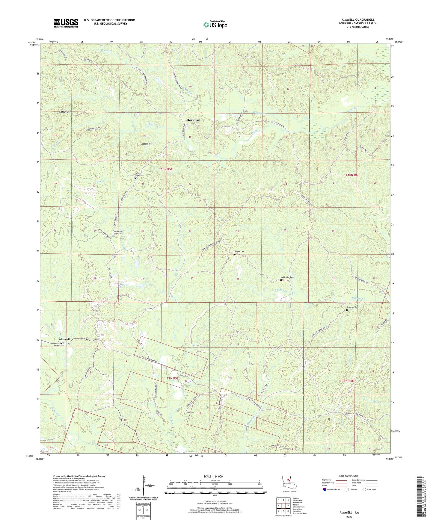
2024 topographic map quadrangle Aimwell in the state of Louisiana. Scale: 1:24000. Based on the newly updated USGS 7.5' US Topo map series, this map is in the following counties: Catahoula. The map contains contour data, water features, and other items you are used to seeing on USGS maps, but also has updated roads and other features. This is the next generation of topographic maps. Printed on high-quality waterproof paper with UV fade-resistant inks.
Quads adjacent to this one:
West: Nickel
Northwest: Holum
North: Enterprise
Northeast: Extension
East: Harrisonburg
Southeast: Jonesville North
South: Manifest
Southwest: Jena East
This map covers the same area as the classic USGS quad with code o31091g8.
Contains the following named places: Aimwell, Aimwell Baptist Church, Aimwell Cemetery, Aimwell Lookout Tower, Aimwell Pentecostal Church, Aimwell Post Office, Cassels Hill, Chalk Hills, Ford Cemetery, Haggerty Creek, McClendon Cemetery, Old Spring Ridge Cemetery, Parish Governing Authority District 3, Prichard, Pritchard Cemetery, Rocky Creek, Sherwood, Siloam Cemetery, Spring Ridge, Spring Ridge Cemetery, Spring Ridge Church, Sugar Creek, Ward Three, ZIP Code: 71401