MyTopo
Harrisonburg Louisiana US Topo Map
Couldn't load pickup availability
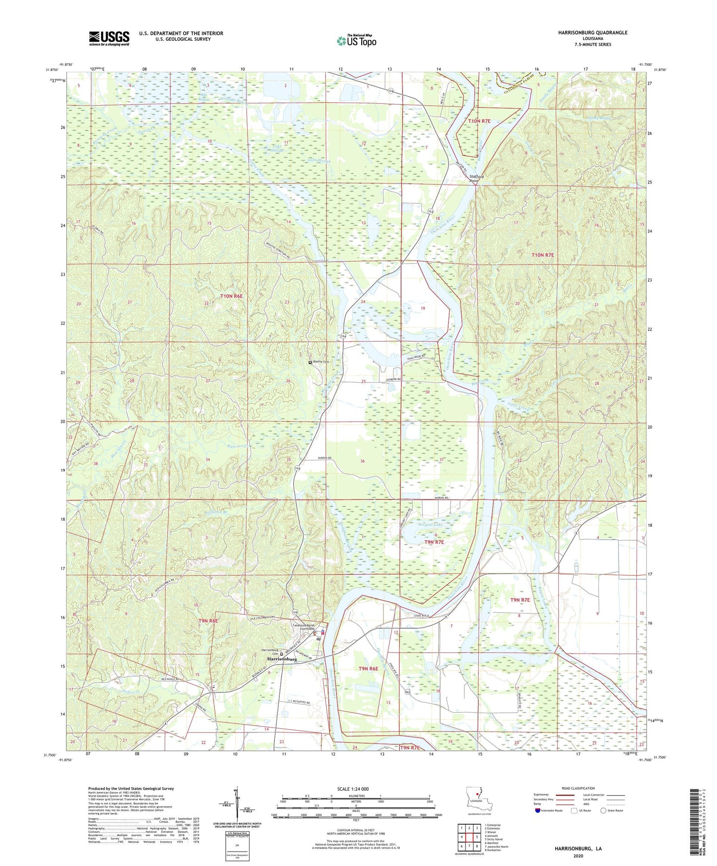
2024 topographic map quadrangle Harrisonburg in the state of Louisiana. Scale: 1:24000. Based on the newly updated USGS 7.5' US Topo map series, this map is in the following counties: Catahoula, Franklin. The map contains contour data, water features, and other items you are used to seeing on USGS maps, but also has updated roads and other features. This is the next generation of topographic maps. Printed on high-quality waterproof paper with UV fade-resistant inks.
Quads adjacent to this one:
West: Aimwell
Northwest: Enterprise
North: Extension
Northeast: Wisner
East: Sicily Island
Southeast: Dunbarton
South: Jonesville North
Southwest: Manifest
This map covers the same area as the classic USGS quad with code o31091g7.
Contains the following named places: Bayou Louis, Big Bayou, Big Creek, Boeuf River, Boothe Cemetery, Brushy Creek, Callahan Branch, Catahoula Parish Courthouse, Catahoula Parish Sheriff's Office, Coke Creek, Deer Creek, Dry Lake, Gastis Creek, Guthrie Lake, Harrisonburg, Harrisonburg Cemetery, Harrisonburg Elementary School, Harrisonburg High School, Harrisonburg Oil Field, Harrisonburg Police Department, Harrisonburg Post Office, Harrisonburg Volunteer Fire Department, Hooter Creek, Kennedy Creek, Kidron Baptist Church, Lake Slough, Little Creek, Lock and Dam Number Two, Onemile Bayou, Parish Governing Authority District 4, Prichard Oil Field, Rawson Creek, Rawson Creek Church, Rawson Creek Oil Field, Sandy Bayou, Sargent Lake, Sicily Island, Sicily Island Hills State Wildlife Management Area, South Prichard Oil Field, Stafford Lake, Stafford Point, Stafford Point Church, Stokes Creek Oil Field, Straight Bayou, Town Lake, Village of Harrisonburg, Ward Four, ZIP Code: 71340