MyTopo
Weeks Louisiana US Topo Map
Couldn't load pickup availability
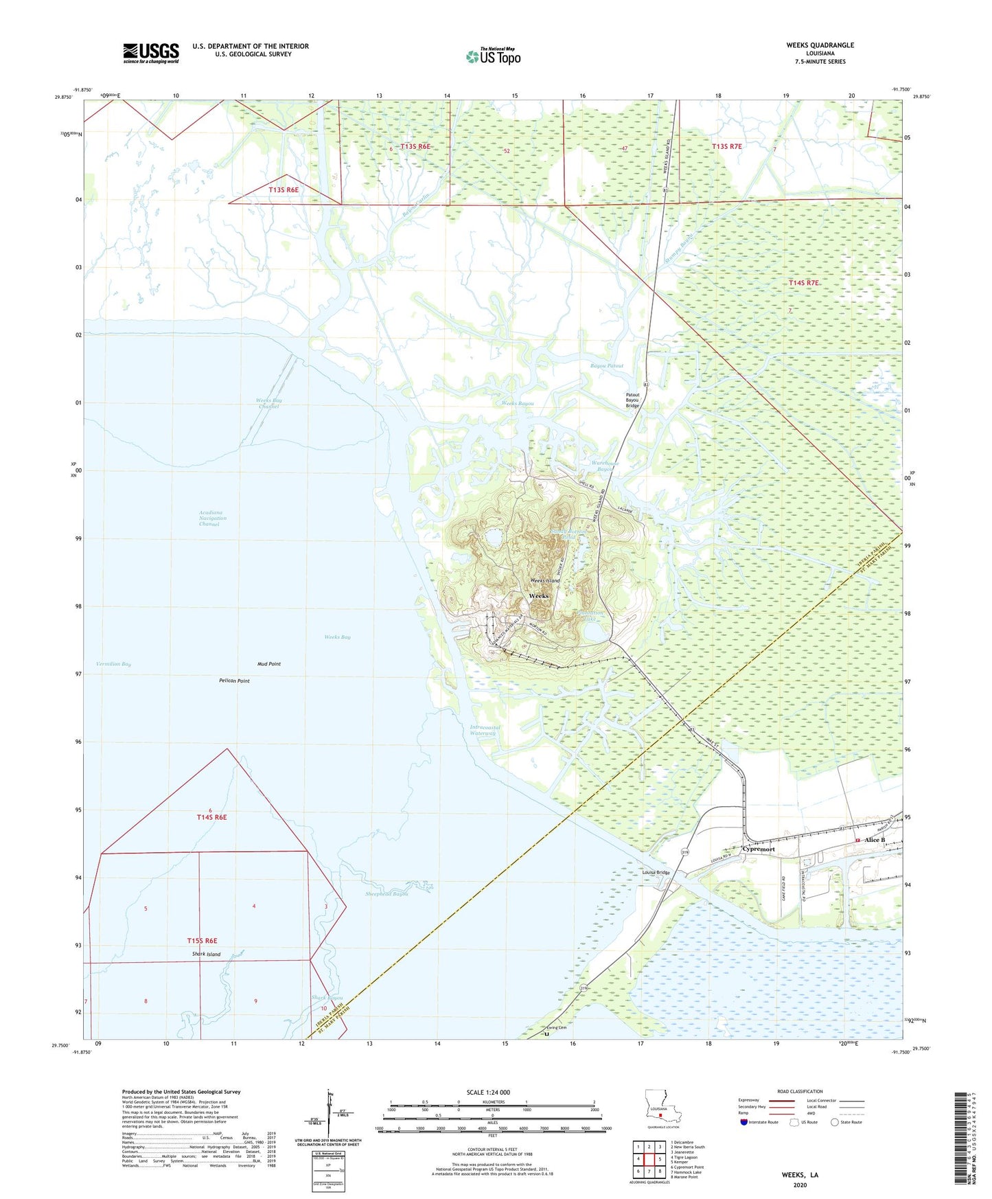
2024 topographic map quadrangle Weeks in the state of Louisiana. Scale: 1:24000. Based on the newly updated USGS 7.5' US Topo map series, this map is in the following counties: Iberia, St. Mary. The map contains contour data, water features, and other items you are used to seeing on USGS maps, but also has updated roads and other features. This is the next generation of topographic maps. Printed on high-quality waterproof paper with UV fade-resistant inks.
Quads adjacent to this one:
West: Tigre Lagoon
Northwest: Delcambre
North: New Iberia South
Northeast: Jeanerette
East: Kemper
Southeast: Marone Point
South: Hammock Lake
Southwest: Cypremort Point
This map covers the same area as the classic USGS quad with code o29091g7.
Contains the following named places: Alice B, Bayou Carlin, Bayou Cypremort, Bayou Garrett, Bayou Patout, Bayou Pete, Bayou Pirre, Cypremort, Cypremort Prairie, Ewing Cemetery, Long Ride Barge Bayou, Louisa Bridge, Mud Point, Patout Bayou Bridge, Pelican Point, Pentecostal Church, Plantation Lake, Port of West Saint Mary, Saint Mary Parish Volunteer Fire Department Louisa / Port of West Saint Mary Community Station 4, Sandy Bottom Pond, Shark Island, Sheephead Bayou, Stumpy Bayou, Two Mouth Bayou, Warehouse Bayou, Weeks, Weeks Bay, Weeks Bay Channel, Weeks Bayou, Weeks Island, Weeks Island Oil and Gas Field