MyTopo
Kilbourne Louisiana US Topo Map
Couldn't load pickup availability
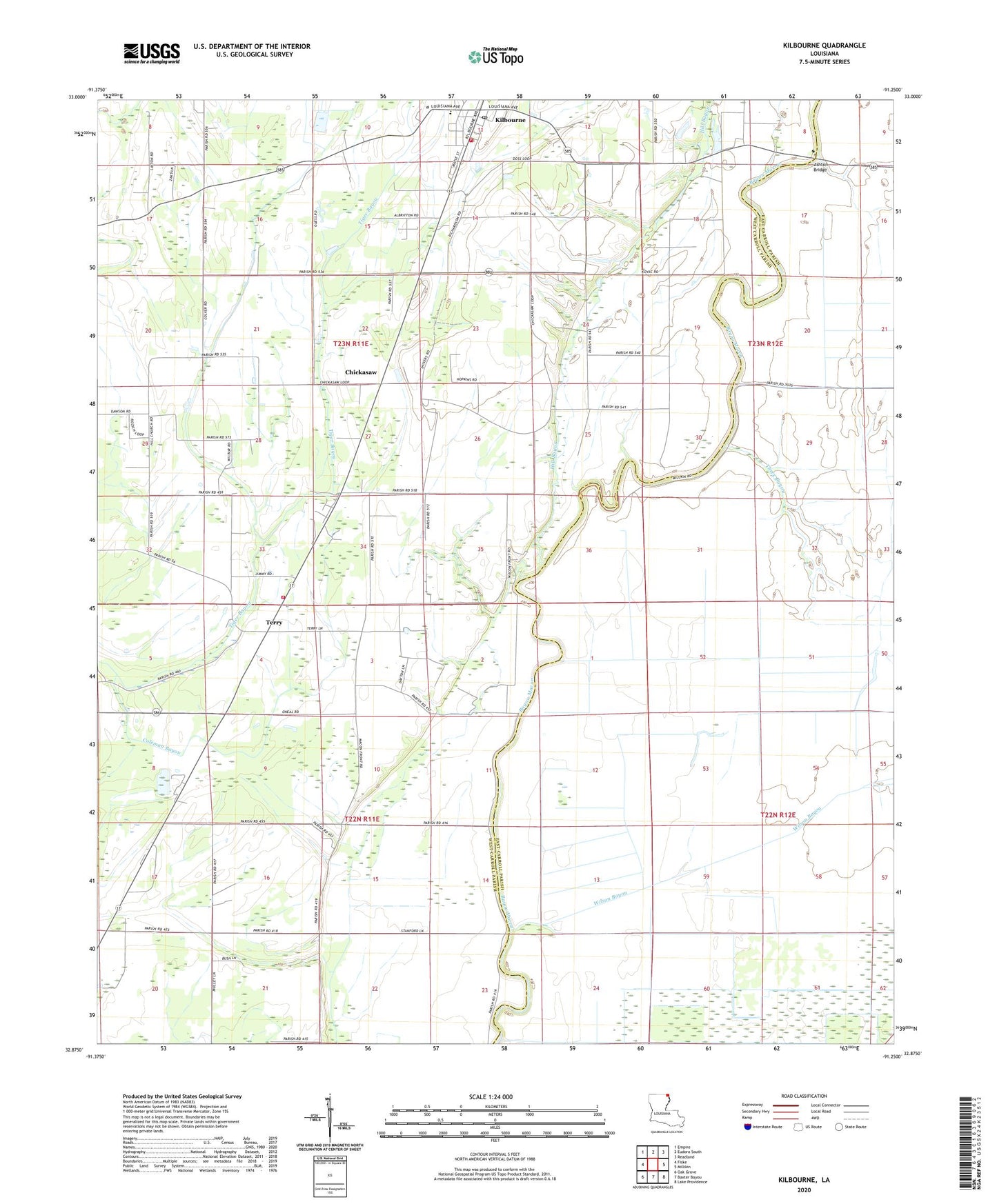
2024 topographic map quadrangle Kilbourne in the state of Louisiana. Scale: 1:24000. Based on the newly updated USGS 7.5' US Topo map series, this map is in the following counties: West Carroll, East Carroll. The map contains contour data, water features, and other items you are used to seeing on USGS maps, but also has updated roads and other features. This is the next generation of topographic maps. Printed on high-quality waterproof paper with UV fade-resistant inks.
Quads adjacent to this one:
West: Fiske
Northwest: Empire
North: Eudora South
Northeast: Readland
East: Millikin
Southeast: Lake Providence
South: Baxter Bayou
Southwest: Oak Grove
This map covers the same area as the classic USGS quad with code o32091h3.
Contains the following named places: Ashton Bridge, Bethlehem Church, Bloomshade Church, Chickasaw, Church of Christ, Coleman Bayou, Concord Volunteer Fire Department Oak Grove Station, Hill Bayou, Hill Church, Hill School, Kilbourne, Kilbourne High School, Kilbourne Post Office, Kilbourne Village Police Department, Kilbourne Volunteer Fire Department, Locust Grove Church, Parish Governing Authority District D, Terry, Terry Post Office, Three Bayou, Village of Kilbourne, Ward Five, Wilson Bayou, ZIP Code: 71253