MyTopo
Oak Grove Louisiana US Topo Map
Couldn't load pickup availability
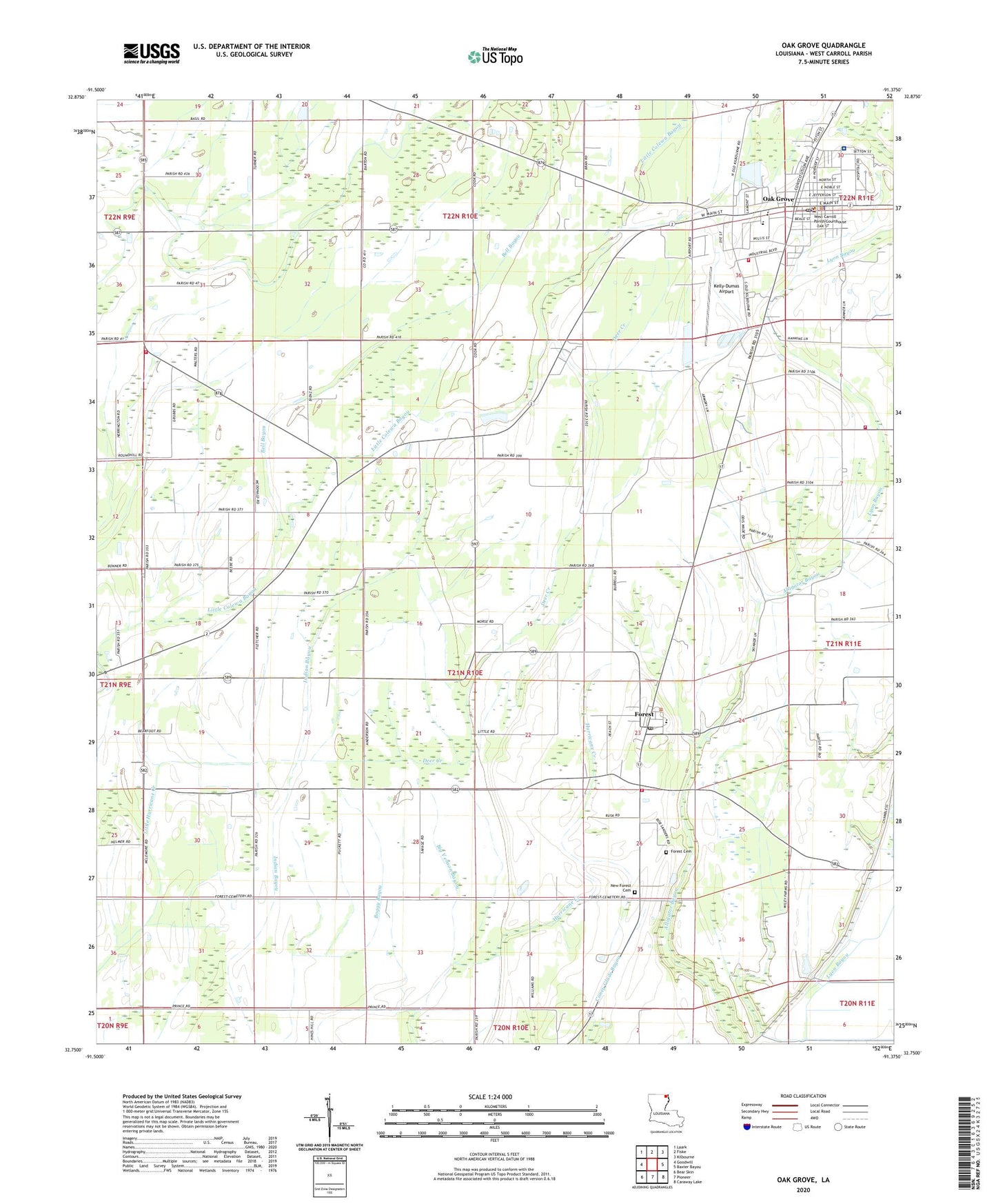
2024 topographic map quadrangle Oak Grove in the state of Louisiana. Scale: 1:24000. Based on the newly updated USGS 7.5' US Topo map series, this map is in the following counties: West Carroll. The map contains contour data, water features, and other items you are used to seeing on USGS maps, but also has updated roads and other features. This is the next generation of topographic maps. Printed on high-quality waterproof paper with UV fade-resistant inks.
Quads adjacent to this one:
West: Goodwill
Northwest: Laark
North: Fiske
Northeast: Kilbourne
East: Baxter Bayou
Southeast: Caraway Lake
South: Pioneer
Southwest: Bear Skin
This map covers the same area as the classic USGS quad with code o32091g4.
Contains the following named places: Bell Bayou, Big Black Slough, Big Venson Bayou, Colewa Bayou, Deer Creek, Fiske Union Volunteer Fire Department South Station, Forest, Forest Cemetery, Forest High School, Forest Post Office, Forest Volunteer Fire Department Central Station, Forest Volunteer Fire Department Substation, Green, Green Chapel, Green Church, Hixon Church, Kelly-Dumas Airport, Little Colewa Bayou, New Forest Cemetery, New Zion Church, Oak Grove, Oak Grove Elementary School, Oak Grove High School, Oak Grove Police Department, Oak Grove Post Office, Oak Grove Volunteer Fire Department, Parish Governing Authority District C, Redwing, Redwing Church, Redwing School, Sardis Church, Town of Oak Grove, Village of Forest, Ward Four, Ward Three, West Carroll Memorial Hospital, West Carroll Parish, West Carroll Parish Library, West Carroll Parish Sheriff's Office, ZIP Code: 71263