MyTopo
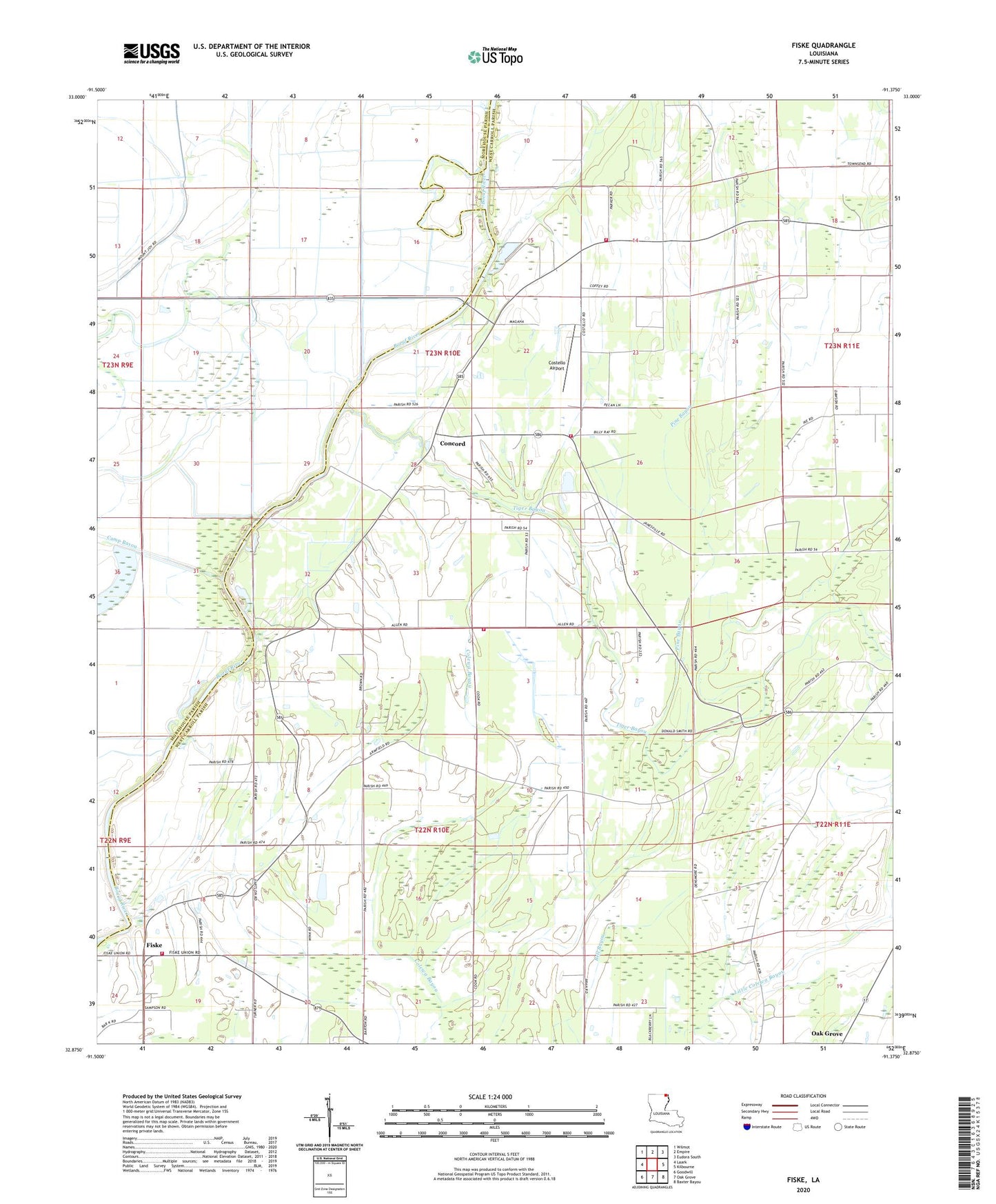
Fiske Louisiana US Topo Map
Couldn't load pickup availability
2024 topographic map quadrangle Fiske in the state of Louisiana. Scale: 1:24000. Based on the newly updated USGS 7.5' US Topo map series, this map is in the following counties: West Carroll, Morehouse. The map contains contour data, water features, and other items you are used to seeing on USGS maps, but also has updated roads and other features. This is the next generation of topographic maps. Printed on high-quality waterproof paper with UV fade-resistant inks.
Quads adjacent to this one:
West: Laark
Northwest: Wilmot
North: Empire
Northeast: Eudora South
East: Kilbourne
Southeast: Baxter Bayou
South: Oak Grove
Southwest: Goodwill
This map covers the same area as the classic USGS quad with code o32091h4.
Contains the following named places: Beulah Church, Camp Bayou, Concord, Concord Church, Concord Volunteer Fire Department Central Station, Concord Volunteer Fire Department Macedonia Station, Costello Airport, Dam 73, Dam 76, Dam 78, Dam 80, Fiske, Fiske Union School, Fiske Union Volunteer Fire Department Central Station, Fiske Union Volunteer Fire Department North Station, Green Cove Church, Macedonia Church, Parish Governing Authority District E, Pine Bayou, Saint Clemith Church, Tiger Bayou