MyTopo
Collinston East Louisiana US Topo Map
Couldn't load pickup availability
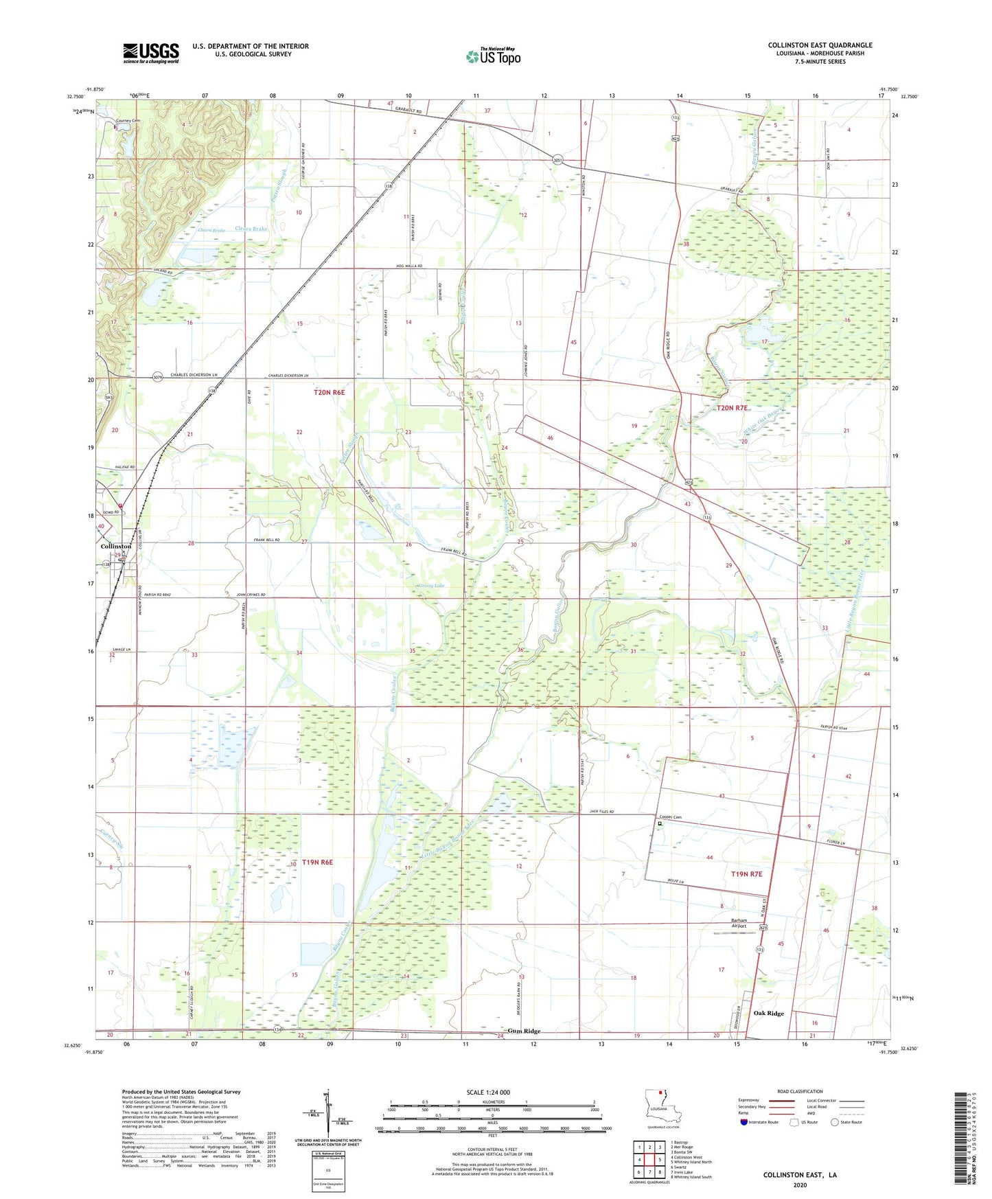
2024 topographic map quadrangle Collinston East in the state of Louisiana. Scale: 1:24000. Based on the newly updated USGS 7.5' US Topo map series, this map is in the following counties: Morehouse. The map contains contour data, water features, and other items you are used to seeing on USGS maps, but also has updated roads and other features. This is the next generation of topographic maps. Printed on high-quality waterproof paper with UV fade-resistant inks.
Quads adjacent to this one:
West: Collinston West
Northwest: Bastrop
North: Mer Rouge
Northeast: Bonita SW
East: Whitney Island North
Southeast: Whitney Island South
South: Irwin Lake
Southwest: Swartz
This map covers the same area as the classic USGS quad with code o32091f7.
Contains the following named places: Barham Airport, Carney Slough, Cleora, Cleora Brake, Collinston, Collinston Elementary School, Collinston Police Department, Cooper Cemetery, Cooper School, Coulee State Wildlife Refuge, Courney Cemetery, Eudora Church, Fellowship Church, Grassy Lake, Gum Ridge, Jerusalem Church, Little Bayou Bonne Idee, New Mount Olive Church, Oak Grove Church, Olive Grove Church, Patten Slough, Sweet Home Church, True Vine Church, Village of Collinston, Ward Eight, White Oak Bayou