MyTopo
Satsuma Louisiana US Topo Map
Couldn't load pickup availability
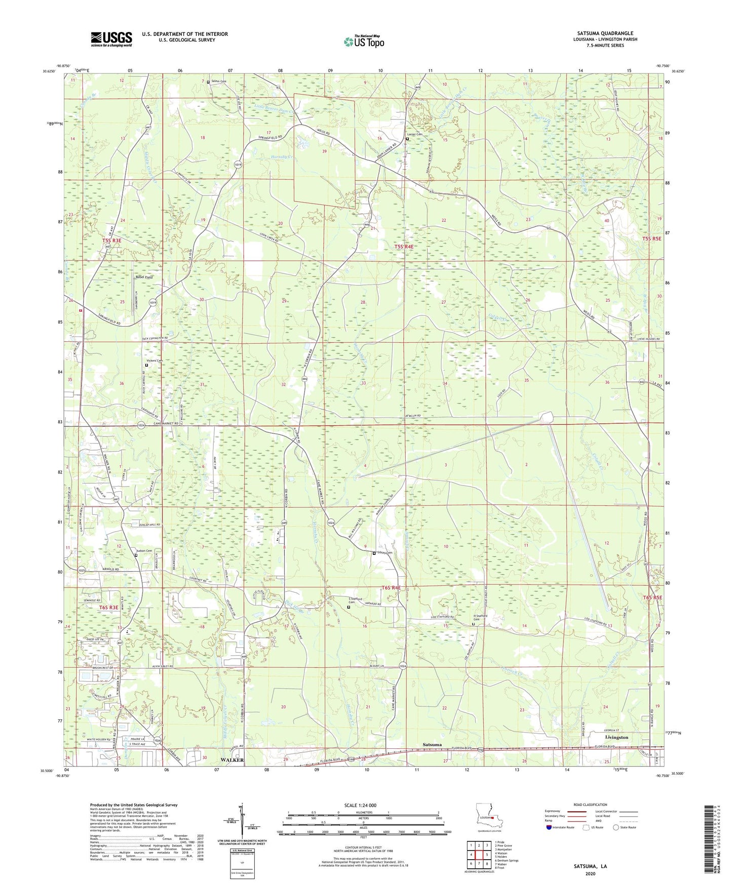
2024 topographic map quadrangle Satsuma in the state of Louisiana. Scale: 1:24000. Based on the newly updated USGS 7.5' US Topo map series, this map is in the following counties: Livingston. The map contains contour data, water features, and other items you are used to seeing on USGS maps, but also has updated roads and other features. This is the next generation of topographic maps. Printed on high-quality waterproof paper with UV fade-resistant inks.
Quads adjacent to this one:
West: Watson
Northwest: Pride
North: Pine Grove
Northeast: Montpelier
East: Holden
Southeast: Frost
South: Walker
Southwest: Denham Springs
This map covers the same area as the classic USGS quad with code o30090e7.
Contains the following named places: Antioch Creek, Beaver Dam Creek, Beech Ridge Baptist Church, Carroll Baptist Church, Community Chapel, Cutrer Branch, Dick Hill Branch, Friendship, Friendship United Methodist Church, H Stafford Cemetery, Holiness Tabernacle, John Lanier Cemetery, Judson Baptist Church, Judson Cemetery, Kids' Corner Child Development Center, Lanier School, Levi Milton Elementary School, Little Beaver Dam Creek, Livingston Lookout Tower, Livingston Parish Fire Protection District 4 Station 2, Mangum Chapel United Methodist Church, North Corbin Elementary School, North Corbin Junior High School, Parish Governing Authority District 1, Rebel Field, S Stafford Cemetery, Saint Marys Baptist Church, Salem Cemetery, Satsuma, Shady Bowery Church, Sibley Cemetery, True Light Church, Vickers Cemetery, Ward One, ZIP Code: 70785