MyTopo
Rocky Branch Louisiana US Topo Map
Couldn't load pickup availability
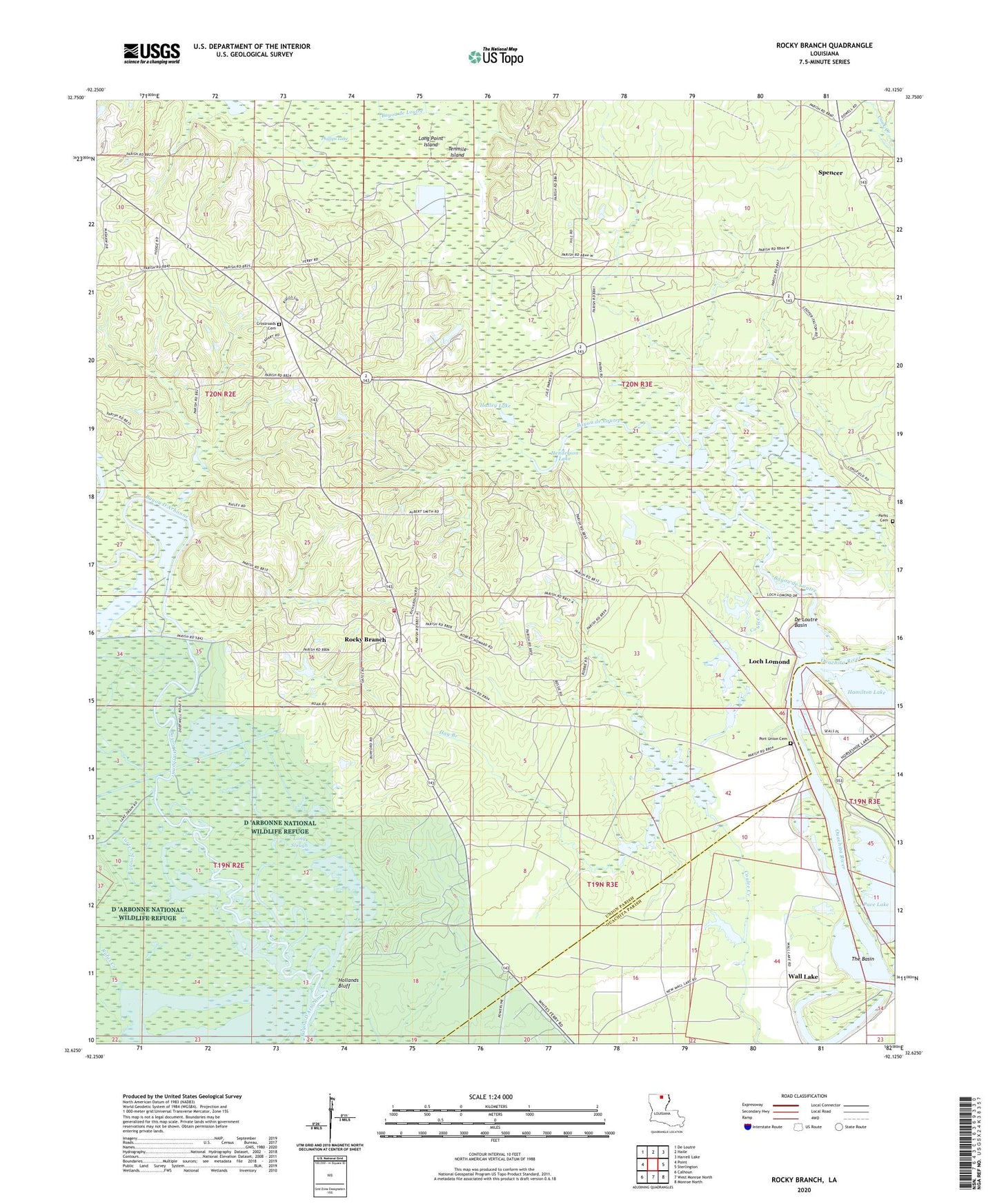
2024 topographic map quadrangle Rocky Branch in the state of Louisiana. Scale: 1:24000. Based on the newly updated USGS 7.5' US Topo map series, this map is in the following counties: Union, Ouachita. The map contains contour data, water features, and other items you are used to seeing on USGS maps, but also has updated roads and other features. This is the next generation of topographic maps. Printed on high-quality waterproof paper with UV fade-resistant inks.
Quads adjacent to this one:
West: Point
Northwest: De Loutre
North: Haile
Northeast: Harrell Lake
East: Sterlington
Southeast: Monroe North
South: West Monroe North
Southwest: Calhoun
This map covers the same area as the classic USGS quad with code o32092f2.
Contains the following named places: Bakers Landing, Bayou D'Arbonne Recreation Area, Bayou de Loutre, Big Island, Blasingame Brake, Carter Slough, Colsons, Coulee Creek, Crossroads, Crossroads Cemetery, Crossroads Church, De Loutre Basin, Eagle Lake, Hamilton Lake, Hatley Lake, Hay Branch, Henderson Lake, Hollands Bluff, Lake Drain Landing, Lake Drain Slough, Loch Lomond, Long Point Island, Long Slough, Pace Lake, Parish Governing Authority District 8, Parks Cemetery, Phillips Ferry, Phillips Lake, Port Union, Port Union Cemetery, Rocky Branch, Rocky Branch Crossroads Fire Department, Rocky Branch Elementary School, Rufus Creek, Spencer, Spencer Post Office, Tenmile Island, The Basin, Wall Lake, Ward Eight