MyTopo
De Loutre Louisiana US Topo Map
Couldn't load pickup availability
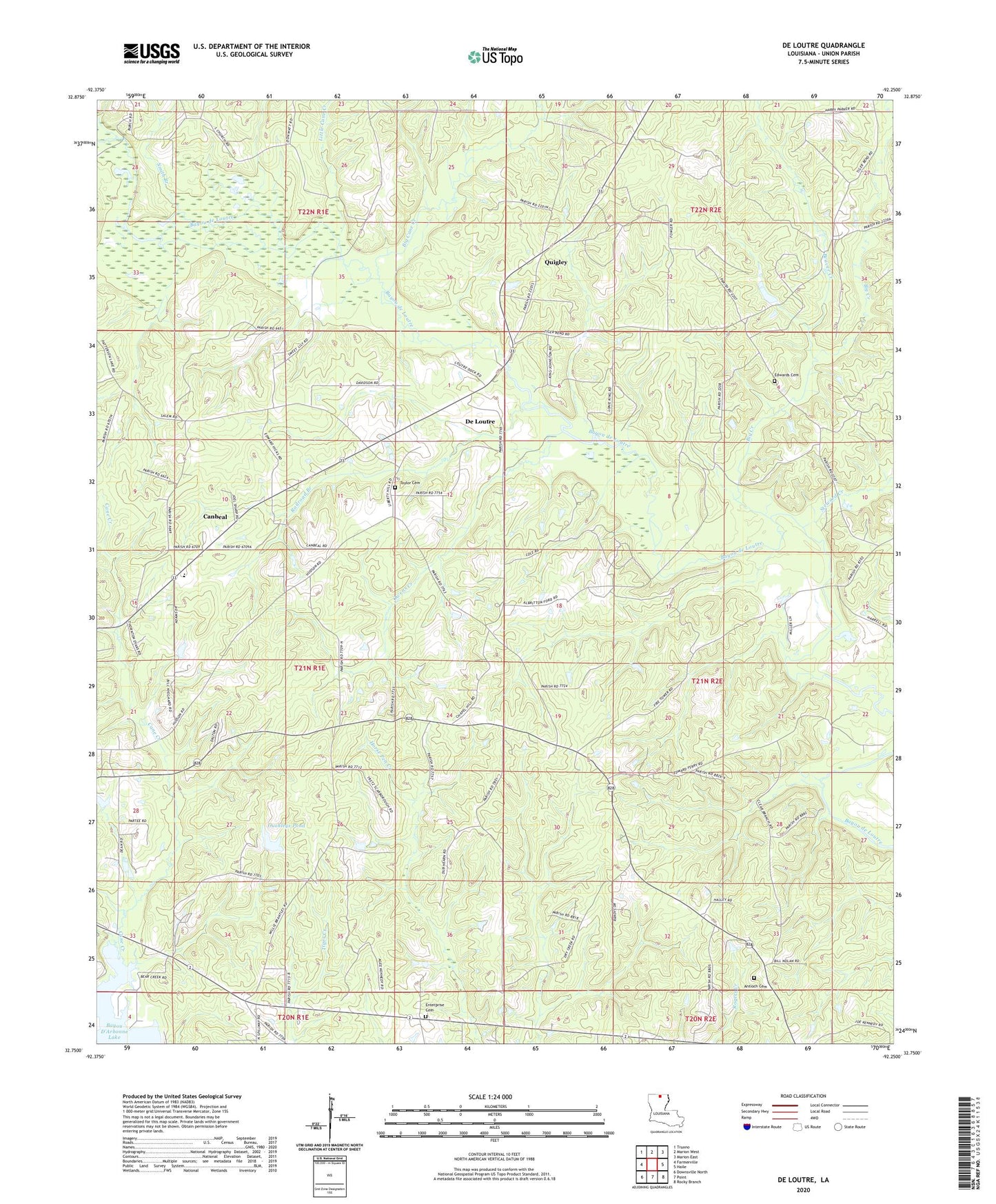
2024 topographic map quadrangle De Loutre in the state of Louisiana. Scale: 1:24000. Based on the newly updated USGS 7.5' US Topo map series, this map is in the following counties: Union. The map contains contour data, water features, and other items you are used to seeing on USGS maps, but also has updated roads and other features. This is the next generation of topographic maps. Printed on high-quality waterproof paper with UV fade-resistant inks.
Quads adjacent to this one:
West: Farmerville
Northwest: Truxno
North: Marion West
Northeast: Marion East
East: Haile
Southeast: Rocky Branch
South: Point
Southwest: Downsville North
This map covers the same area as the classic USGS quad with code o32092g3.
Contains the following named places: Antioch Cemetery, Antioch Church, Beaver Creek, Big Cane Creek, Big Creek, Canbeal, De Loutre, Defees Ferry, Edwards Cemetery, Enterprise Cemetery, Enterprise Church, Halls Church, Jerusalem Church, KTDL-AM (Farmerville), KWJM-FM (Farmerville), Liberty Church, Little Cane Creek, Ouchley Pond Dam, Ouchleys Pond, Owens Creek, Parish Governing Authority District 7, Quigley, Railroad Branch, Saint Johns Chapel, Salem Church, Smith Branch, Steward Creek, Sweet Lily Church, Taylor Cemetery, Union Church, Union Parish, Union Parish Elementary School, Wards Chapel, Zion Watch Church, ZIP Code: 71241