MyTopo
Potters Point Texas US Topo Map
Couldn't load pickup availability
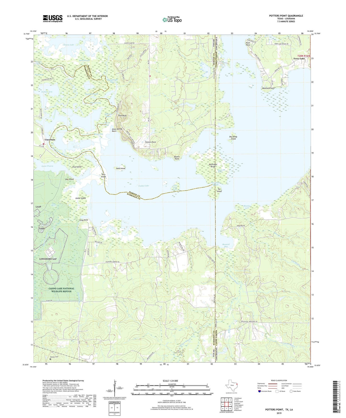
2022 topographic map quadrangle Potters Point in the states of Texas, Louisiana. Scale: 1:24000. Based on the newly updated USGS 7.5' US Topo map series, this map is in the following counties: Harrison, Caddo, Marion. The map contains contour data, water features, and other items you are used to seeing on USGS maps, but also has updated roads and other features. This is the next generation of topographic maps. Printed on high-quality waterproof paper with UV fade-resistant inks.
Quads adjacent to this one:
West: Karnack
Northwest: Smithland
North: Trees
Northeast: Vivian South
East: Mooringsport
Southeast: Blanchard
South: Latex
Southwest: Scottsville
This map covers the same area as the classic USGS quad with code o32094f1.
Contains the following named places: Alligator Bayou, Ames Spring Basin, Big Cypress Bayou, Big Green Break, Big Lake, Big Sandy Island, Blind Slough, Blocker Cemetery, Britts Gap, Buzzard Bay, Caddo Lake, Caddo Oil Field, Clinton Lake, Clintons Chute, Elizabeth Church, Ferry Lake, Fish Net Gap, Fly-N-Fish Lodge Airport, Gardener Bayou, Goose Island, Goose Prairie, Government Ditch, Gray Volunteer Fire Department, Harrison Bayou, Hawley Arm, Jackson Arm, James Bayou, Jeter Branch, Jeters Landing, Kitchen Creek, Little Green Brake, Long Point, Longwood Oil Field, Miller Branch, Millers Point, Mossy Brake, Perch Gap, Pine Bluff, Pine Island, Plum Point, Potters Point, Rag Island, Sand Island, Saunders Branch, South Shore, Starr Ditch, Stumpy Slough, Swansons Landing, Tar Island, Tar Island Slough, Taylor Island, Tete Bayou, Twin Island, Uncertain, Uncertain City Hall, Uncertain Volunteer Fire Department, Watson Bayou, Westfield Point, Whangdoodle Pass