MyTopo
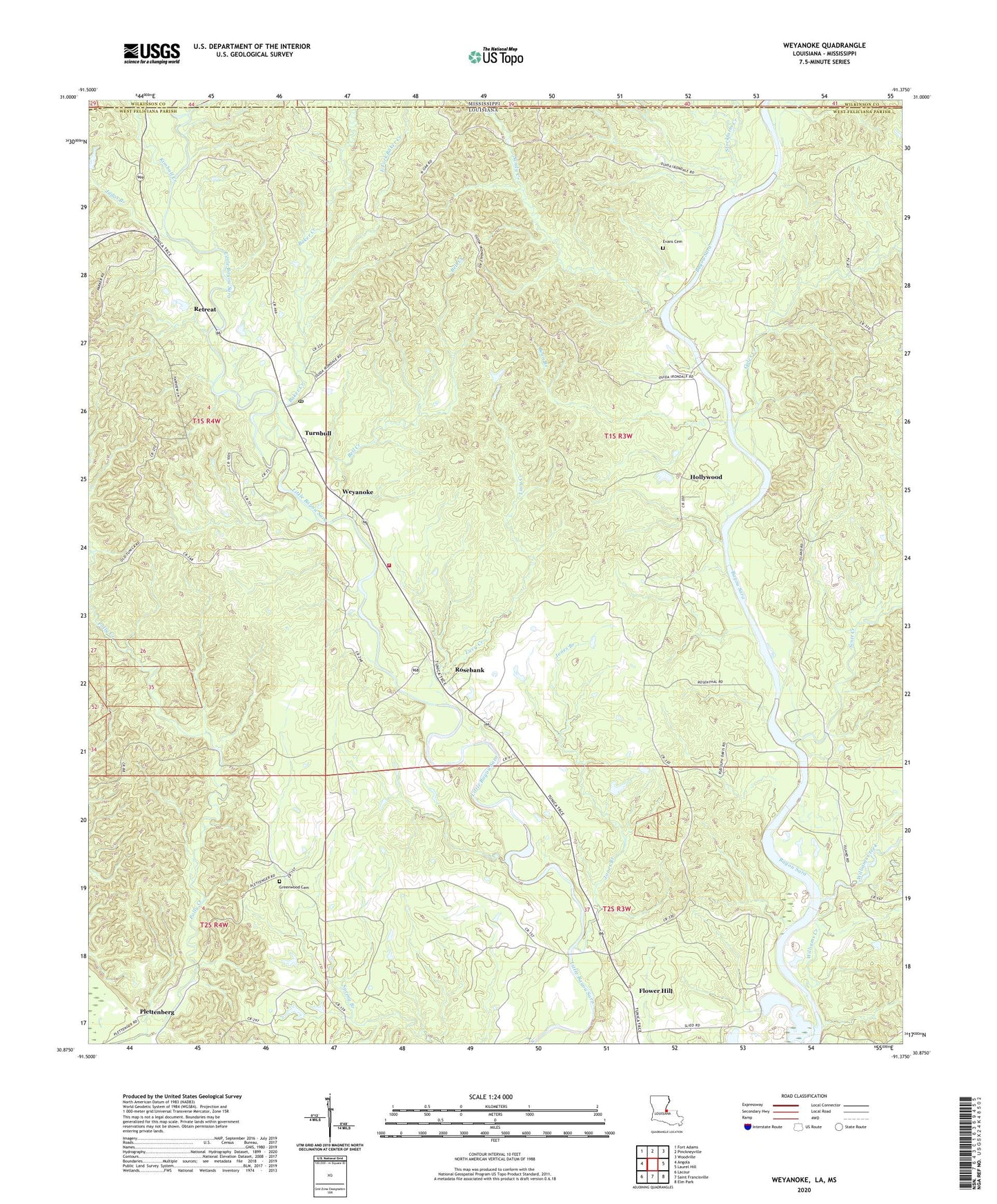
Weyanoke Louisiana US Topo Map
Couldn't load pickup availability
2020 topographic map quadrangle Weyanoke in the states of Louisiana, Mississippi. Scale: 1:24000. Based on the newly updated USGS 7.5' US Topo map series, this map is in the following counties: West Feliciana, Wilkinson. The map contains contour data, water features, and other items you are used to seeing on USGS maps, but also has updated roads and other features. This is the next generation of topographic maps. Printed on high-quality waterproof paper with UV fade-resistant inks.
Quads adjacent to this one:
West: Angola
Northwest: Fort Adams
North: Pinckneyville
Northeast: Woodville
East: Laurel Hill
Southeast: Elm Park
South: Saint Francisville
Southwest: Lacour
Contains the following named places: Baker Creek, Bayou Sara Oil Field, Bean Branch, Bell Creek, Butler Pit, District D, East Fork Baker Creek, Ellerslie Plantation, Evans Cemetery, Feliciana Plantation, Flower Hill, Gales Creek, Greater New Canaan Church, Greater New Hollywood Baptist Church, Greenwood Cemetery, Highland Plantation, Hollywood, Hollywood Post Office, Irondale Church, Jones Branch, Judas Branch, Kimball Creek, Lucy Creek, Magnolia Church, Mount Zion Church, New Canyon Church, New Irondale Baptist Church, New Mount Zion Baptist Church, Plettenberg, Plettenburg Post Office, Retreat, Retreat Post Office, Rosebank, Saint Marys Episcopal Church, Saint Pauls Church, Saint Peters Church, Sandy Creek, Sara Field Ultralight Flightpark, Scott Creek, Sleepy Hollow Woods, Stockfarm Creek, Tunica Hills State Wildlife Management Area, Turnbull, Turnbull Post Office, Union Bethel Church, Ward Eight, West Feliciana Parish, Weyanoke, Weyanoke Post Office, Weyanoke Volunteer Fire Department, Williams Creek, ZIP Code: 70787