MyTopo
Wright Louisiana US Topo Map
Couldn't load pickup availability
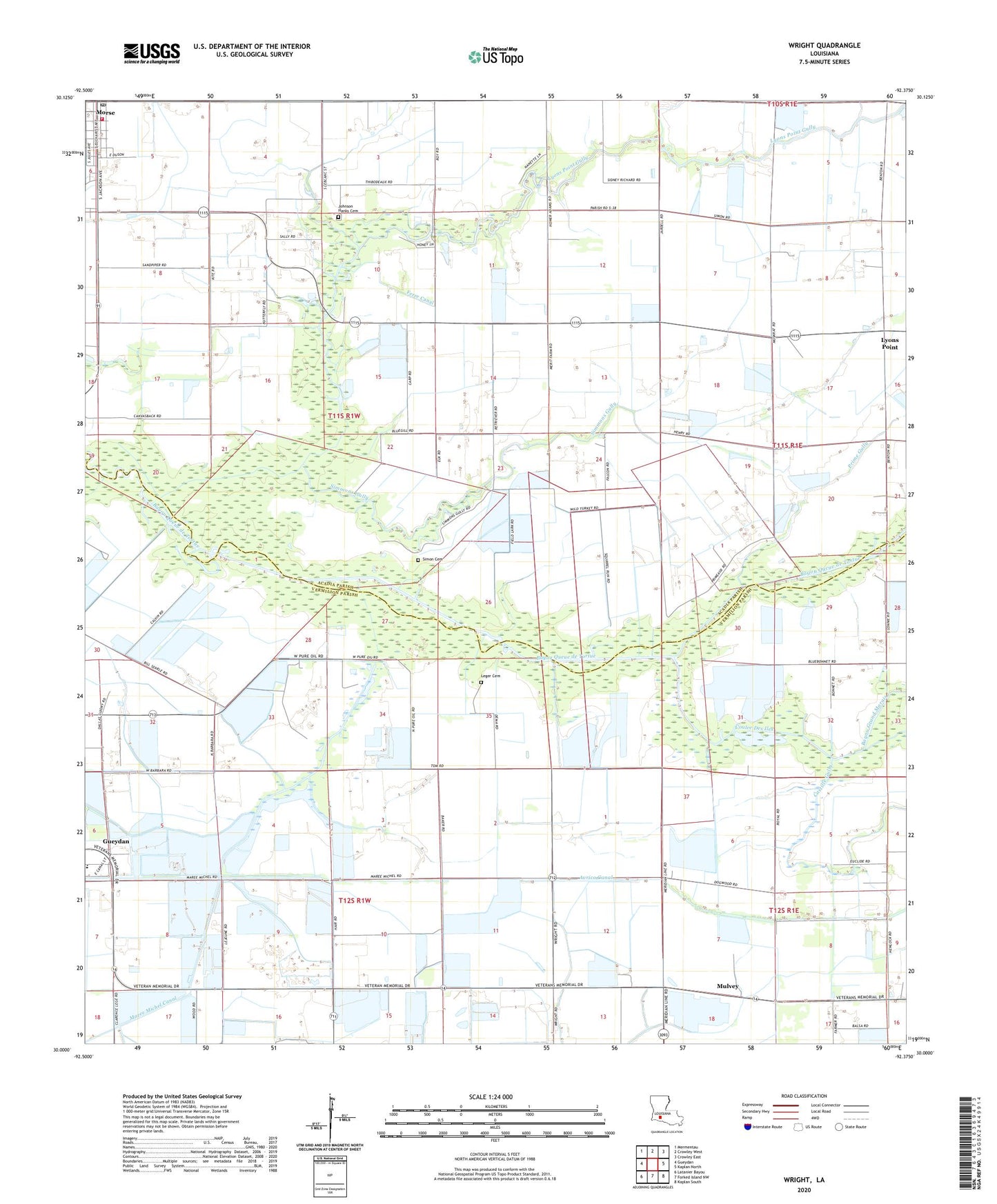
2024 topographic map quadrangle Wright in the state of Louisiana. Scale: 1:24000. Based on the newly updated USGS 7.5' US Topo map series, this map is in the following counties: Vermilion, Acadia. The map contains contour data, water features, and other items you are used to seeing on USGS maps, but also has updated roads and other features. This is the next generation of topographic maps. Printed on high-quality waterproof paper with UV fade-resistant inks.
Quads adjacent to this one:
West: Gueydan
Northwest: Mermentau
North: Crowley West
Northeast: Crowley East
East: Kaplan North
Southeast: Kaplan South
South: Forked Island NW
Southwest: Latanier Bayou
This map covers the same area as the classic USGS quad with code o30092a4.
Contains the following named places: Acadia Parish Library Morse Branch, Avrico Canal, Bayou Grand Marais, Castille Gully, Coulee Des Iles, East Gueydan Oil and Gas Field, Ferre Canal, Gueydan Oil and Gas Field, Jesse Owens Elementary School, Johnson Hanks Cemetery, Le Blanc School, Leger Cemetery, Lyons Point, Lyons Point Gully, Lyons Point School, Maree Michel Canal, Merrit Landing Strip, Morse, Morse Post Office, Mulvey, Prime Gully, Saint Johns Church, Simmons Gully, Simon Cemetery, Sixteenth Section School, Village of Morse, Wright, Wright Oil and Gas Field, Wright Post Office