MyTopo
Benedicta Maine US Topo Map
Couldn't load pickup availability
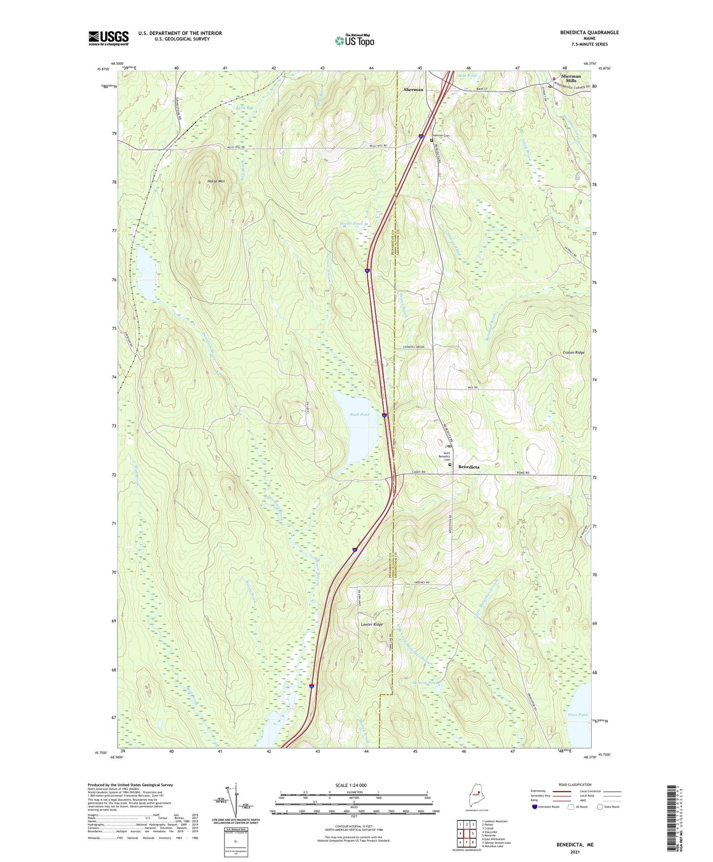
2024 topographic map quadrangle Benedicta in the state of Maine. Scale: 1:24000. Based on the newly updated USGS 7.5' US Topo map series, this map is in the following counties: Penobscot, Aroostook. The map contains contour data, water features, and other items you are used to seeing on USGS maps, but also has updated roads and other features. This is the next generation of topographic maps. Printed on high-quality waterproof paper with UV fade-resistant inks.
Quads adjacent to this one:
West: Stacyville
Northwest: Lookout Mountain
North: Patten
Northeast: Crystal
East: Monarda
Southeast: Molunkus Lake
South: Salmon Stream Lake
Southwest: East Millinocket
This map covers the same area as the classic USGS quad with code o45068g4.
Contains the following named places: Benedicta, Benedicta Elementary School, Benedicta Post Office, Benedicts Parish Church, Bog Brook, Croton Ridge, Davidson, Davidson Brook, Davidson Pond, Flinn Pond, Gantners Landing, Herseytown Township, High Landing, Hocter Pond, Horse Mountain, Kelly Bog, Lawler Ridge, Little Salmon Stream Lake, McAvoy Pond, Moody Brook, Rogan Brook, Rush Pond, Saint Benedict Cemetery, Sherman, Sherman Cemetery, Sherman Mills, Sherman Mills Post Office, Sherman Post Office, Sherman Public Library, Sherman Volunteer Fire Department, Stacyville Post Office, The Ledge, Tracy Brook, ZIP Code: 04733