MyTopo
Patten Maine US Topo Map
Couldn't load pickup availability
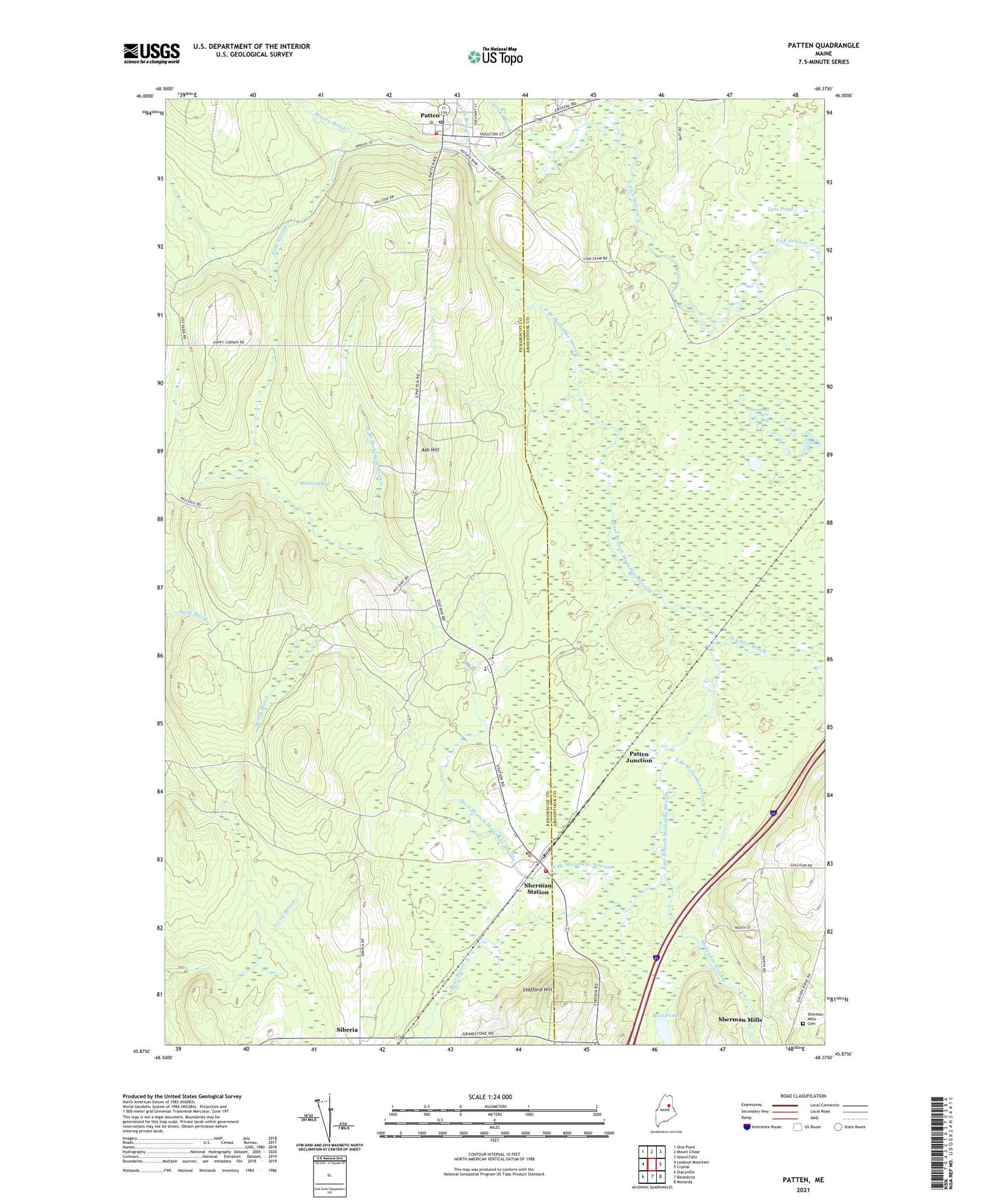
2021 topographic map quadrangle Patten in the state of Maine. Scale: 1:24000. Based on the newly updated USGS 7.5' US Topo map series, this map is in the following counties: Penobscot, Aroostook. The map contains contour data, water features, and other items you are used to seeing on USGS maps, but also has updated roads and other features. This is the next generation of topographic maps. Printed on high-quality waterproof paper with UV fade-resistant inks.
Quads adjacent to this one:
West: Lookout Mountain
Northwest: Shin Pond
North: Mount Chase
Northeast: Island Falls
East: Crystal
Southeast: Monarda
South: Benedicta
Southwest: Stacyville
Contains the following named places: Ash Hill, Bear Brook, Blackwell Bog, Boot Swamp Brook, Caldwell Brook, Calvary Baptist Church, East Branch Molunkus Stream, Katahdin Elementary School, Katahdin Junior High School, Katahdin Middle / High School, Lost Pond, Mud Pond, Patten, Patten Ambulance Service, Patten Fire Department, Patten Grammar School, Patten Junction, Patten Post Office, Patten Primary School, Patten United Methodist Church, Peavey Brook, Sandy Brook, Scudder Brook, Sherman Mills Cemetery, Sherman Station, Siberia, South Patten School, Stacyville Elementary School, Stacyville Post Office, Stacyville Volunteer Fire Department, Stafford Hill, Thousand Acre Bog, Town of Patten, Town of Stacyville, Veterans Memorial Library, Webb Brook, Webster Brook, Weeks Brook, West Branch Molunkus Stream, Wheelabrator-Sherman Heliport