MyTopo
Northeast Bluff Maine US Topo Map
Couldn't load pickup availability
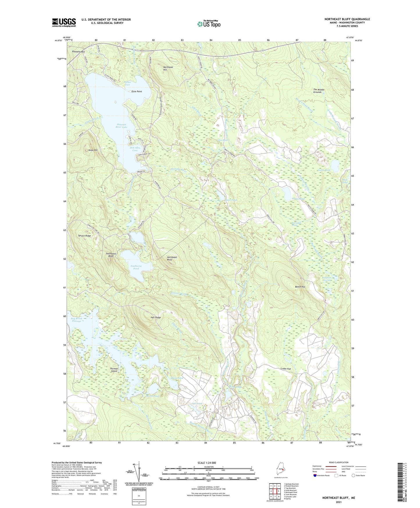
2024 topographic map quadrangle Northeast Bluff in the state of Maine. Scale: 1:24000. Based on the newly updated USGS 7.5' US Topo map series, this map is in the following counties: Washington. The map contains contour data, water features, and other items you are used to seeing on USGS maps, but also has updated roads and other features. This is the next generation of topographic maps. Printed on high-quality waterproof paper with UV fade-resistant inks.
Quads adjacent to this one:
West: Lead Mountain
Northwest: Quillpig Mountain
North: Peaked Mountain
Northeast: Tug Mountain
East: Montegail Pond
Southeast: Epping
South: Schoodic Lake
Southwest: Tunk Mountain
This map covers the same area as the classic USGS quad with code o44067g8.
Contains the following named places: Allen Brook, Allen Heath, Allison Worcester Camp, Beech Hill, Beech Hill Brook, Beech Hill Heath, Bog Brook Flowage, Bridgham Swamp, Canoe Brook, Colonel Brook, Crebo Flat, Davis Camp, Dick Allen Cove, Dorman Island, Elsie Point, Flynn Brook, Flynn Pond, Goose Pond, Hall Ridge, Hartford Camp, Irving Worcester Camp, Knox Hill, Long Pond, Merrit Brook, Merrit Pond, Morse Camp, Northeast Bluff, Northeast Brook, Northeast Hill, Oak Pond, Otter Pond, Parker Cove, Pineo Camp, Pleasant River Lake, Pleasant River Lake Water Dam, Pretty Pond, Southwest Bluff, Southwest Brook, Southwest Pond, Sprague Camp, Spruce Mountain Lake Brook, Spruce Ridge, Stewart Camp, T24 MD BPP, ZIP Code: 04622