MyTopo
Tug Mountain Maine US Topo Map
Couldn't load pickup availability
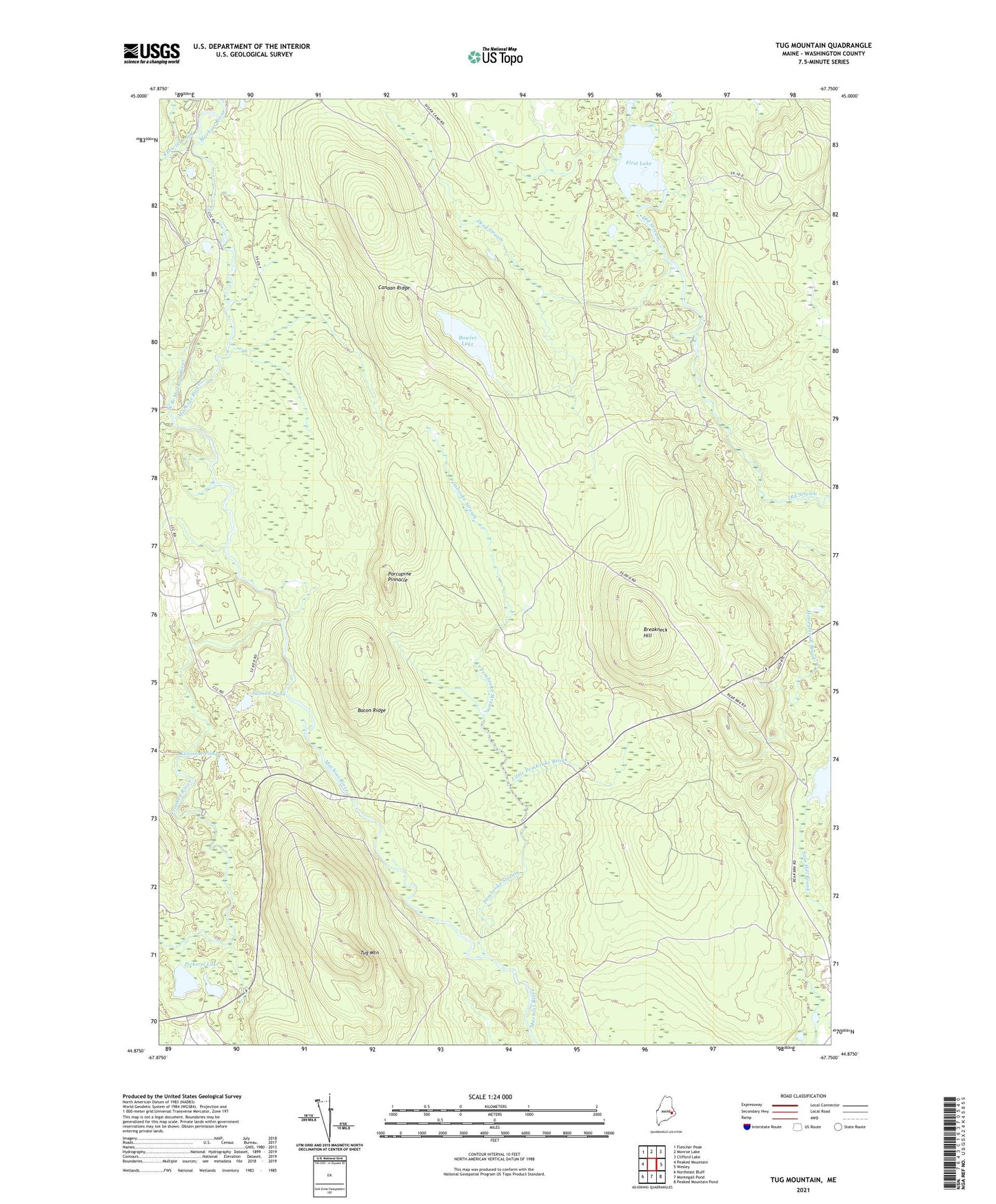
2024 topographic map quadrangle Tug Mountain in the state of Maine. Scale: 1:24000. Based on the newly updated USGS 7.5' US Topo map series, this map is in the following counties: Washington. The map contains contour data, water features, and other items you are used to seeing on USGS maps, but also has updated roads and other features. This is the next generation of topographic maps. Printed on high-quality waterproof paper with UV fade-resistant inks.
Quads adjacent to this one:
West: Peaked Mountain
Northwest: Fletcher Peak
North: Monroe Lake
Northeast: Clifford Lake
East: Wesley
Southeast: Peaked Mountain Pond
South: Montegail Pond
Southwest: Northeast Bluff
This map covers the same area as the classic USGS quad with code o44067h7.
Contains the following named places: Bacon Ridge, Bowles Lake, Breakneck Hill, Canaan Dam, Canaan Ridge, Crooked River, Day Block Township, Dead Stream, First Lake, Kerosene Pond, Kerwin Brook, Little Pembroke Brook, Pembroke Stream, Pickerel Lake, Porcupine Pinnacle, Robinson Dam, Salmon Pond, Sam Hill Lake, Tug Mountain, West Branch Machias River, Worcester Lodge