MyTopo
Manomet Massachusetts US Topo Map
Couldn't load pickup availability
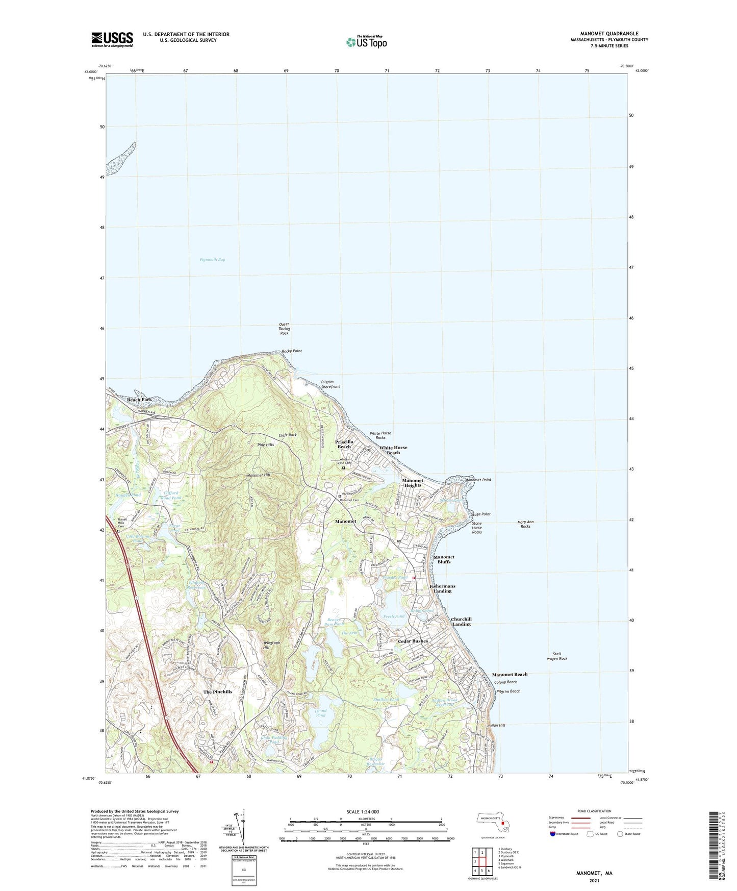
2024 topographic map quadrangle Manomet in the state of Massachusetts. Scale: 1:24000. Based on the newly updated USGS 7.5' US Topo map series, this map is in the following counties: Plymouth. The map contains contour data, water features, and other items you are used to seeing on USGS maps, but also has updated roads and other features. This is the next generation of topographic maps. Printed on high-quality waterproof paper with UV fade-resistant inks.
Quads adjacent to this one:
West: Plymouth
Northwest: Duxbury
North: Duxbury OE E
Southeast: Sandwich OE N
South: Sagamore
Southwest: Wareham
This map covers the same area as the classic USGS quad with code o41070h5.
Contains the following named places: Bancroft Landing, Bartlett Pond, Beach Park, Beaver Dam Brook, Beaver Dam Pond, Beaver Dam Pond Dam, Briggs Playground, Briggs Reservoir Number 2, Browns Bank, Cedar Bushes, Churchill Landing, Clam Pudding Pond, Cleft Rock, Clifford Road Dam, Clifford Road Pond, Cold Bottom Pond, Cold Bottom Pond Dam, Colony Beach, Fishermans Landing, Forge Pond, Fresh Pond, Fresh Pond Dam, Hayden Pond, Hayden Pond Dam, Indian Brook, Indian Brook Dam, Indian Brook Reservoir, Indian Brook School, Indian Hill, Island Pond, Island Pond Dam, Manomet, Manomet Beach, Manomet Bluffs, Manomet Brook, Manomet Cemetery, Manomet Dump, Manomet Elementary School, Manomet Heights, Manomet Hill, Manomet Life Saving Station, Manomet Point, Manomet Post Office, Manomet Shopping Center, Mary Ann Rocks, Mayflower Park, Outer Tautog Rock, Pilgrim Beach, Pilgrim Shorefront, Pilgrim Station Nuclear Plant, Pine Hills, Plimoth Plantation, Plymouth Bay, Plymouth Country Club, Plymouth Fire Department Station 3, Plymouth Fire Department Station 5, Plymouth South High School, Plymouth South Middle School, Plymouth South Technical School, Priscilla Beach, Rabbit Pond, Rocky Point, Russell Mills Cemetery, Scokes Pond, Second Church of Plymouth, Shallow Pond, Stage Point, Stell wagen Rock, Stone Horse Rocks, Telegraph Hill, The Arm, The Arm Pond Dam, The Pinehills Census Designated Place, Town of Plymouth, Warner Pond, Waverly Oaks Golf Course, Whipple Reservoir, Whipple Reservoir Dam, White Horse Beach, White Horse Beach Post Office, White Horse Cemetery, White Horse Rocks