MyTopo
Avery Michigan US Topo Map
Couldn't load pickup availability
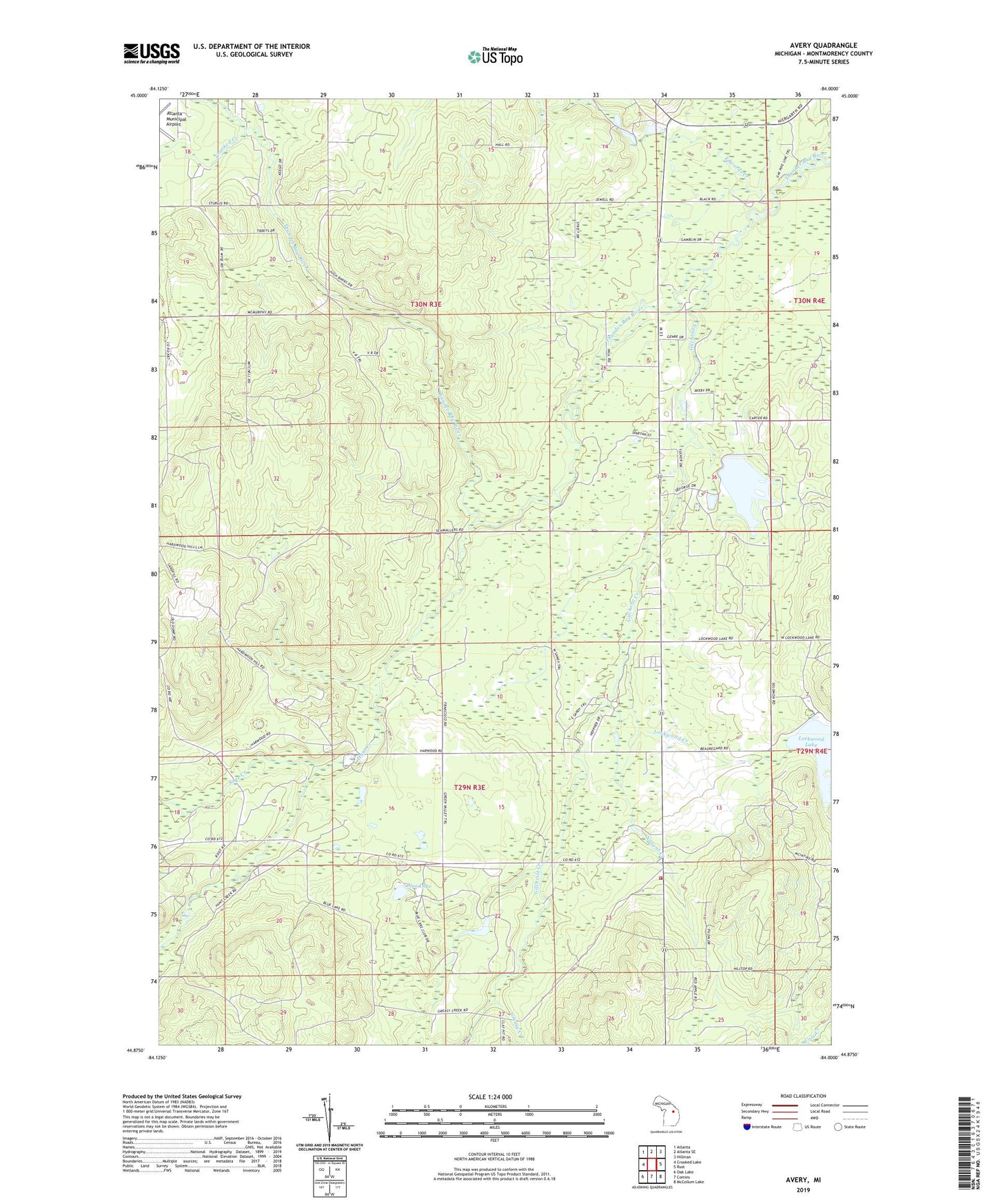
2019 topographic map quadrangle Avery in the state of Michigan. Scale: 1:24000. Based on the newly updated USGS 7.5' US Topo map series, this map is in the following counties: Montmorency. The map contains contour data, water features, and other items you are used to seeing on USGS maps, but also has updated roads and other features. This is the next generation of topographic maps. Printed on high-quality waterproof paper with UV fade-resistant inks.
Quads adjacent to this one:
West: Crooked Lake
Northwest: Atlanta
North: Atlanta SE
Northeast: Hillman
East: Rust
Southeast: McCollum Lake
South: Comins
Southwest: Oak Lake
Contains the following named places: Avery, Blue Lake, Crooked Creek, Edwards Creek, Gilchrist Creek, Greasy Creek, Hunt Creek, Lockwood Creek, Lockwood Lake, Loud School, Nugent Creek, Sage Creek, Township of Avery, Township of Loud, Tri - Township Fire Department Station 2