MyTopo
Onaway Michigan US Topo Map
Couldn't load pickup availability
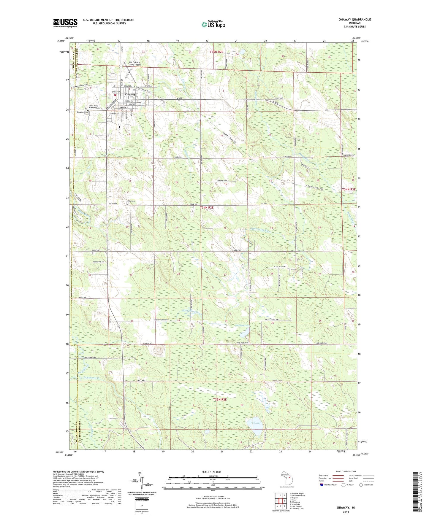
2023 topographic map quadrangle Onaway in the state of Michigan. Scale: 1:24000. Based on the newly updated USGS 7.5' US Topo map series, this map is in the following counties: Presque Isle, Cheboygan. The map contains contour data, water features, and other items you are used to seeing on USGS maps, but also has updated roads and other features. This is the next generation of topographic maps. Printed on high-quality waterproof paper with UV fade-resistant inks.
Quads adjacent to this one:
West: Tower
Northwest: Hangore Heights
North: Black Lake Bluffs
Northeast: Ocqueoc
East: Millersburg
Southeast: Cranberry Lake
South: Lake Geneva
Southwest: Silver Lake
This map covers the same area as the classic USGS quad with code o45084c2.
Contains the following named places: Allis Cemetery, Case Post Office, Case Station, City of Onaway, Community of Christ, East Branch Rainy River, Edna Lound Recreational Park, Elmwood Cemetery, First Baptist Church, Forest Waverly Fire Department, Hackett Lake, Hackett Lake School, Holy Cross Lutheran Church, Leo E Goetz County Airport, Little Rainy River, Little Traverse Primary Care, Loon Lake, Onaway, Onaway Area Ambulance Service, Onaway Area Community Schools, Onaway Assembly of God Church, Onaway Baptist Church, Onaway Branch Library, Onaway Fire Department, Onaway Medical Center, Onaway Motor Speedway, Onaway Post Office, Onaway Station, Saint Paul's Catholic Cemetery, Saint Paul's Catholic Church, Seventh-Day Adventist Church, Seventh-Day Adventist School, Stoney Links Golf Course, Tomahawk Creek, Tomahawk School, Township of Allis, United Methodist Church, ZIP Code: 49765