MyTopo
Chippewa Lake South Michigan US Topo Map
Couldn't load pickup availability
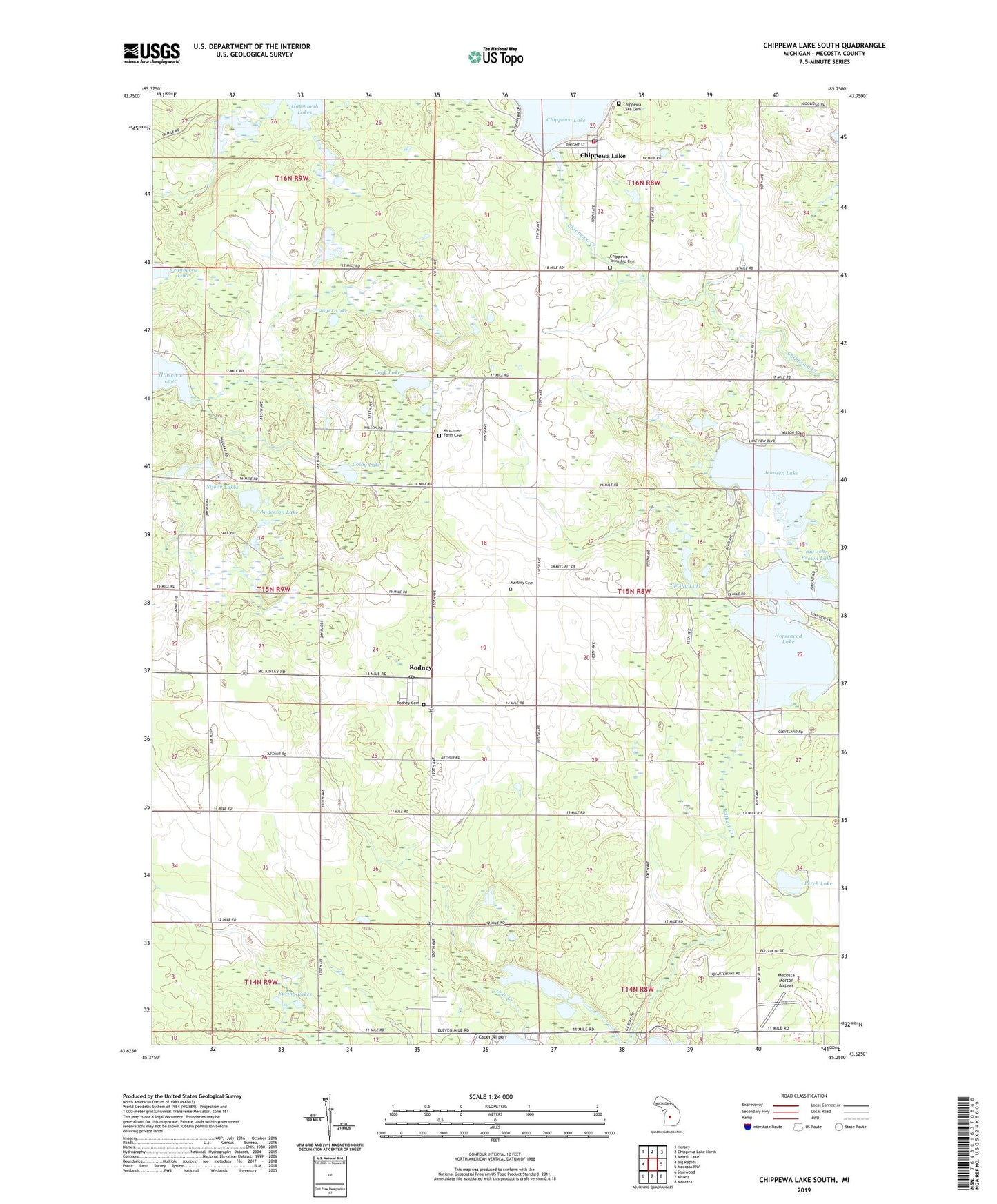
2019 topographic map quadrangle Chippewa Lake South in the state of Michigan. Scale: 1:24000. Based on the newly updated USGS 7.5' US Topo map series, this map is in the following counties: Mecosta. The map contains contour data, water features, and other items you are used to seeing on USGS maps, but also has updated roads and other features. This is the next generation of topographic maps. Printed on high-quality waterproof paper with UV fade-resistant inks.
Quads adjacent to this one:
West: Big Rapids
Northwest: Hersey
North: Chippewa Lake North
Northeast: Merrill Lake
East: Mecosta NW
Southeast: Mecosta
South: Altona
Southwest: Stanwood
Contains the following named places: Anderson Lake, Austin Gas Storage Field, Barry Post Office, Chippewa - Martiny Fire Department, Chippewa Lake, Chippewa Lake Cemetery, Chippewa Lake Community Church, Chippewa Lake Post Office, Chippewa Lake Station, Chippewa Township Cemetery, Chippewa Township Hall, Colby Lake, Cole Creek, Cook Lake, Cranberry Lake, Granger Lake, Hillsview Lake, Horesehead Lake Marina, Horsehead Lake, Hunters Creek Estates Mobile Home Park, Jehnsen Lake, Kirschner Farm Cemetery, Martiny Township Cemetery, Maynard School, Mecosta County, Mecosta Morton Airport, Nijode Lakes, Perch Lake, Rodney, Rodney Cemetery, Rodney Post Office, Rodney Station, Spring Lake, Spring Lakes, Thompson Lake, Township of Martiny, ZIP Code: 49342