MyTopo
Pleasanton Michigan US Topo Map
Couldn't load pickup availability
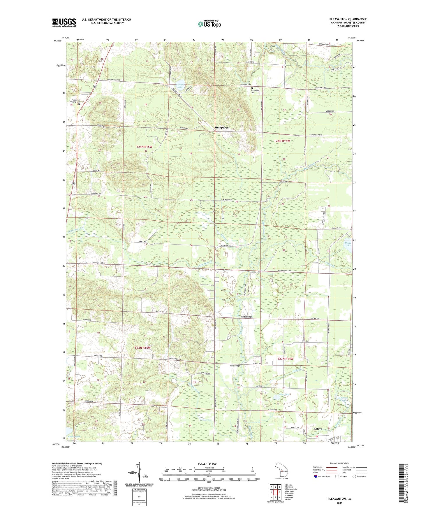
2023 topographic map quadrangle Pleasanton in the state of Michigan. Scale: 1:24000. Based on the newly updated USGS 7.5' US Topo map series, this map is in the following counties: Manistee. The map contains contour data, water features, and other items you are used to seeing on USGS maps, but also has updated roads and other features. This is the next generation of topographic maps. Printed on high-quality waterproof paper with UV fade-resistant inks.
Quads adjacent to this one:
West: Bear Lake
Northwest: Elberta
North: Benzonia
Northeast: Thompsonville
East: Copemish
Southeast: Marilla
South: Brethren
Southwest: Onekama
This map covers the same area as the classic USGS quad with code o44086d1.
Contains the following named places: Big Four Corners, Bonds Bridge, Crystal Forest Campground, Fuzzy Bear Campground, Glovers Lake, Glover's Lake Station, Greens Creek, Hale Corners, Halls Creek, Healy Lake, Humphrey, Humphrey Post Office, Humphrey Station, Jopp Bridge, Kaleva Library, Kampvilla Mobile Home Park, Kilborn School, Lemon Creek, Little Bear Creek, Makinen Pond, Maple Grove Township Fire Department, Mud Lake, Northern Michigan Dragway, Pleasanton, Pleasanton Post Office, Pleasanton Township Hall, Pleasonton Township Cemetery, Springdale Church, Springdale Township Cemetery, Township of Bear Lake, Township of Maple Grove, Township of Pleasanton, West Shore Emergency Medical Services House 2, WRQT-FM (Bear Lake), ZIP Code: 49614