MyTopo
Marilla Michigan US Topo Map
Couldn't load pickup availability
Also explore the Marilla Forest Service Topo of this same quad for updated USFS data
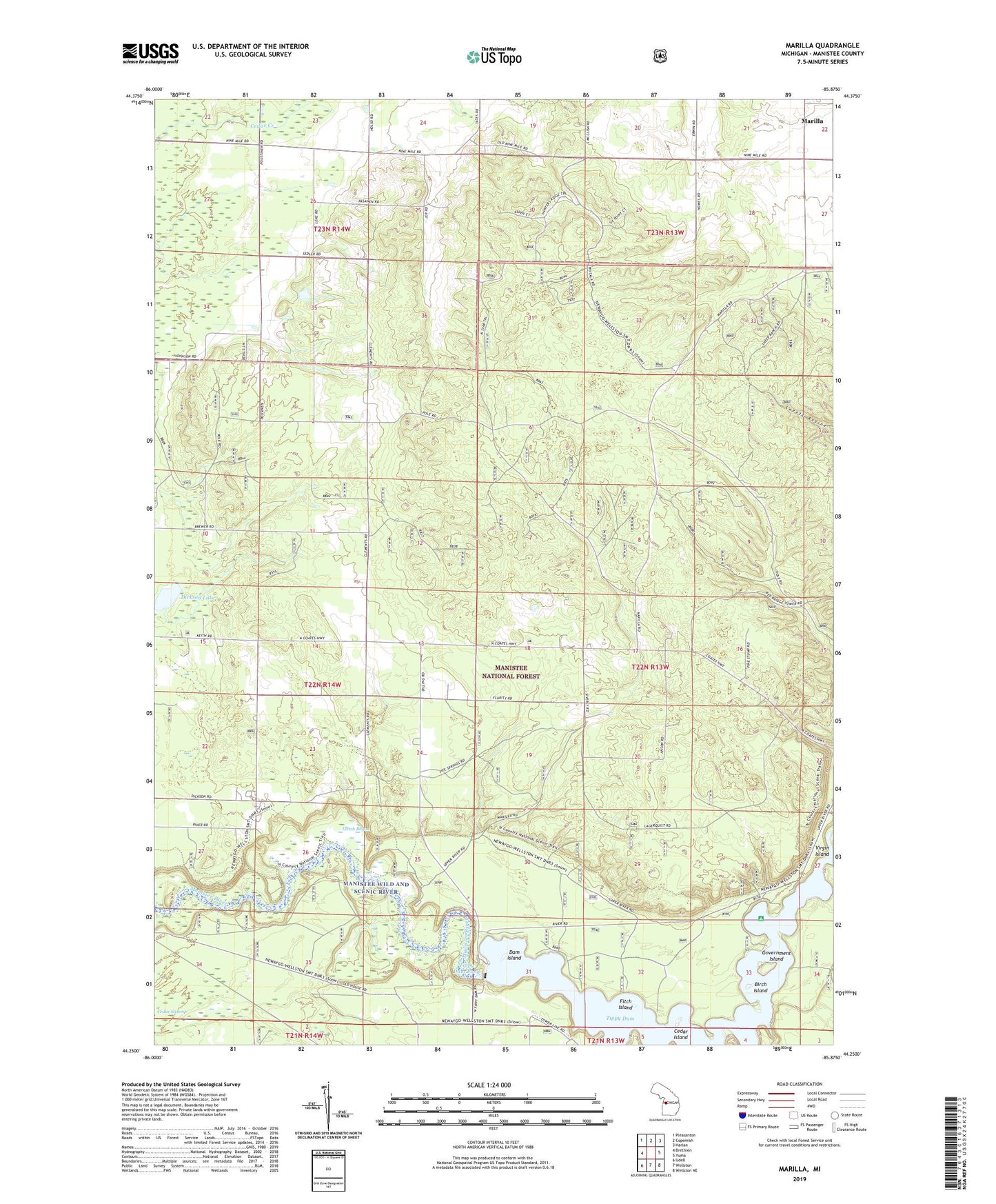
2023 topographic map quadrangle Marilla in the state of Michigan. Scale: 1:24000. Based on the newly updated USGS 7.5' US Topo map series, this map is in the following counties: Manistee. The map contains contour data, water features, and other items you are used to seeing on USGS maps, but also has updated roads and other features. This is the next generation of topographic maps. Printed on high-quality waterproof paper with UV fade-resistant inks.
Quads adjacent to this one:
West: Brethren
Northwest: Pleasanton
North: Copemish
Northeast: Harlan
East: Yuma
Southeast: Wellston NE
South: Wellston
Southwest: Udell
This map covers the same area as the classic USGS quad with code o44085c8.
Contains the following named places: Birch Island, Cedar Island, Cedar Swamp, Dam Island, Dickson Lake, Fitch Island, Government Island, Leitch Bayou, Marilla, Marilla Post Office, Marilla Township Hall, Oak Grove School, Tippy Dam, Tippy Dam North Recreation Area, Tippy Dam Pond, Tippy Dam Road Campgrounds, Township of Dickson, ZIP Code: 49619