MyTopo
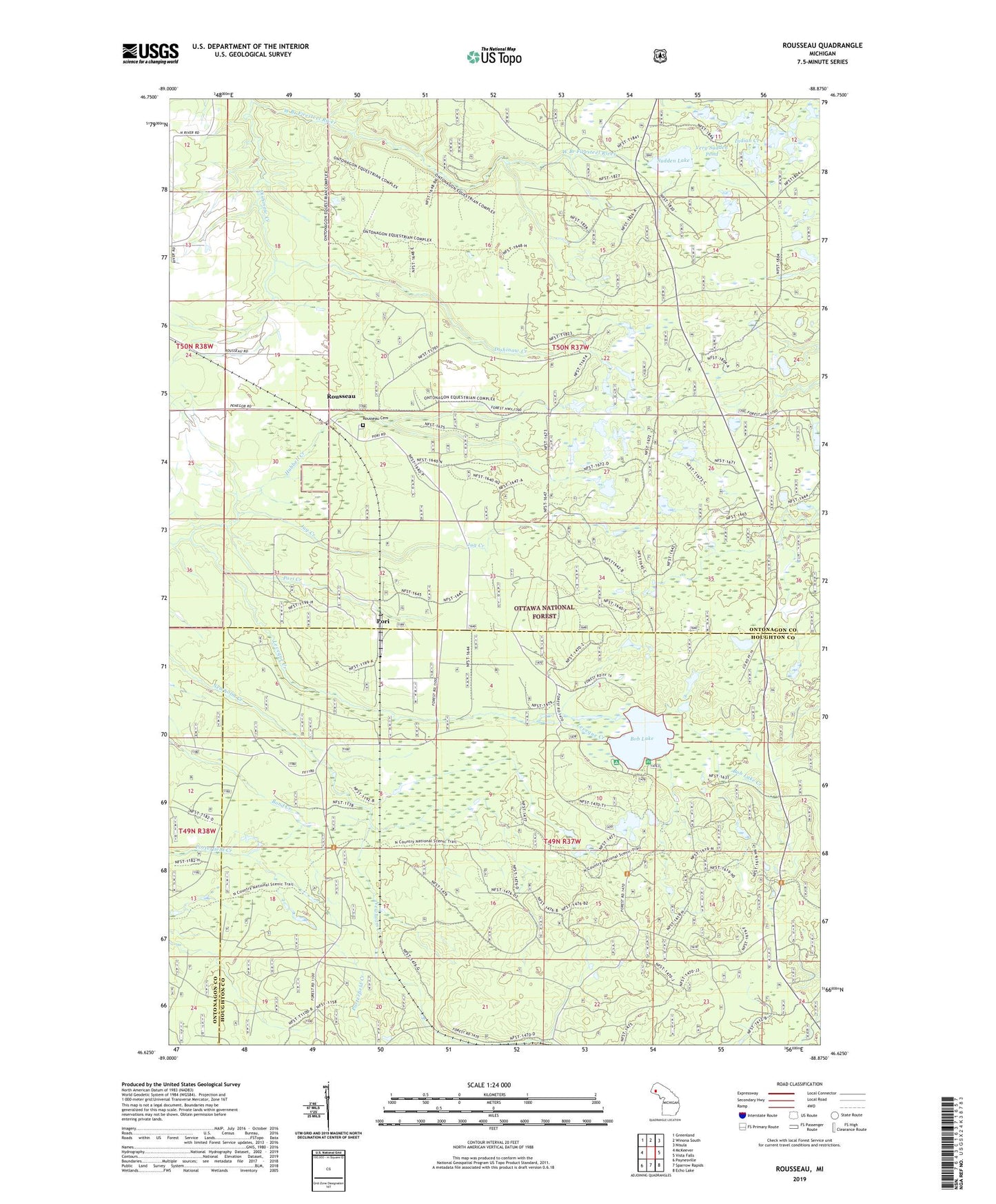
Rousseau Michigan US Topo Map
Couldn't load pickup availability
Also explore the Rousseau Forest Service Topo of this same quad for updated USFS data
2023 topographic map quadrangle Rousseau in the state of Michigan. Scale: 1:24000. Based on the newly updated USGS 7.5' US Topo map series, this map is in the following counties: Ontonagon, Houghton. The map contains contour data, water features, and other items you are used to seeing on USGS maps, but also has updated roads and other features. This is the next generation of topographic maps. Printed on high-quality waterproof paper with UV fade-resistant inks.
Quads adjacent to this one:
West: McKeever
Northwest: Greenland
North: Winona South
Northeast: Nisula
East: Vista Falls
Southeast: Echo Lake
South: Sparrow Rapids
Southwest: Paynesville
This map covers the same area as the classic USGS quad with code o46088f8.
Contains the following named places: Bob Lake, Bob Lake Campground and Picnic Area, Bob Lake Creek, Dishinaw Creek, Indian Creek, Jug Creek, Leveque Creek, Michigan College of Mining Forestry Camp, New Home Post Office, New Home Station, Nikkila Farms Airport, Ontonagon Equestrian Complex, Plato Post Office, Pori, Pori Creek, Pori Station, Rousseau, Rousseau Cemetery, Rousseau Post Office, Rousseau Station, Sudden Lake, Very Sudden Pond