MyTopo
Vista Falls Michigan US Topo Map
Couldn't load pickup availability
Also explore the Vista Falls Forest Service Topo of this same quad for updated USFS data
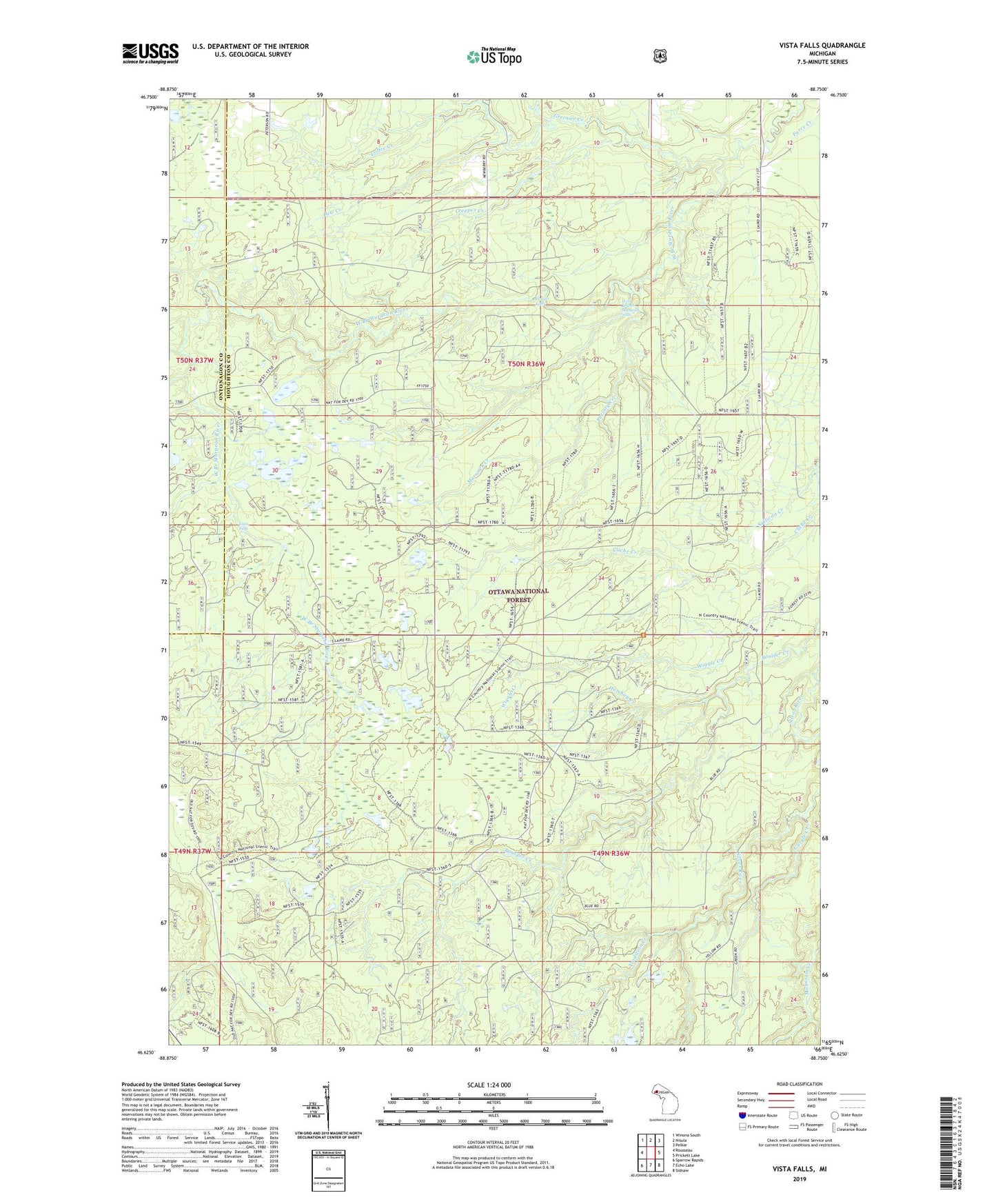
2023 topographic map quadrangle Vista Falls in the state of Michigan. Scale: 1:24000. Based on the newly updated USGS 7.5' US Topo map series, this map is in the following counties: Houghton, Ontonagon. The map contains contour data, water features, and other items you are used to seeing on USGS maps, but also has updated roads and other features. This is the next generation of topographic maps. Printed on high-quality waterproof paper with UV fade-resistant inks.
Quads adjacent to this one:
West: Rousseau
Northwest: Winona South
North: Nisula
Northeast: Pelkie
East: Prickett Lake
Southeast: Sidnaw
South: Echo Lake
Southwest: Sparrow Rapids
This map covers the same area as the classic USGS quad with code o46088f7.
Contains the following named places: Coffee Creek, Creeper Creek, Dew Creek, Greenier Creek, Gurgle Creek, Hogger Falls, Humbug Creek, Maronen Creek, Perjury Creek, Silver Post Office, Township of Laird, Tradition Creek, Vista Falls, West Branch Sturgeon Falls, ZIP Code: 49952