MyTopo
Dovray Minnesota US Topo Map
Couldn't load pickup availability
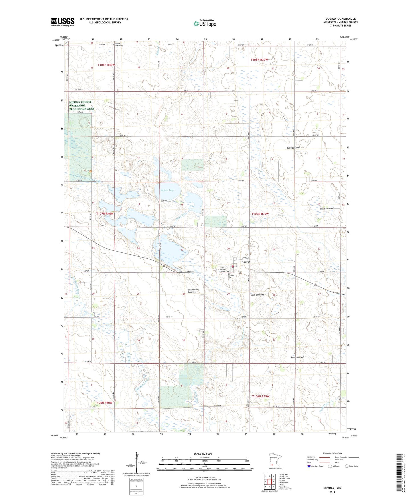
2022 topographic map quadrangle Dovray in the state of Minnesota. Scale: 1:24000. Based on the newly updated USGS 7.5' US Topo map series, this map is in the following counties: Murray. The map contains contour data, water features, and other items you are used to seeing on USGS maps, but also has updated roads and other features. This is the next generation of topographic maps. Printed on high-quality waterproof paper with UV fade-resistant inks.
Quads adjacent to this one:
West: Currie
Northwest: Tracy West
North: Tracy East
Northeast: Walnut Grove
East: Westbrook
Southeast: Heron Lake NW
South: Lime Creek
Southwest: Avoca
This map covers the same area as the classic USGS quad with code o44095a5.
Contains the following named places: Buffalo Lake, Buffalo Lake State Wildlife Management Area, City of Dovray, County Ditch Number Four, County Ditch Number Nineteen, Dovray, Dovray Fire Department, Dovray Post Office, Dovray State Wildlife Management Area, Duck Lakebed, Long Lakebed, Old German Cemetery, Our Saviors Cemetery, Our Saviour's Lutheran Church, Phelan State Wildlife Management Area, Rush Lakebed, School Number 1254, Slaughter Slough, Star Lakebed, Township of Dovray, Willow Lake Cemetery, Willow Lake Church, ZIP Codes: 56123, 56125