MyTopo
West Point Mississippi US Topo Map
Couldn't load pickup availability
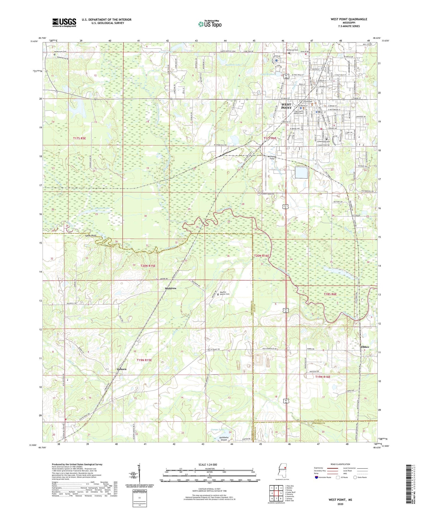
2024 topographic map quadrangle West Point in the state of Mississippi. Scale: 1:24000. Based on the newly updated USGS 7.5' US Topo map series, this map is in the following counties: Clay, Oktibbeha, Lowndes. The map contains contour data, water features, and other items you are used to seeing on USGS maps, but also has updated roads and other features. This is the next generation of topographic maps. Printed on high-quality waterproof paper with UV fade-resistant inks.
Quads adjacent to this one:
West: Cedar Bluff
Northwest: Palo Alto
North: Muldon
Northeast: Strong
East: Waverly
Southeast: Bent Oak
South: Artesia
Southwest: Starkville
This map covers the same area as the classic USGS quad with code o33088e6.
Contains the following named places: Alexander Attendance Center, Apostolic Church, Ash Creek, Bible Baptist Church, Bible Believers Fellowship Church, Bruce Field, Bryan Memorial Library, Calvary Baptist Church, Camps Lake, Camps Lake Dam, Central Junior High School, Christ Methodist Church, Chuck Keys Field, Chuquatonchee Creek, Church of God, City of West Point, Clay County Courthouse, Crumpton Lake Dam, Davidson Chapel Christian Methodist Episcopal Church, Dicks Ferry, East Oktibbeha Volunteer Fire Department Osborne Station, East Side Elementary School, Episcopal Church of the Incarnation, Fifth Street Junior High School, First Baptist Church, First Christian Church, First Pentecostal Church, First Presbyterian Church, First United Methodist Church, Gospel Temple, Greenwood Cemetery, Half Mile Park, Harmon Church, Harmon Lake, Hawkins Lake, Hawkins Lake Dam, Immaculate Conception Catholic Church, Ivy Memorial Hospital, Johnson Lake Dam, Lake Wooten, Line Creek, Lone Oak Baptist Church, Long Branch, Love Lake Dam, Lyons Bluff, Marshall Park, Mary Holmes College, Mayhew Mission, Mayhew Mission Cemetery, McCharen Field, McPherson Cemetery, Mississippi No Name 152 Dam, Moseleys Switch, Muldrow, New Hope Church, North Mississippi Medical Center, North Side Elementary School, Northside Christian Church, Oak Hill Academy, Oktibbeha Airport, Old Saint Peter Missionary Baptist Church, Osborn, Pilgrim Grove Missionary Baptist Church, Pleasant Grove United Methodist Church, Point Plaza Shopping Center, Proctor Lake, Proctor Lake Dam, Saint Matthew Temple Church of God and Christ, Saint Paul Baptist Church, Saint Paul United Methodist Church, Siloam Church, Sixteenth Section Missionary Baptist Church, South Side Elementary School, Sportsman Park, Starkville Gun Club Lake Dam, Stumpy Wood Field, Third Mount Olive Baptist Church, Tibbee, Tibbee Lake, Trinity Baptist Church, Trinity United Presbyterian Church, Walker Lake, Walker Lake Dam, West End Baptist Church, West Point, West Point City Hall, West Point City Park, West Point Fire Department Station 1, West Point Fire Department Station 2, West Point High School, West Point Police Department, West Point Post Office, West Point Sewage Lagoon Dam, West Point Shopping Center, West Side Elementary School, Westbrook Cemetery, Westland Shopping Center, Wilkie Lake Dam, WKBB-FM (West Point), WROB-AM (West Point), Zuber Park