MyTopo
Oak Grove Mississippi US Topo Map
Couldn't load pickup availability
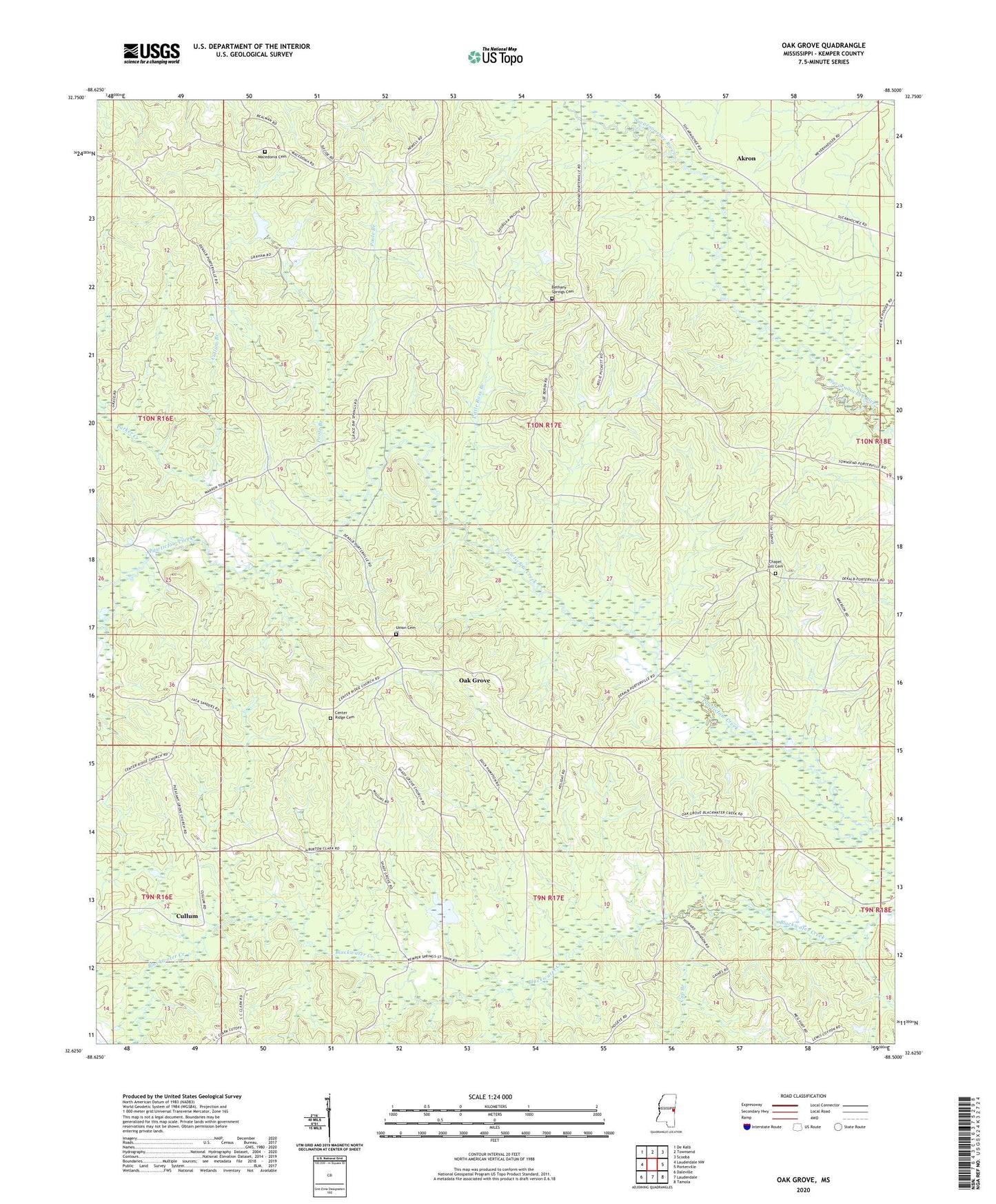
2024 topographic map quadrangle Oak Grove in the state of Mississippi. Scale: 1:24000. Based on the newly updated USGS 7.5' US Topo map series, this map is in the following counties: Kemper. The map contains contour data, water features, and other items you are used to seeing on USGS maps, but also has updated roads and other features. This is the next generation of topographic maps. Printed on high-quality waterproof paper with UV fade-resistant inks.
Quads adjacent to this one:
West: Lauderdale NW
Northwest: De Kalb
North: Townsend
Northeast: Scooba
East: Porterville
Southeast: Tamola
South: Lauderdale
Southwest: Daleville
This map covers the same area as the classic USGS quad with code o32088f5.
Contains the following named places: Akron, Bay Springs Baptist Church, Bay Springs School, Bethany Springs Cemetery, Cap Branch, Center Ridge, Center Ridge Baptist Church, Center Ridge Cemetery, Center Ridge School, Centerville School, Chapel Hill Cemetery, Chapel Hill Church, Chapel Hill Grammar School, Cook Lake Dam, Cullum, Cullum Branch, Cuthi Uckehaca, Dorothy Stennis Pond Dam, Grange School, Kemper Normal College, Little Ross Branch, Macedonia Cemetery, Macedonia Church, Oak Grove, Oak Grove School, Parker Creek, Pleasant Grove Church, Poole Branch, Porterville Lookout Tower, Rocky Mount, Rocky Point School, Saint Johns Church, Shady Grove Church, Shady Grove School, Supervisor District 2, Union Cemetery, Union Church