MyTopo
Lauderdale Mississippi US Topo Map
Couldn't load pickup availability
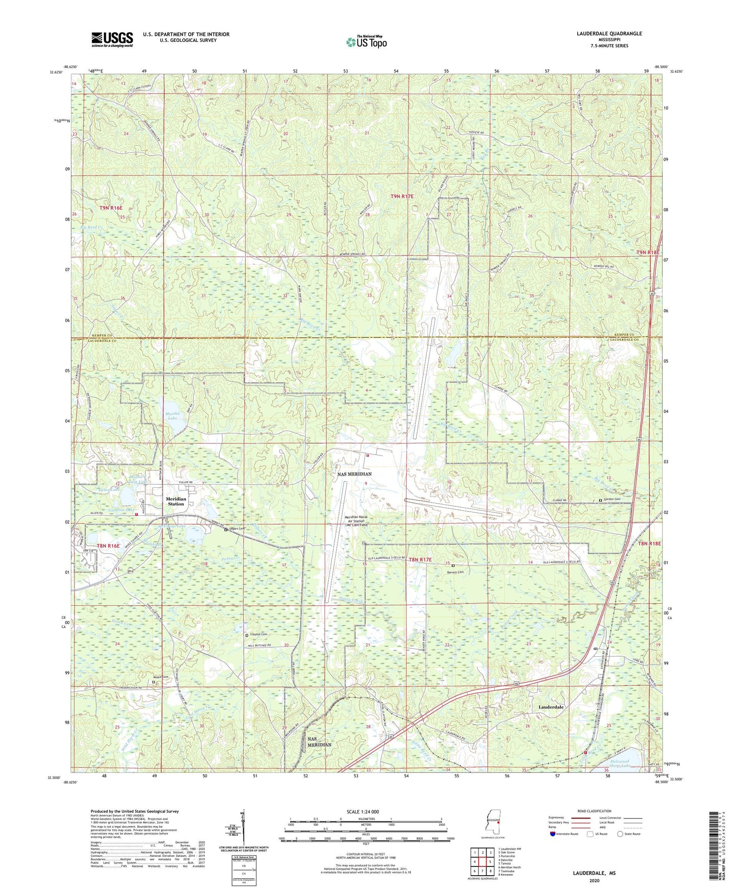
2024 topographic map quadrangle Lauderdale in the state of Mississippi. Scale: 1:24000. Based on the newly updated USGS 7.5' US Topo map series, this map is in the following counties: Lauderdale, Kemper. The map contains contour data, water features, and other items you are used to seeing on USGS maps, but also has updated roads and other features. This is the next generation of topographic maps. Printed on high-quality waterproof paper with UV fade-resistant inks.
Quads adjacent to this one:
West: Daleville
Northwest: Lauderdale NW
North: Oak Grove
Northeast: Porterville
East: Tamola
Southeast: Kewanee
South: Toomsuba
Southwest: Meridian North
This map covers the same area as the classic USGS quad with code o32088e5.
Contains the following named places: Annette Lake, Barrett Cemetery, Beatrice Lake, Caroline Lake, Charles Steele Pond Dam, Clayton Cemetery, Davis Mill, First Baptist Church of Lauderdale, Gordon Cemetery, Helen Lake, Holden Church, Holiness Church, Kemper Springs, Kemper Springs Baptist Church, Lake Helen Dam, Lake Lucille Dam, Lauderdale, Lauderdale Census Designated Place, Lauderdale Post Office, Lauderdale United Methodist Church, Lauderdale Volunteer Fire Department, Little Reed Creek, Lost Horse Creek, Maftin C Tant Lake, Martha Lake, McElroys Lake, Meridian Naval Air Station /Mc Cain Field, Meridian Station Census Designated Place, Moore Cemetery, Moores Mill, Mount Olive Church, Naval Air Station Meridian, Naval Air Station Meridian Fire Department Station 2, Naval Air Station Meridian Fire Rescue Station, Oak Grove Church, Pilgrim Rest Church, Pine Grove Church, Ponta, Possum Creek, Segars Cemetery, Segars Creek, Sonny Montgomery Recreation Park, Soules Chapel, Wild Horse Creek, Wright Creek, ZIP Code: 39309