MyTopo
Everett Missouri US Topo Map
Couldn't load pickup availability
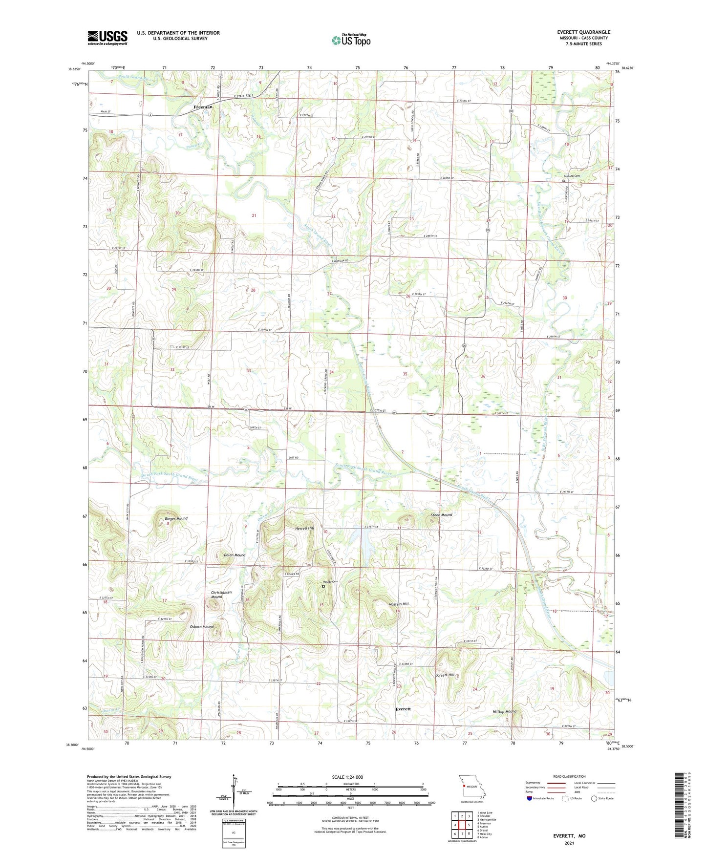
2021 topographic map quadrangle Everett in the state of Missouri. Scale: 1:24000. Based on the newly updated USGS 7.5' US Topo map series, this map is in the following counties: Cass. The map contains contour data, water features, and other items you are used to seeing on USGS maps, but also has updated roads and other features. This is the next generation of topographic maps. Printed on high-quality waterproof paper with UV fade-resistant inks.
Quads adjacent to this one:
West: Freeman
Northwest: West Line
North: Peculiar
Northeast: Harrisonville
East: Austin
Southeast: Adrian
South: Main City
Southwest: Drexel
This map covers the same area as the classic USGS quad with code o38094e4.
Contains the following named places: Adams Branch, Bieger Mound, Burford Cemetery, Bybee School, Christiansen Mound, Dolan Mound, Dorsett Hill, East Branch South Grand River, Everett, Freeman Wastewater Treatment Facility, Grand River Church, Hart Airport, Herrell Hill, Hickory Grove School, Hilltop Mound, Masters Hill, Moudy Cemetery, Oak Grove School, Oakland Farms Lake, Oakland Farms Lake Dam, Osburn Mound, Owens Creek, Poney Creek, Prospect School, Rocky Point School, South Fork South Grand River, Steen Mound, Steen School, Township of Dolan, Township of Everett, Zion School, ZIP Code: 64746