MyTopo
Savannah Missouri US Topo Map
Couldn't load pickup availability
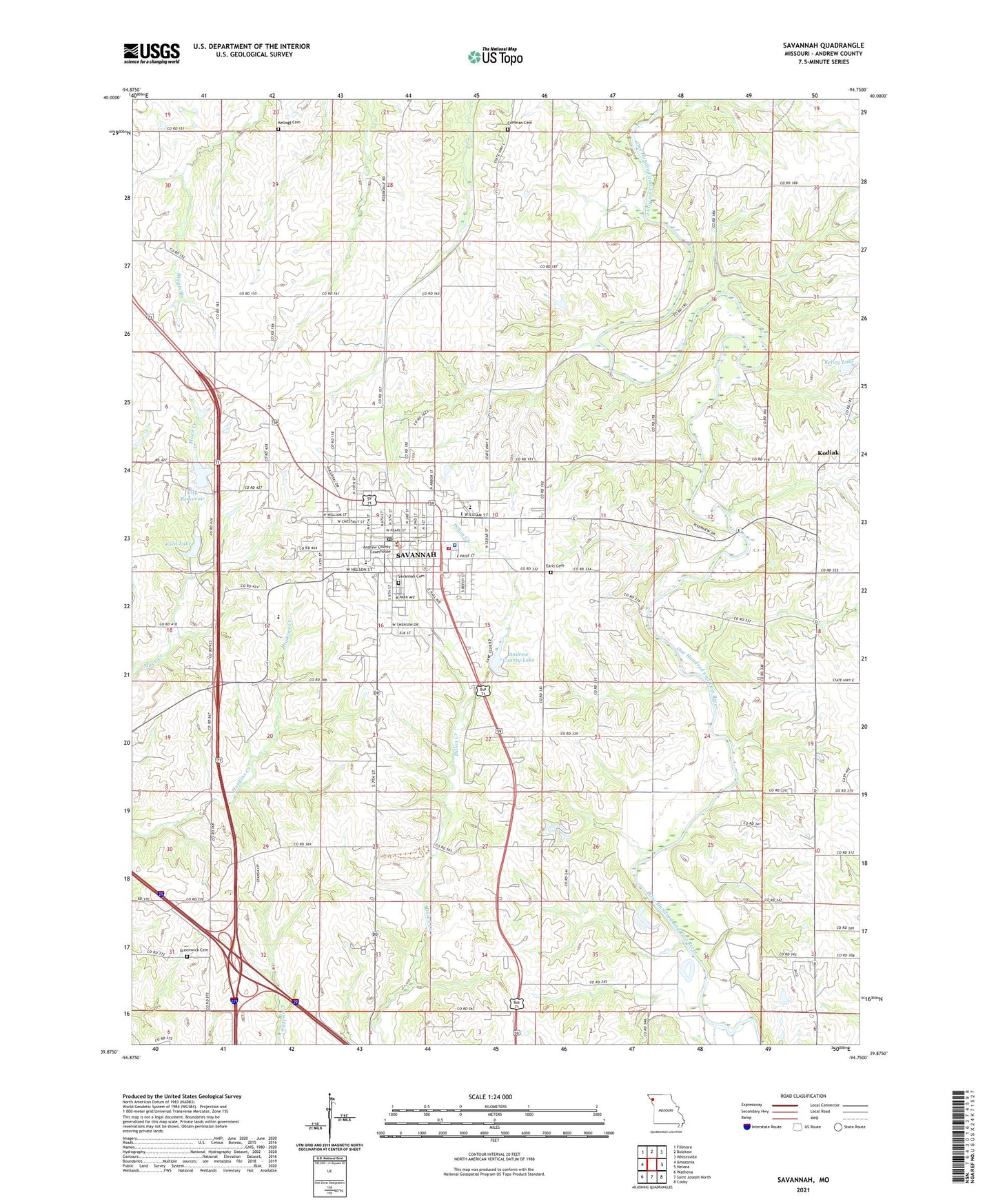
2021 topographic map quadrangle Savannah in the state of Missouri. Scale: 1:24000. Based on the newly updated USGS 7.5' US Topo map series, this map is in the following counties: Andrew. The map contains contour data, water features, and other items you are used to seeing on USGS maps, but also has updated roads and other features. This is the next generation of topographic maps. Printed on high-quality waterproof paper with UV fade-resistant inks.
Quads adjacent to this one:
West: Amazonia
Northwest: Fillmore
North: Bolckow
Northeast: Whitesville
East: Helena
Southeast: Cosby
South: Saint Joseph North
Southwest: Wathena
This map covers the same area as the classic USGS quad with code o39094h7.
Contains the following named places: Andrew County, Andrew County Lake, Andrew County Lake Dam, Andrew County Sheriff's Office, Barr School, Bedford Chapel, City of Savannah, City Reservoir, Coffman Cemetery, Coffman School, County Farm, Cumberland Ridge Church, Dakin School, Dewitt School, Earls Cemetery, Ford Lake, Ford Lake Dam, Greenwick Cemetery, Howard School, Kelley Lake, Kelley Lake Dam, Kellogg Cemetery, Kodiak, Minnie Cline Elementary School, Mount Pleasant School, Republican School, Salem School, Savannah, Savannah Cemetery, Savannah City Reservoir Dam, Savannah Fire Department, Savannah High School, Savannah Middle School, Savannah Post Office, Savannah Rural Fire District, Schuster, Township of Nodaway, Washington School, Woodlawn School, Worth Airport, ZIP Code: 64485